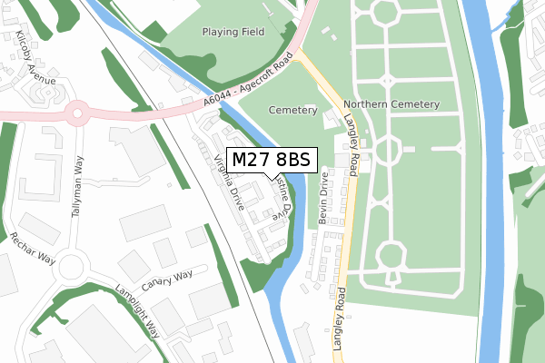
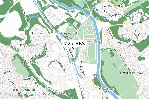
M27 8BS is located in the Pendlebury & Clifton electoral ward, within the metropolitan district of Salford and the English Parliamentary constituency of Salford and Eccles. The Sub Integrated Care Board (ICB) Location is NHS Greater Manchester ICB - 01G and the police force is Greater Manchester. This postcode has been in use since December 2017.


GetTheData
Source: OS Open Zoomstack (Ordnance Survey)
Licence: Open Government Licence (requires attribution)
Attribution: Contains OS data © Crown copyright and database right 2024
Source: Open Postcode Geo
Licence: Open Government Licence (requires attribution)
Attribution: Contains OS data © Crown copyright and database right 2024; Contains Royal Mail data © Royal Mail copyright and database right 2024; Source: Office for National Statistics licensed under the Open Government Licence v.3.0
| Easting | 380432 |
| Northing | 401467 |
| Latitude | 53.509536 |
| Longitude | -2.296524 |
GetTheData
Source: Open Postcode Geo
Licence: Open Government Licence
| Country | England |
| Postcode District | M27 |
| ➜ M27 open data dashboard ➜ See where M27 is on a map ➜ Where is Pendlebury? | |
GetTheData
Source: Land Registry Price Paid Data
Licence: Open Government Licence
| Ward | Pendlebury & Clifton |
| Constituency | Salford And Eccles |
GetTheData
Source: ONS Postcode Database
Licence: Open Government Licence
2022 9 SEP £370,000 |
2022 29 MAR £315,000 |
2, AUGUSTINE DRIVE, PENDLEBURY, MANCHESTER, M27 8BS 2019 4 OCT £247,995 |
4, AUGUSTINE DRIVE, PENDLEBURY, MANCHESTER, M27 8BS 2019 6 SEP £277,995 |
10, AUGUSTINE DRIVE, PENDLEBURY, MANCHESTER, M27 8BS 2019 2 AUG £209,995 |
1, AUGUSTINE DRIVE, PENDLEBURY, MANCHESTER, M27 8BS 2019 2 AUG £244,995 |
12, AUGUSTINE DRIVE, PENDLEBURY, MANCHESTER, M27 8BS 2019 26 JUL £199,995 |
3, AUGUSTINE DRIVE, PENDLEBURY, MANCHESTER, M27 8BS 2019 5 JUL £272,995 |
5, AUGUSTINE DRIVE, PENDLEBURY, MANCHESTER, M27 8BS 2019 28 JUN £272,995 |
7, AUGUSTINE DRIVE, PENDLEBURY, MANCHESTER, M27 8BS 2019 14 JUN £201,995 |
GetTheData
Source: HM Land Registry Price Paid Data
Licence: Contains HM Land Registry data © Crown copyright and database right 2024. This data is licensed under the Open Government Licence v3.0.
| Langley Rd/Cemetery Lodge (Langley Rd) | Agecroft | 151m |
| Langley Rd/Cemetery Lodge (Langley Rd) | Agecroft | 179m |
| Agecroft Rd/Langley Rd (Agecroft Rd) | Agecroft | 187m |
| Langley Rd/Cemetery Gate (Langley Rd) | Lower Kersal | 188m |
| Langley Rd/Cemetery Gate (Langley Rd) | Lower Kersal | 203m |
| Clifton (Manchester) Station | 1.9km |
| Swinton (Manchester) Station | 2.8km |
| Salford Crescent Station | 2.9km |
GetTheData
Source: NaPTAN
Licence: Open Government Licence
| Percentage of properties with Next Generation Access | 100.0% |
| Percentage of properties with Superfast Broadband | 100.0% |
| Percentage of properties with Ultrafast Broadband | 100.0% |
| Percentage of properties with Full Fibre Broadband | 100.0% |
Superfast Broadband is between 30Mbps and 300Mbps
Ultrafast Broadband is > 300Mbps
| Percentage of properties unable to receive 2Mbps | 0.0% |
| Percentage of properties unable to receive 5Mbps | 0.0% |
| Percentage of properties unable to receive 10Mbps | 0.0% |
| Percentage of properties unable to receive 30Mbps | 0.0% |
GetTheData
Source: Ofcom
Licence: Ofcom Terms of Use (requires attribution)
GetTheData
Source: ONS Postcode Database
Licence: Open Government Licence


➜ Get more ratings from the Food Standards Agency
GetTheData
Source: Food Standards Agency
Licence: FSA terms & conditions
| Last Collection | |||
|---|---|---|---|
| Location | Mon-Fri | Sat | Distance |
| Agecroft Road | 17:30 | 12:00 | 659m |
| Cromwell Bridge P.o. | 17:30 | 12:00 | 1,047m |
| Sandy Lane P.o. | 17:30 | 12:00 | 1,632m |
GetTheData
Source: Dracos
Licence: Creative Commons Attribution-ShareAlike
| Facility | Distance |
|---|---|
| Agecroft Road Pitch Agecroft Road, Pendlebury, Swinton, Manchester Grass Pitches | 290m |
| Hmp Forest Bank Forestbank, Swinton, Manchester Artificial Grass Pitch, Health and Fitness Gym, Sports Hall | 643m |
| Salford Sports Village Littleton Road, Salford Artificial Grass Pitch, Health and Fitness Gym, Grass Pitches | 688m |
GetTheData
Source: Active Places
Licence: Open Government Licence
| School | Phase of Education | Distance |
|---|---|---|
| Summerville Primary School Summerville Road, Salford, M6 7HB | Primary | 1.2km |
| St John's CofE Primary School Daisy Bank Avenue, Swinton, Manchester, M27 5FU | Primary | 1.4km |
| Lower Kersal Community Primary School St Aidan's Grove, Salford, M7 3TN | Primary | 1.4km |
GetTheData
Source: Edubase
Licence: Open Government Licence
The below table lists the International Territorial Level (ITL) codes (formerly Nomenclature of Territorial Units for Statistics (NUTS) codes) and Local Administrative Units (LAU) codes for M27 8BS:
| ITL 1 Code | Name |
|---|---|
| TLD | North West (England) |
| ITL 2 Code | Name |
| TLD3 | Greater Manchester |
| ITL 3 Code | Name |
| TLD34 | Greater Manchester South West |
| LAU 1 Code | Name |
| E08000006 | Salford |
GetTheData
Source: ONS Postcode Directory
Licence: Open Government Licence
The below table lists the Census Output Area (OA), Lower Layer Super Output Area (LSOA), and Middle Layer Super Output Area (MSOA) for M27 8BS:
| Code | Name | |
|---|---|---|
| OA | E00028745 | |
| LSOA | E01005675 | Salford 008B |
| MSOA | E02001164 | Salford 008 |
GetTheData
Source: ONS Postcode Directory
Licence: Open Government Licence
| M27 8SN | Agecroft Road | 219m |
| M27 8SW | Billington Road | 413m |
| M27 8BA | Giants Seat Grove | 424m |
| M27 8BG | Giants Seat Grove | 426m |
| M27 8AT | Kilcoby Avenue | 448m |
| M27 8BD | Giants Seat Grove | 460m |
| M27 8BE | Giants Seat Grove | 465m |
| M7 3AR | Tideway Close | 479m |
| M27 8AU | Kilcoby Avenue | 480m |
| M6 6JQ | Park House Bridge Estate | 501m |
GetTheData
Source: Open Postcode Geo; Land Registry Price Paid Data
Licence: Open Government Licence