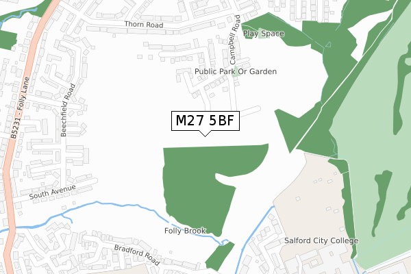
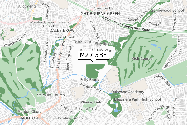
M27 5BF is located in the Swinton Park electoral ward, within the metropolitan district of Salford and the English Parliamentary constituency of Salford and Eccles. The Sub Integrated Care Board (ICB) Location is NHS Greater Manchester ICB - 01G and the police force is Greater Manchester. This postcode has been in use since August 2019.


GetTheData
Source: OS Open Zoomstack (Ordnance Survey)
Licence: Open Government Licence (requires attribution)
Attribution: Contains OS data © Crown copyright and database right 2024
Source: Open Postcode Geo
Licence: Open Government Licence (requires attribution)
Attribution: Contains OS data © Crown copyright and database right 2024; Contains Royal Mail data © Royal Mail copyright and database right 2024; Source: Office for National Statistics licensed under the Open Government Licence v.3.0
| Easting | 377304 |
| Northing | 400303 |
| Latitude | 53.499028 |
| Longitude | -2.343605 |
GetTheData
Source: Open Postcode Geo
Licence: Open Government Licence
| Country | England |
| Postcode District | M27 |
| ➜ M27 open data dashboard ➜ See where M27 is on a map ➜ Where is Swinton? | |
GetTheData
Source: Land Registry Price Paid Data
Licence: Open Government Licence
| Ward | Swinton Park |
| Constituency | Salford And Eccles |
GetTheData
Source: ONS Postcode Database
Licence: Open Government Licence
27, ARKWRIGHT WAY, SWINTON, MANCHESTER, M27 5BF 2022 31 AUG £424,995 |
25, ARKWRIGHT WAY, SWINTON, MANCHESTER, M27 5BF 2022 26 AUG £499,995 |
23, ARKWRIGHT WAY, SWINTON, MANCHESTER, M27 5BF 2022 21 JUL £499,995 |
15, ARKWRIGHT WAY, SWINTON, MANCHESTER, M27 5BF 2022 15 JUL £376,995 |
19, ARKWRIGHT WAY, SWINTON, MANCHESTER, M27 5BF 2022 1 JUL £412,995 |
17, ARKWRIGHT WAY, SWINTON, MANCHESTER, M27 5BF 2022 24 JUN £479,995 |
9, ARKWRIGHT WAY, SWINTON, MANCHESTER, M27 5BF 2022 20 MAY £376,995 |
7, ARKWRIGHT WAY, SWINTON, MANCHESTER, M27 5BF 2022 29 APR £406,995 |
11, ARKWRIGHT WAY, SWINTON, MANCHESTER, M27 5BF 2022 29 APR £406,995 |
21, ARKWRIGHT WAY, SWINTON, MANCHESTER, M27 5BF 2022 28 APR £474,995 |
GetTheData
Source: HM Land Registry Price Paid Data
Licence: Contains HM Land Registry data © Crown copyright and database right 2024. This data is licensed under the Open Government Licence v3.0.
| Folly Ln/Leigh Ave (Folly Ln) | Dales Brow | 412m |
| Folly Ln/Leigh Ave (Folly Ln) | Dales Brow | 420m |
| Folly Ln/Birch Rd (Folly Ln) | Dales Brow | 459m |
| Folly Ln/Dales Brow (Folly Ln) | Dales Brow | 466m |
| Folly Ln/Dales Brow (Folly Ln) | Dales Brow | 470m |
| Eccles Station | 1.6km |
| Swinton (Manchester) Station | 1.8km |
| Patricroft Station | 1.9km |
GetTheData
Source: NaPTAN
Licence: Open Government Licence
GetTheData
Source: ONS Postcode Database
Licence: Open Government Licence


➜ Get more ratings from the Food Standards Agency
GetTheData
Source: Food Standards Agency
Licence: FSA terms & conditions
| Last Collection | |||
|---|---|---|---|
| Location | Mon-Fri | Sat | Distance |
| 53 Eccles Road Near East Lancs | 17:30 | 12:00 | 640m |
| Cnr Park Road Rockey Lane | 17:30 | 12:00 | 697m |
| Ellesmere Park | 17:30 | 12:00 | 960m |
GetTheData
Source: Dracos
Licence: Creative Commons Attribution-ShareAlike
| Facility | Distance |
|---|---|
| Beechfield Road Playing Fields (Closed) Beechfield Road, Swinton, Manchester Grass Pitches | 229m |
| Monton Sports Club Welbeck Road, Eccles, Manchester Grass Pitches, Squash Courts, Outdoor Tennis Courts | 478m |
| Salford City College (Eccles 6th Form Centre) Chatsworth Road, Eccles, Manchester Sports Hall, Artificial Grass Pitch | 488m |
GetTheData
Source: Active Places
Licence: Open Government Licence
| School | Phase of Education | Distance |
|---|---|---|
| Monton Green Primary School Pine Grove, Eccles, Manchester, M30 9JP | Primary | 620m |
| Oakwood Academy Chatsworth Road, Ellesmere Park, Eccles, M30 9DY | Not applicable | 663m |
| Chatsworth High School and Community College Chatsworth Road, Eccles, Salford, M30 9DY | Not applicable | 797m |
GetTheData
Source: Edubase
Licence: Open Government Licence
The below table lists the International Territorial Level (ITL) codes (formerly Nomenclature of Territorial Units for Statistics (NUTS) codes) and Local Administrative Units (LAU) codes for M27 5BF:
| ITL 1 Code | Name |
|---|---|
| TLD | North West (England) |
| ITL 2 Code | Name |
| TLD3 | Greater Manchester |
| ITL 3 Code | Name |
| TLD34 | Greater Manchester South West |
| LAU 1 Code | Name |
| E08000006 | Salford |
GetTheData
Source: ONS Postcode Directory
Licence: Open Government Licence
The below table lists the Census Output Area (OA), Lower Layer Super Output Area (LSOA), and Middle Layer Super Output Area (MSOA) for M27 5BF:
| Code | Name | |
|---|---|---|
| OA | E00028829 | |
| LSOA | E01005696 | Salford 012D |
| MSOA | E02001168 | Salford 012 |
GetTheData
Source: ONS Postcode Directory
Licence: Open Government Licence
| M27 5GQ | Campbell Road | 218m |
| M27 5QT | Thorn Road | 226m |
| M27 5GR | Campbell Road | 238m |
| M27 5QU | Thorn Road | 257m |
| M27 5RL | The Square | 272m |
| M27 5GT | Thorn Road | 302m |
| M27 5GS | Marlow Drive | 315m |
| M30 9FT | Bradford Road | 316m |
| M27 5RA | Beechfield Road | 320m |
| M27 5QZ | Gorse Road | 323m |
GetTheData
Source: Open Postcode Geo; Land Registry Price Paid Data
Licence: Open Government Licence