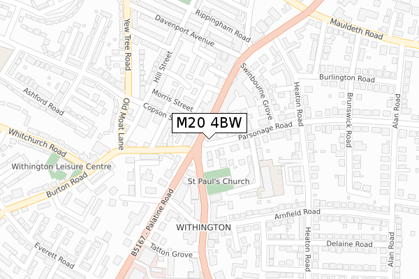
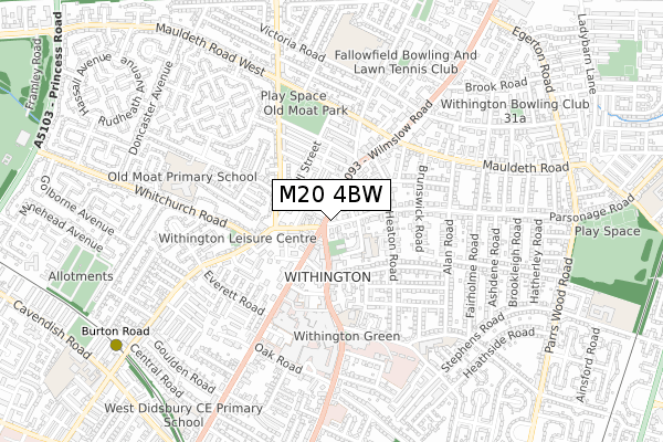
M20 4BW is located in the Withington electoral ward, within the metropolitan district of Manchester and the English Parliamentary constituency of Manchester, Withington. The Sub Integrated Care Board (ICB) Location is NHS Greater Manchester ICB - 14L and the police force is Greater Manchester. This postcode has been in use since November 2019.


GetTheData
Source: OS Open Zoomstack (Ordnance Survey)
Licence: Open Government Licence (requires attribution)
Attribution: Contains OS data © Crown copyright and database right 2024
Source: Open Postcode Geo
Licence: Open Government Licence (requires attribution)
Attribution: Contains OS data © Crown copyright and database right 2024; Contains Royal Mail data © Royal Mail copyright and database right 2024; Source: Office for National Statistics licensed under the Open Government Licence v.3.0
| Easting | 384918 |
| Northing | 392984 |
| Latitude | 53.433436 |
| Longitude | -2.228473 |
GetTheData
Source: Open Postcode Geo
Licence: Open Government Licence
| Country | England |
| Postcode District | M20 |
| ➜ M20 open data dashboard ➜ See where M20 is on a map ➜ Where is Manchester? | |
GetTheData
Source: Land Registry Price Paid Data
Licence: Open Government Licence
| Ward | Withington |
| Constituency | Manchester, Withington |
GetTheData
Source: ONS Postcode Database
Licence: Open Government Licence
| Wilmslow Rd/Withington St Paul's (Wilmslow Rd) | Withington | 89m |
| Palatine Rd/Wilmslow Rd (Palatine Rd) | Withington | 100m |
| Wilmslow Rd/Withington St Paul's (Wilmslow Rd) | Withington | 120m |
| Copson St/Patten St (Copson St) | Withington | 138m |
| Palatine Rd/Wilmslow Rd (Palatine Rd) | Withington | 141m |
| Burton Road (Manchester Metrolink) (Burton Road) | West Didsbury | 939m |
| West Didsbury (Manchester Metrolink) (Lapwing Lane) | West Didsbury | 1,116m |
| Withington (Manchester Metrolink) (Princess Road) | Withington | 1,393m |
| Mauldeth Road Station | 1.3km |
| Burnage Station | 1.6km |
| Levenshulme Station | 2.7km |
GetTheData
Source: NaPTAN
Licence: Open Government Licence
GetTheData
Source: ONS Postcode Database
Licence: Open Government Licence


➜ Get more ratings from the Food Standards Agency
GetTheData
Source: Food Standards Agency
Licence: FSA terms & conditions
| Last Collection | |||
|---|---|---|---|
| Location | Mon-Fri | Sat | Distance |
| Withington P.o. | 17:30 | 12:00 | 99m |
| White Lion | 17:30 | 12:00 | 108m |
| Opposite Withington Library | 17:30 | 12:00 | 286m |
GetTheData
Source: Dracos
Licence: Creative Commons Attribution-ShareAlike
| Facility | Distance |
|---|---|
| Withington Baths & Leisure Centre Burton Road, Manchester Swimming Pool, Health and Fitness Gym, Studio | 349m |
| Withington Girls School Wellington Road, Fallowfield, Manchester Sports Hall, Grass Pitches, Artificial Grass Pitch, Health and Fitness Gym, Studio | 643m |
| Fallowfields Lawn Tennis Club Wellington Road, Fallowfield, Manchester Outdoor Tennis Courts | 665m |
GetTheData
Source: Active Places
Licence: Open Government Licence
| School | Phase of Education | Distance |
|---|---|---|
| St Paul's CofE Primary School St Paul's Road, Withington, Manchester, M20 4PG | Primary | 144m |
| Bridgelea Pupil Referral Unit Bridgelea Road, Withington, Manchester, M20 3FB | Not applicable | 163m |
| St Cuthbert's RC Primary School Heyscroft Road, Withington, Manchester, M20 4UZ | Primary | 598m |
GetTheData
Source: Edubase
Licence: Open Government Licence
The below table lists the International Territorial Level (ITL) codes (formerly Nomenclature of Territorial Units for Statistics (NUTS) codes) and Local Administrative Units (LAU) codes for M20 4BW:
| ITL 1 Code | Name |
|---|---|
| TLD | North West (England) |
| ITL 2 Code | Name |
| TLD3 | Greater Manchester |
| ITL 3 Code | Name |
| TLD33 | Manchester |
| LAU 1 Code | Name |
| E08000003 | Manchester |
GetTheData
Source: ONS Postcode Directory
Licence: Open Government Licence
The below table lists the Census Output Area (OA), Lower Layer Super Output Area (LSOA), and Middle Layer Super Output Area (MSOA) for M20 4BW:
| Code | Name | |
|---|---|---|
| OA | E00026873 | |
| LSOA | E01005304 | Manchester 040B |
| MSOA | E02001084 | Manchester 040 |
GetTheData
Source: ONS Postcode Directory
Licence: Open Government Licence
| M20 4PQ | Parsonage Road | 40m |
| M20 4PB | Parsonage Road | 46m |
| M20 3BG | Wilmslow Road | 52m |
| M20 4PN | Egerton Crescent | 81m |
| M20 4AN | Wilmslow Road | 85m |
| M20 3HE | Copson Street | 87m |
| M20 3JB | Palatine Road | 108m |
| M20 3HD | Patten Street | 112m |
| M20 3BW | Wilmslow Road | 126m |
| M20 3JA | Palatine Road | 134m |
GetTheData
Source: Open Postcode Geo; Land Registry Price Paid Data
Licence: Open Government Licence