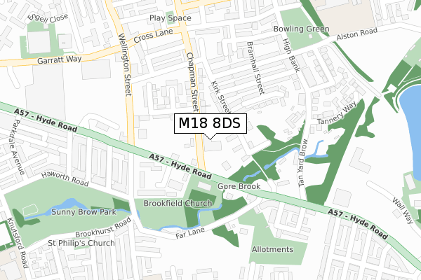
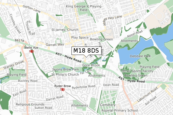
M18 8DS is located in the Gorton & Abbey Hey electoral ward, within the metropolitan district of Manchester and the English Parliamentary constituency of Manchester, Gorton. The Sub Integrated Care Board (ICB) Location is NHS Greater Manchester ICB - 14L and the police force is Greater Manchester. This postcode has been in use since January 2019.


GetTheData
Source: OS Open Zoomstack (Ordnance Survey)
Licence: Open Government Licence (requires attribution)
Attribution: Contains OS data © Crown copyright and database right 2024
Source: Open Postcode Geo
Licence: Open Government Licence (requires attribution)
Attribution: Contains OS data © Crown copyright and database right 2024; Contains Royal Mail data © Royal Mail copyright and database right 2024; Source: Office for National Statistics licensed under the Open Government Licence v.3.0
| Easting | 388931 |
| Northing | 396029 |
| Latitude | 53.460906 |
| Longitude | -2.168179 |
GetTheData
Source: Open Postcode Geo
Licence: Open Government Licence
| Country | England |
| Postcode District | M18 |
| ➜ M18 open data dashboard ➜ See where M18 is on a map ➜ Where is Manchester? | |
GetTheData
Source: Land Registry Price Paid Data
Licence: Open Government Licence
| Ward | Gorton & Abbey Hey |
| Constituency | Manchester, Gorton |
GetTheData
Source: ONS Postcode Database
Licence: Open Government Licence
| August 2021 | Other theft | On or near Wellington Street | 319m |
| ➜ Get more crime data in our Crime section | |||
GetTheData
Source: data.police.uk
Licence: Open Government Licence
| Chapman Rd/Hyde Rd (Chapman St) | Gorton | 41m |
| Hyde Rd/Wellington St (Hyde Rd) | Gorton | 117m |
| Hyde Rd/Far Lane (Hyde Rd) | Gorton | 156m |
| Hyde Road/Tesco (Hyde Rd) | Gorton | 245m |
| Hyde Rd/Wellington St (Hyde Rd) | Gorton | 272m |
| Ryder Brow Station | 0.6km |
| Belle Vue Station | 0.8km |
| Gorton Station | 0.9km |
GetTheData
Source: NaPTAN
Licence: Open Government Licence
GetTheData
Source: ONS Postcode Database
Licence: Open Government Licence


➜ Get more ratings from the Food Standards Agency
GetTheData
Source: Food Standards Agency
Licence: FSA terms & conditions
| Last Collection | |||
|---|---|---|---|
| Location | Mon-Fri | Sat | Distance |
| Hengist St | 17:30 | 12:00 | 186m |
| Brookhurst Road | 17:30 | 12:00 | 362m |
| Gorton P.o. | 17:30 | 12:00 | 381m |
GetTheData
Source: Dracos
Licence: Creative Commons Attribution-ShareAlike
| Facility | Distance |
|---|---|
| Abbey Hey Playing Field Alston Road, Manchester Grass Pitches | 405m |
| Puregym (Manchester Debdale) Wall Way, Manchester Health and Fitness Gym, Studio | 477m |
| West Gorton Playing Field Knutsford Road, Manchester Grass Pitches | 571m |
GetTheData
Source: Active Places
Licence: Open Government Licence
| School | Phase of Education | Distance |
|---|---|---|
| Old Hall Drive Academy Old Hall Drive, Gorton, Manchester, M18 7FU | Primary | 407m |
| St James' CofE Primary School Gorton Stelling Street, Gorton, Manchester, M18 8LW | Primary | 441m |
| Abbey Hey Primary Academy Abbey Hey Lane, Gorton, Manchester, M18 8PF | Primary | 448m |
GetTheData
Source: Edubase
Licence: Open Government Licence
The below table lists the International Territorial Level (ITL) codes (formerly Nomenclature of Territorial Units for Statistics (NUTS) codes) and Local Administrative Units (LAU) codes for M18 8DS:
| ITL 1 Code | Name |
|---|---|
| TLD | North West (England) |
| ITL 2 Code | Name |
| TLD3 | Greater Manchester |
| ITL 3 Code | Name |
| TLD33 | Manchester |
| LAU 1 Code | Name |
| E08000003 | Manchester |
GetTheData
Source: ONS Postcode Directory
Licence: Open Government Licence
The below table lists the Census Output Area (OA), Lower Layer Super Output Area (LSOA), and Middle Layer Super Output Area (MSOA) for M18 8DS:
| Code | Name | |
|---|---|---|
| OA | E00026288 | |
| LSOA | E01005192 | Manchester 021D |
| MSOA | E02001065 | Manchester 021 |
GetTheData
Source: ONS Postcode Directory
Licence: Open Government Licence
| M18 8UE | Kirk Street | 61m |
| M18 8WE | Peel Square | 71m |
| M18 7FD | Brookfield Grove | 93m |
| M18 8UH | Wallworth Avenue | 96m |
| M18 8WF | Kirk Street | 97m |
| M18 8UB | Garlick Street | 126m |
| M18 7EA | Kirkman Close | 136m |
| M18 8UU | Hinstock Crescent | 140m |
| M18 7EF | Hyde Road | 142m |
| M18 8UA | Chapman Street | 159m |
GetTheData
Source: Open Postcode Geo; Land Registry Price Paid Data
Licence: Open Government Licence