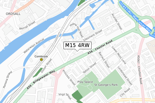
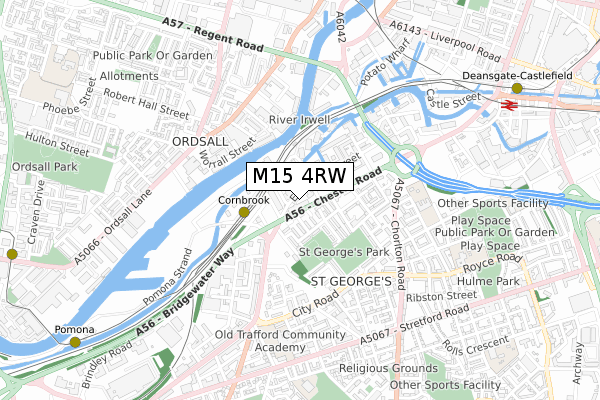
M15 4RW is located in the Hulme electoral ward, within the metropolitan district of Manchester and the English Parliamentary constituency of Manchester Central. The Sub Integrated Care Board (ICB) Location is NHS Greater Manchester ICB - 14L and the police force is Greater Manchester. This postcode has been in use since March 2019.


GetTheData
Source: OS Open Zoomstack (Ordnance Survey)
Licence: Open Government Licence (requires attribution)
Attribution: Contains OS data © Crown copyright and database right 2024
Source: Open Postcode Geo
Licence: Open Government Licence (requires attribution)
Attribution: Contains OS data © Crown copyright and database right 2024; Contains Royal Mail data © Royal Mail copyright and database right 2024; Source: Office for National Statistics licensed under the Open Government Licence v.3.0
| Easting | 382557 |
| Northing | 397123 |
| Latitude | 53.470566 |
| Longitude | -2.264240 |
GetTheData
Source: Open Postcode Geo
Licence: Open Government Licence
| Country | England |
| Postcode District | M15 |
| ➜ M15 open data dashboard ➜ See where M15 is on a map ➜ Where is Manchester? | |
GetTheData
Source: Land Registry Price Paid Data
Licence: Open Government Licence
| Ward | Hulme |
| Constituency | Manchester Central |
GetTheData
Source: ONS Postcode Database
Licence: Open Government Licence
| August 2021 | Violence and sexual offences | On or near Worsley Street | 340m |
| ➜ Get more crime data in our Crime section | |||
GetTheData
Source: data.police.uk
Licence: Open Government Licence
| Chester Rd/Cornbrook (Chester Rd) | Cornbrook | 81m |
| Chester Rd/Hulme Hall Rd (Chester Rd) | Cornbrook | 121m |
| Chester Rd/Hulme Hall Rd (Chester Rd) | Cornbrook | 155m |
| Chester Rd/Cornbrook (Chester Rd) | Cornbrook | 244m |
| Cornbrook Metrolink Stop (Bridgewater Way) | Cornbrook | 259m |
| Cornbrook (Manchester Metrolink) | Cornbrook | 234m |
| Deansgate-castlefield (Manchester Metrolink) (Whitworth Street West) | Manchester City Centre | 977m |
| Pomona (Manchester Metrolink) (Pomona Strand) | Salford Quays | 1,112m |
| Trafford Bar (Manchester Metrolink) (Seymour Grove) | Trafford Bar | 1,269m |
| Exchange Quay (Manchester Metrolink) (Exchange Quay) | Salford Quays | 1,269m |
| Deansgate Station | 1km |
| Manchester Oxford Road Station | 1.5km |
| Salford Central Station | 1.5km |
GetTheData
Source: NaPTAN
Licence: Open Government Licence
| Percentage of properties with Next Generation Access | 100.0% |
| Percentage of properties with Superfast Broadband | 100.0% |
| Percentage of properties with Ultrafast Broadband | 100.0% |
| Percentage of properties with Full Fibre Broadband | 100.0% |
Superfast Broadband is between 30Mbps and 300Mbps
Ultrafast Broadband is > 300Mbps
| Percentage of properties unable to receive 2Mbps | 0.0% |
| Percentage of properties unable to receive 5Mbps | 0.0% |
| Percentage of properties unable to receive 10Mbps | 0.0% |
| Percentage of properties unable to receive 30Mbps | 0.0% |
GetTheData
Source: Ofcom
Licence: Ofcom Terms of Use (requires attribution)
GetTheData
Source: ONS Postcode Database
Licence: Open Government Licence


➜ Get more ratings from the Food Standards Agency
GetTheData
Source: Food Standards Agency
Licence: FSA terms & conditions
| Last Collection | |||
|---|---|---|---|
| Location | Mon-Fri | Sat | Distance |
| Chester Road/Hulme Hall Road | 17:30 | 12:00 | 66m |
| Angela Street | 17:30 | 12:00 | 331m |
| Hullard Hall P.o. | 17:30 | 12:00 | 443m |
GetTheData
Source: Dracos
Licence: Creative Commons Attribution-ShareAlike
| Facility | Distance |
|---|---|
| Barrack Park Barrack Street, Manchester Grass Pitches | 280m |
| Club Urban (Closed) Worsley Street, Manchester Studio, Health and Fitness Gym | 299m |
| Hulme Park Jackson Crescent, Manchester Grass Pitches | 726m |
GetTheData
Source: Active Places
Licence: Open Government Licence
| School | Phase of Education | Distance |
|---|---|---|
| Old Trafford Community Academy Malvern Street, Old Trafford, Manchester, M15 4FL | Primary | 608m |
| St Wilfrid's RC Primary School Birchvale Close, Hulme, M15 5BJ | Primary | 750m |
| St Alphonsus RC Primary School Hamilton Street, Off Stretford Road, Old Trafford, Manchester, M16 7PT | Primary | 782m |
GetTheData
Source: Edubase
Licence: Open Government Licence
The below table lists the International Territorial Level (ITL) codes (formerly Nomenclature of Territorial Units for Statistics (NUTS) codes) and Local Administrative Units (LAU) codes for M15 4RW:
| ITL 1 Code | Name |
|---|---|
| TLD | North West (England) |
| ITL 2 Code | Name |
| TLD3 | Greater Manchester |
| ITL 3 Code | Name |
| TLD33 | Manchester |
| LAU 1 Code | Name |
| E08000003 | Manchester |
GetTheData
Source: ONS Postcode Directory
Licence: Open Government Licence
The below table lists the Census Output Area (OA), Lower Layer Super Output Area (LSOA), and Middle Layer Super Output Area (MSOA) for M15 4RW:
| Code | Name | |
|---|---|---|
| OA | E00175905 | |
| LSOA | E01033672 | Manchester 059C |
| MSOA | E02006916 | Manchester 059 |
GetTheData
Source: ONS Postcode Directory
Licence: Open Government Licence
| M15 4QR | Ellesmere Street | 37m |
| M15 4QQ | Ellesmere Street | 47m |
| M15 4JY | Ellesmere Street | 52m |
| M15 4QS | Ellesmere Street | 71m |
| M15 4LY | Hulme Hall Road | 77m |
| M15 4EY | Chester Road | 80m |
| M15 4FS | Brackley Avenue | 90m |
| M15 4QT | Ellesmere Street | 98m |
| M15 4EX | Chester Road | 127m |
| M15 4FT | Manson Avenue | 127m |
GetTheData
Source: Open Postcode Geo; Land Registry Price Paid Data
Licence: Open Government Licence