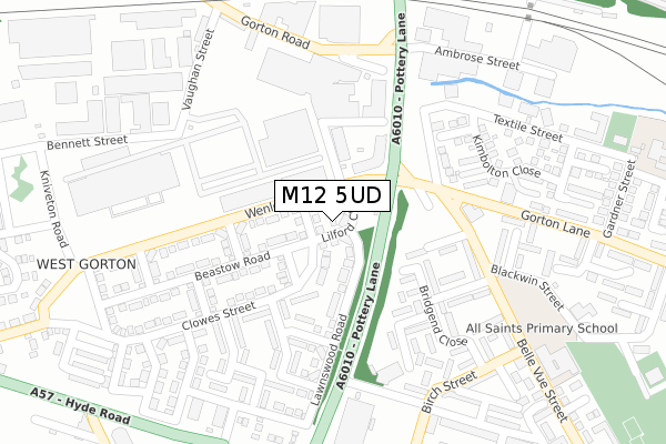
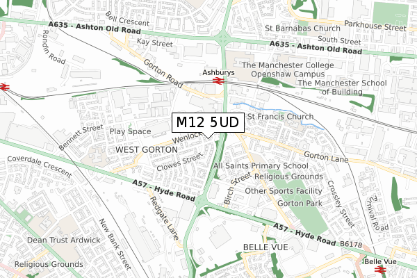
M12 5UD is located in the Ardwick electoral ward, within the metropolitan district of Manchester and the English Parliamentary constituency of Manchester Central. The Sub Integrated Care Board (ICB) Location is NHS Greater Manchester ICB - 14L and the police force is Greater Manchester. This postcode has been in use since August 2017.


GetTheData
Source: OS Open Zoomstack (Ordnance Survey)
Licence: Open Government Licence (requires attribution)
Attribution: Contains OS data © Crown copyright and database right 2024
Source: Open Postcode Geo
Licence: Open Government Licence (requires attribution)
Attribution: Contains OS data © Crown copyright and database right 2024; Contains Royal Mail data © Royal Mail copyright and database right 2024; Source: Office for National Statistics licensed under the Open Government Licence v.3.0
| Easting | 387105 |
| Northing | 396908 |
| Latitude | 53.468765 |
| Longitude | -2.195717 |
GetTheData
Source: Open Postcode Geo
Licence: Open Government Licence
| Country | England |
| Postcode District | M12 |
| ➜ M12 open data dashboard ➜ See where M12 is on a map ➜ Where is Manchester? | |
GetTheData
Source: Land Registry Price Paid Data
Licence: Open Government Licence
| Ward | Ardwick |
| Constituency | Manchester Central |
GetTheData
Source: ONS Postcode Database
Licence: Open Government Licence
2, LILFORD CLOSE, MANCHESTER, M12 5UD 2017 29 SEP £214,995 |
1, LILFORD CLOSE, MANCHESTER, M12 5UD 2017 31 JUL £204,995 |
GetTheData
Source: HM Land Registry Price Paid Data
Licence: Contains HM Land Registry data © Crown copyright and database right 2024. This data is licensed under the Open Government Licence v3.0.
| Wenlock Way/Clowes St (Wenlock Way) | West Gorton | 43m |
| Wenlock Way/Woodfall Cl (Wenlock Way) | West Gorton | 85m |
| Wenlock Way/Pottery Ln (Wenlock Way) | West Gorton | 87m |
| Wenlock Way/Kempley Cl (Wenlock Way) | West Gorton | 145m |
| Belle Vue St/Gorton Ln (Belle Vue St) | West Gorton | 217m |
| Ashburys Station | 0.3km |
| Belle Vue Station | 1.2km |
| Ardwick Station | 1.2km |
GetTheData
Source: NaPTAN
Licence: Open Government Licence
➜ Broadband speed and availability dashboard for M12 5UD
| Percentage of properties with Next Generation Access | 100.0% |
| Percentage of properties with Superfast Broadband | 100.0% |
| Percentage of properties with Ultrafast Broadband | 90.9% |
| Percentage of properties with Full Fibre Broadband | 0.0% |
Superfast Broadband is between 30Mbps and 300Mbps
Ultrafast Broadband is > 300Mbps
| Median download speed | 39.1Mbps |
| Average download speed | 46.7Mbps |
| Maximum download speed | 80.00Mbps |
| Median upload speed | 9.8Mbps |
| Average upload speed | 10.5Mbps |
| Maximum upload speed | 20.00Mbps |
| Percentage of properties unable to receive 2Mbps | 0.0% |
| Percentage of properties unable to receive 5Mbps | 0.0% |
| Percentage of properties unable to receive 10Mbps | 0.0% |
| Percentage of properties unable to receive 30Mbps | 0.0% |
➜ Broadband speed and availability dashboard for M12 5UD
GetTheData
Source: Ofcom
Licence: Ofcom Terms of Use (requires attribution)
GetTheData
Source: ONS Postcode Database
Licence: Open Government Licence


➜ Get more ratings from the Food Standards Agency
GetTheData
Source: Food Standards Agency
Licence: FSA terms & conditions
| Last Collection | |||
|---|---|---|---|
| Location | Mon-Fri | Sat | Distance |
| West Gorton | 17:30 | 12:00 | 197m |
| Birch Street | 17:30 | 12:00 | 299m |
| Gorton Brook | 17:30 | 12:00 | 305m |
GetTheData
Source: Dracos
Licence: Creative Commons Attribution-ShareAlike
| Facility | Distance |
|---|---|
| Bridge College Whitworth Street, Openshaw, Manchester Sports Hall | 505m |
| The Manchester College (Openshaw Campus) Ashton Old Road, Openshaw, Manchester Health and Fitness Gym, Sports Hall | 649m |
| Co-op Academy Belle Vue Hyde Road, Manchester Sports Hall, Outdoor Tennis Courts | 791m |
GetTheData
Source: Active Places
Licence: Open Government Licence
| School | Phase of Education | Distance |
|---|---|---|
| All Saints Primary School Belle Vue Street, Gorton, Manchester, M12 5PW | Primary | 384m |
| St Francis RC Primary School Ellenbrook Close, Gorton, Manchester, M12 5LZ | Primary | 517m |
| St Francis RC Primary School Ellenbrook Close, Gorton, Manchester, M12 5LZ | Primary | 520m |
GetTheData
Source: Edubase
Licence: Open Government Licence
The below table lists the International Territorial Level (ITL) codes (formerly Nomenclature of Territorial Units for Statistics (NUTS) codes) and Local Administrative Units (LAU) codes for M12 5UD:
| ITL 1 Code | Name |
|---|---|
| TLD | North West (England) |
| ITL 2 Code | Name |
| TLD3 | Greater Manchester |
| ITL 3 Code | Name |
| TLD33 | Manchester |
| LAU 1 Code | Name |
| E08000003 | Manchester |
GetTheData
Source: ONS Postcode Directory
Licence: Open Government Licence
The below table lists the Census Output Area (OA), Lower Layer Super Output Area (LSOA), and Middle Layer Super Output Area (MSOA) for M12 5UD:
| Code | Name | |
|---|---|---|
| OA | E00025624 | |
| LSOA | E01005067 | Manchester 020A |
| MSOA | E02001064 | Manchester 020 |
GetTheData
Source: ONS Postcode Directory
Licence: Open Government Licence
| M12 5ER | Dashwood Walk | 155m |
| M12 5HP | Dougall Walk | 157m |
| M12 5TG | Wenlock Way | 173m |
| M12 5UB | Lawnswood Road | 173m |
| M12 5HN | Bridgend Close | 176m |
| M12 5EP | Radbourne Close | 193m |
| M12 5DF | Gorton Lane | 195m |
| M12 5HR | Stonehurst Close | 203m |
| M12 5EQ | Abbotsbury Close | 222m |
| M12 5JG | Belle Vue Street | 232m |
GetTheData
Source: Open Postcode Geo; Land Registry Price Paid Data
Licence: Open Government Licence