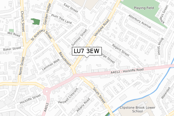
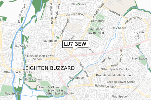
LU7 3EW is located in the Leighton-Linslade North electoral ward, within the unitary authority of Central Bedfordshire and the English Parliamentary constituency of South West Bedfordshire. The Sub Integrated Care Board (ICB) Location is NHS Bedfordshire, Luton and Milton Keynes ICB - M1J4Y and the police force is Bedfordshire. This postcode has been in use since December 2018.


GetTheData
Source: OS Open Zoomstack (Ordnance Survey)
Licence: Open Government Licence (requires attribution)
Attribution: Contains OS data © Crown copyright and database right 2024
Source: Open Postcode Geo
Licence: Open Government Licence (requires attribution)
Attribution: Contains OS data © Crown copyright and database right 2024; Contains Royal Mail data © Royal Mail copyright and database right 2024; Source: Office for National Statistics licensed under the Open Government Licence v.3.0
| Easting | 492606 |
| Northing | 225350 |
| Latitude | 51.918994 |
| Longitude | -0.654874 |
GetTheData
Source: Open Postcode Geo
Licence: Open Government Licence
| Country | England |
| Postcode District | LU7 |
| ➜ LU7 open data dashboard ➜ See where LU7 is on a map ➜ Where is Leighton Buzzard? | |
GetTheData
Source: Land Registry Price Paid Data
Licence: Open Government Licence
| Ward | Leighton-linslade North |
| Constituency | South West Bedfordshire |
GetTheData
Source: ONS Postcode Database
Licence: Open Government Licence
| December 2023 | Public order | On or near Lovent Drive | 321m |
| December 2023 | Violence and sexual offences | On or near Parking Area | 388m |
| November 2023 | Anti-social behaviour | On or near Miles Avenue | 326m |
| ➜ Get more crime data in our Crime section | |||
GetTheData
Source: data.police.uk
Licence: Open Government Licence
| Police Station (Hockliffe Road) | Leighton Buzzard | 89m |
| George Street (Vandyke Road) | Leighton Buzzard | 156m |
| Beaudesert | Leighton Buzzard | 173m |
| Regent Street (Hockliffe Road) | Leighton Buzzard | 227m |
| Council Offices (Hockliffe Street) | Leighton Buzzard | 230m |
| Leighton Buzzard Station | 1.5km |
GetTheData
Source: NaPTAN
Licence: Open Government Licence
| Percentage of properties with Next Generation Access | 100.0% |
| Percentage of properties with Superfast Broadband | 100.0% |
| Percentage of properties with Ultrafast Broadband | 100.0% |
| Percentage of properties with Full Fibre Broadband | 0.0% |
Superfast Broadband is between 30Mbps and 300Mbps
Ultrafast Broadband is > 300Mbps
| Percentage of properties unable to receive 2Mbps | 0.0% |
| Percentage of properties unable to receive 5Mbps | 0.0% |
| Percentage of properties unable to receive 10Mbps | 0.0% |
| Percentage of properties unable to receive 30Mbps | 0.0% |
GetTheData
Source: Ofcom
Licence: Ofcom Terms of Use (requires attribution)
GetTheData
Source: ONS Postcode Database
Licence: Open Government Licence


➜ Get more ratings from the Food Standards Agency
GetTheData
Source: Food Standards Agency
Licence: FSA terms & conditions
| Last Collection | |||
|---|---|---|---|
| Location | Mon-Fri | Sat | Distance |
| Hockliffe Street | 18:30 | 12:30 | 113m |
| St Georges Court | 17:15 | 12:00 | 239m |
| Atterbury Avenue | 17:00 | 12:00 | 335m |
GetTheData
Source: Dracos
Licence: Creative Commons Attribution-ShareAlike
| Facility | Distance |
|---|---|
| Vandyke Road Playing Field (Closed) Vandyke Road, Leighton Buzzard Grass Pitches | 434m |
| Colloseum Gym (Closed) Lake Street, Leighton Buzzard Health and Fitness Gym | 476m |
| Brooklands Middle School Brooklands Drive, Leighton Buzzard Sports Hall, Grass Pitches, Outdoor Tennis Courts | 675m |
GetTheData
Source: Active Places
Licence: Open Government Licence
| School | Phase of Education | Distance |
|---|---|---|
| The Rushmere Park Academy East Street, Leighton Buzzard, LU7 1EW | Primary | 409m |
| Clipstone Brook Lower School Brooklands Drive, Leighton Buzzard, LU7 3PG | Primary | 417m |
| Brooklands Middle School Brooklands Drive, Leighton Buzzard, LU7 3PF | Middle deemed secondary | 674m |
GetTheData
Source: Edubase
Licence: Open Government Licence
The below table lists the International Territorial Level (ITL) codes (formerly Nomenclature of Territorial Units for Statistics (NUTS) codes) and Local Administrative Units (LAU) codes for LU7 3EW:
| ITL 1 Code | Name |
|---|---|
| TLH | East |
| ITL 2 Code | Name |
| TLH2 | Bedfordshire and Hertfordshire |
| ITL 3 Code | Name |
| TLH25 | Central Bedfordshire |
| LAU 1 Code | Name |
| E06000056 | Central Bedfordshire |
GetTheData
Source: ONS Postcode Directory
Licence: Open Government Licence
The below table lists the Census Output Area (OA), Lower Layer Super Output Area (LSOA), and Middle Layer Super Output Area (MSOA) for LU7 3EW:
| Code | Name | |
|---|---|---|
| OA | E00088624 | |
| LSOA | E01017556 | Central Bedfordshire 021B |
| MSOA | E02003639 | Central Bedfordshire 021 |
GetTheData
Source: ONS Postcode Directory
Licence: Open Government Licence
| LU7 3HH | Vandyke Road | 32m |
| LU7 3HG | Vandyke Road | 73m |
| LU7 1FN | Summer Street | 88m |
| LU7 3FF | Hockliffe Road | 89m |
| LU7 3AR | Newman Way | 95m |
| LU7 3JX | George Street | 126m |
| LU7 1HR | Beaudesert | 128m |
| LU7 1HZ | Beaudesert | 135m |
| LU7 1HT | Summer Street | 137m |
| LU7 3FP | Hockliffe Road | 163m |
GetTheData
Source: Open Postcode Geo; Land Registry Price Paid Data
Licence: Open Government Licence