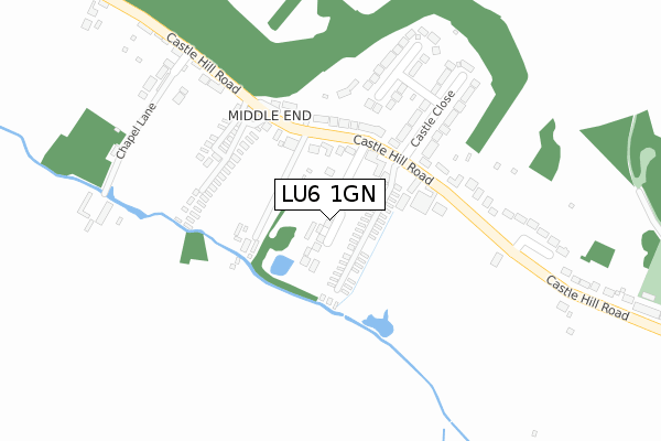
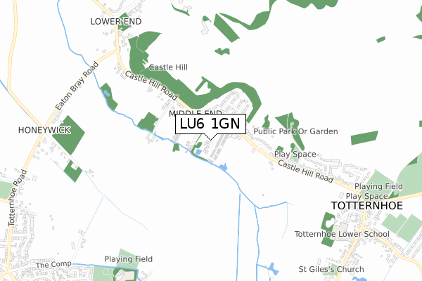
LU6 1GN is located in the Eaton Bray electoral ward, within the unitary authority of Central Bedfordshire and the English Parliamentary constituency of South West Bedfordshire. The Sub Integrated Care Board (ICB) Location is NHS Bedfordshire, Luton and Milton Keynes ICB - M1J4Y and the police force is Bedfordshire. This postcode has been in use since April 2019.


GetTheData
Source: OS Open Zoomstack (Ordnance Survey)
Licence: Open Government Licence (requires attribution)
Attribution: Contains OS data © Crown copyright and database right 2024
Source: Open Postcode Geo
Licence: Open Government Licence (requires attribution)
Attribution: Contains OS data © Crown copyright and database right 2024; Contains Royal Mail data © Royal Mail copyright and database right 2024; Source: Office for National Statistics licensed under the Open Government Licence v.3.0
| Easting | 498132 |
| Northing | 221636 |
| Latitude | 51.884666 |
| Longitude | -0.575607 |
GetTheData
Source: Open Postcode Geo
Licence: Open Government Licence
| Country | England |
| Postcode District | LU6 |
| ➜ LU6 open data dashboard ➜ See where LU6 is on a map ➜ Where is Totternhoe? | |
GetTheData
Source: Land Registry Price Paid Data
Licence: Open Government Licence
| Ward | Eaton Bray |
| Constituency | South West Bedfordshire |
GetTheData
Source: ONS Postcode Database
Licence: Open Government Licence
6, BRIDGEWATER CLOSE, TOTTERNHOE, DUNSTABLE, LU6 1GN 2019 22 NOV £745,000 |
1, BRIDGEWATER CLOSE, TOTTERNHOE, DUNSTABLE, LU6 1GN 2019 23 OCT £565,000 |
5, BRIDGEWATER CLOSE, TOTTERNHOE, DUNSTABLE, LU6 1GN 2019 27 SEP £700,000 |
3, BRIDGEWATER CLOSE, TOTTERNHOE, DUNSTABLE, LU6 1GN 2019 14 JUN £570,000 |
4, BRIDGEWATER CLOSE, TOTTERNHOE, DUNSTABLE, LU6 1GN 2019 12 APR £572,500 |
2, BRIDGEWATER CLOSE, TOTTERNHOE, DUNSTABLE, LU6 1GN 2019 15 MAR £575,000 |
GetTheData
Source: HM Land Registry Price Paid Data
Licence: Contains HM Land Registry data © Crown copyright and database right 2024. This data is licensed under the Open Government Licence v3.0.
| June 2022 | Violence and sexual offences | On or near Castle Close | 248m |
| May 2022 | Criminal damage and arson | On or near Castle Hill Road | 174m |
| March 2022 | Burglary | On or near Brownlow Rise | 272m |
| ➜ Get more crime data in our Crime section | |||
GetTheData
Source: data.police.uk
Licence: Open Government Licence
| Castle Close (Castle Hill Road) | Totternhoe | 180m |
| Castle Close (Castle Hill Road) | Totternhoe | 199m |
| The Cross Keys Ph (Castle Hill Road) | Totternhoe | 206m |
| The Cross Keys Ph (Castle Hill Road) | Totternhoe | 222m |
| Totternhoe Knolls (Castle Hill Road) | Totternhoe | 490m |
GetTheData
Source: NaPTAN
Licence: Open Government Licence
| Percentage of properties with Next Generation Access | 100.0% |
| Percentage of properties with Superfast Broadband | 100.0% |
| Percentage of properties with Ultrafast Broadband | 0.0% |
| Percentage of properties with Full Fibre Broadband | 0.0% |
Superfast Broadband is between 30Mbps and 300Mbps
Ultrafast Broadband is > 300Mbps
| Percentage of properties unable to receive 2Mbps | 0.0% |
| Percentage of properties unable to receive 5Mbps | 0.0% |
| Percentage of properties unable to receive 10Mbps | 0.0% |
| Percentage of properties unable to receive 30Mbps | 0.0% |
GetTheData
Source: Ofcom
Licence: Ofcom Terms of Use (requires attribution)
GetTheData
Source: ONS Postcode Database
Licence: Open Government Licence


➜ Get more ratings from the Food Standards Agency
GetTheData
Source: Food Standards Agency
Licence: FSA terms & conditions
| Last Collection | |||
|---|---|---|---|
| Location | Mon-Fri | Sat | Distance |
| Post Office Castle Hill Road | 17:30 | 11:30 | 456m |
| Eaton Bray Road | 17:15 | 09:00 | 790m |
| Church Road | 17:30 | 09:00 | 1,038m |
GetTheData
Source: Dracos
Licence: Creative Commons Attribution-ShareAlike
| Facility | Distance |
|---|---|
| Holmans Field School Lane, Eaton Bray, Dunstable Grass Pitches | 837m |
| Eaton Bray Lawn Tennis Club School Lane, Eaton Bray Outdoor Tennis Courts | 952m |
| Totternhoe Ce Academy Church Road, Totternhoe, Dunstable Grass Pitches | 972m |
GetTheData
Source: Active Places
Licence: Open Government Licence
| School | Phase of Education | Distance |
|---|---|---|
| Eaton Bray Academy School Lane, Eaton Bray, Dunstable, LU6 2DT | Primary | 953m |
| Totternhoe Church of England Academy Church Road, Totternhoe, Dunstable, LU6 1RE | Primary | 973m |
| Weatherfield Academy Brewers Hill Road, Dunstable, LU6 1AF | Not applicable | 2.3km |
GetTheData
Source: Edubase
Licence: Open Government Licence
The below table lists the International Territorial Level (ITL) codes (formerly Nomenclature of Territorial Units for Statistics (NUTS) codes) and Local Administrative Units (LAU) codes for LU6 1GN:
| ITL 1 Code | Name |
|---|---|
| TLH | East |
| ITL 2 Code | Name |
| TLH2 | Bedfordshire and Hertfordshire |
| ITL 3 Code | Name |
| TLH25 | Central Bedfordshire |
| LAU 1 Code | Name |
| E06000056 | Central Bedfordshire |
GetTheData
Source: ONS Postcode Directory
Licence: Open Government Licence
The below table lists the Census Output Area (OA), Lower Layer Super Output Area (LSOA), and Middle Layer Super Output Area (MSOA) for LU6 1GN:
| Code | Name | |
|---|---|---|
| OA | E00088778 | |
| LSOA | E01017588 | Central Bedfordshire 032E |
| MSOA | E02003650 | Central Bedfordshire 032 |
GetTheData
Source: ONS Postcode Directory
Licence: Open Government Licence
| LU6 1QQ | Castle Hill Road | 137m |
| LU6 1QJ | Castle Close | 275m |
| LU6 1QL | Brownlow Rise | 283m |
| LU6 2DA | Castle Hill Road | 299m |
| LU6 1QG | Castle Hill Road | 424m |
| LU6 2BY | Castle Hill Road | 486m |
| LU6 1QF | Park Avenue | 685m |
| LU6 2BW | Castle Hill Road | 828m |
| LU6 2BN | Eaton Bray Road | 829m |
| LU6 1RG | Castle Hill Road | 849m |
GetTheData
Source: Open Postcode Geo; Land Registry Price Paid Data
Licence: Open Government Licence