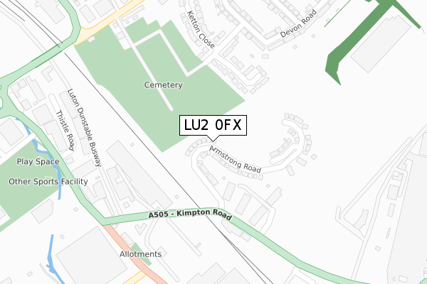
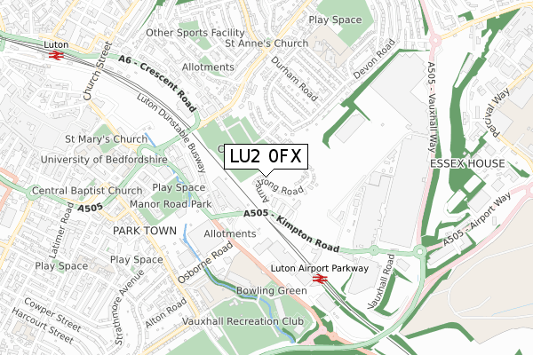
LU2 0FX is located in the Vauxhall electoral ward, within the unitary authority of Luton and the English Parliamentary constituency of Luton South. The Sub Integrated Care Board (ICB) Location is NHS Bedfordshire, Luton and Milton Keynes ICB - M1J4Y and the police force is Bedfordshire. This postcode has been in use since July 2018.


GetTheData
Source: OS Open Zoomstack (Ordnance Survey)
Licence: Open Government Licence (requires attribution)
Attribution: Contains OS data © Crown copyright and database right 2024
Source: Open Postcode Geo
Licence: Open Government Licence (requires attribution)
Attribution: Contains OS data © Crown copyright and database right 2024; Contains Royal Mail data © Royal Mail copyright and database right 2024; Source: Office for National Statistics licensed under the Open Government Licence v.3.0
| Easting | 510435 |
| Northing | 221051 |
| Latitude | 51.877110 |
| Longitude | -0.397114 |
GetTheData
Source: Open Postcode Geo
Licence: Open Government Licence
| Country | England |
| Postcode District | LU2 |
| ➜ LU2 open data dashboard ➜ See where LU2 is on a map ➜ Where is Luton? | |
GetTheData
Source: Land Registry Price Paid Data
Licence: Open Government Licence
| Ward | Vauxhall |
| Constituency | Luton South |
GetTheData
Source: ONS Postcode Database
Licence: Open Government Licence
2023 25 AUG £565,000 |
145, ARMSTRONG ROAD, LUTON, LU2 0FX 2023 17 FEB £520,000 |
141, ARMSTRONG ROAD, LUTON, LU2 0FX 2022 4 NOV £574,995 |
110, ARMSTRONG ROAD, LUTON, LU2 0FX 2022 30 SEP £589,995 |
129, ARMSTRONG ROAD, LUTON, LU2 0FX 2022 30 SEP £577,995 |
139, ARMSTRONG ROAD, LUTON, LU2 0FX 2022 30 SEP £579,995 |
135, ARMSTRONG ROAD, LUTON, LU2 0FX 2022 1 JUL £599,995 |
137, ARMSTRONG ROAD, LUTON, LU2 0FX 2022 1 JUL £589,995 |
127, ARMSTRONG ROAD, LUTON, LU2 0FX 2022 1 JUL £469,995 |
125, ARMSTRONG ROAD, LUTON, LU2 0FX 2022 1 JUL £564,995 |
GetTheData
Source: HM Land Registry Price Paid Data
Licence: Contains HM Land Registry data © Crown copyright and database right 2024. This data is licensed under the Open Government Licence v3.0.
| June 2022 | Public order | On or near Ketton Close | 242m |
| June 2022 | Anti-social behaviour | On or near Ketton Close | 242m |
| June 2022 | Anti-social behaviour | On or near Ketton Close | 242m |
| ➜ Get more crime data in our Crime section | |||
GetTheData
Source: data.police.uk
Licence: Open Government Licence
| The Shops (Kimpton Road) | Vauxhall | 225m |
| Central Car Park Entrance (Kimpton Road) | Vauxhall | 299m |
| War Memorial (Kimpton Road) | Vauxhall | 307m |
| Durham Road | St Annes | 355m |
| Ibc Vehicles Gate 1 (Kimpton Road) | Vauxhall | 375m |
| Luton Airport Parkway Station | 0.5km |
| Luton Station | 1.3km |
| Leagrave Station | 5.3km |
GetTheData
Source: NaPTAN
Licence: Open Government Licence
➜ Broadband speed and availability dashboard for LU2 0FX
| Percentage of properties with Next Generation Access | 100.0% |
| Percentage of properties with Superfast Broadband | 100.0% |
| Percentage of properties with Ultrafast Broadband | 100.0% |
| Percentage of properties with Full Fibre Broadband | 100.0% |
Superfast Broadband is between 30Mbps and 300Mbps
Ultrafast Broadband is > 300Mbps
Ofcom does not currently provide download speed data for LU2 0FX. This is because there are less than four broadband connections in this postcode.
Ofcom does not currently provide upload speed data for LU2 0FX. This is because there are less than four broadband connections in this postcode.
| Percentage of properties unable to receive 2Mbps | 0.0% |
| Percentage of properties unable to receive 5Mbps | 0.0% |
| Percentage of properties unable to receive 10Mbps | 0.0% |
| Percentage of properties unable to receive 30Mbps | 0.0% |
➜ Broadband speed and availability dashboard for LU2 0FX
GetTheData
Source: Ofcom
Licence: Ofcom Terms of Use (requires attribution)
GetTheData
Source: ONS Postcode Database
Licence: Open Government Licence

➜ Get more ratings from the Food Standards Agency
GetTheData
Source: Food Standards Agency
Licence: FSA terms & conditions
| Last Collection | |||
|---|---|---|---|
| Location | Mon-Fri | Sat | Distance |
| Kimpton Road | 17:30 | 12:00 | 295m |
| Crawley Green Road | 17:30 | 12:30 | 438m |
| Blaydon Avenue | 17:30 | 12:00 | 521m |
GetTheData
Source: Dracos
Licence: Creative Commons Attribution-ShareAlike
| Facility | Distance |
|---|---|
| Venue 360 Gipsy Lane, Luton Indoor Tennis Centre, Health and Fitness Gym, Sports Hall, Artificial Grass Pitch, Grass Pitches, Outdoor Tennis Courts, Squash Courts | 647m |
| Luton Town Fc (The Brache) Park Street, Luton Artificial Grass Pitch, Grass Pitches | 690m |
| Adventure Playground (Closed) Brooms Road, Luton Grass Pitches | 806m |
GetTheData
Source: Active Places
Licence: Open Government Licence
| School | Phase of Education | Distance |
|---|---|---|
| Chiltern Academy Gipsy Lane, Luton, LU1 3GF | Secondary | 546m |
| Crawley Green Infant School Beaconsfield, Luton, LU2 0RW | Primary | 579m |
| Wenlock CofE Academy Beaconsfield Road, Luton, LU2 0RW | Primary | 595m |
GetTheData
Source: Edubase
Licence: Open Government Licence
The below table lists the International Territorial Level (ITL) codes (formerly Nomenclature of Territorial Units for Statistics (NUTS) codes) and Local Administrative Units (LAU) codes for LU2 0FX:
| ITL 1 Code | Name |
|---|---|
| TLH | East |
| ITL 2 Code | Name |
| TLH2 | Bedfordshire and Hertfordshire |
| ITL 3 Code | Name |
| TLH21 | Luton |
| LAU 1 Code | Name |
| E06000032 | Luton |
GetTheData
Source: ONS Postcode Directory
Licence: Open Government Licence
The below table lists the Census Output Area (OA), Lower Layer Super Output Area (LSOA), and Middle Layer Super Output Area (MSOA) for LU2 0FX:
| Code | Name | |
|---|---|---|
| OA | E00079492 | |
| LSOA | E01015719 | Luton 016A |
| MSOA | E02003273 | Luton 016 |
GetTheData
Source: ONS Postcode Directory
Licence: Open Government Licence
| LU2 0RQ | Ketton Close | 220m |
| LU2 0RH | Devon Road | 298m |
| LU2 0RG | Rutland Crescent | 306m |
| LU2 0RE | Norfolk Road | 333m |
| LU2 0RD | Durham Road | 389m |
| LU2 0QZ | Ketton Close | 395m |
| LU2 0QY | Crawley Green Road | 427m |
| LU2 0QX | Crawley Green Road | 442m |
| LU2 0QW | Crawley Green Road | 446m |
| LU2 0RF | Rutland Crescent | 457m |
GetTheData
Source: Open Postcode Geo; Land Registry Price Paid Data
Licence: Open Government Licence