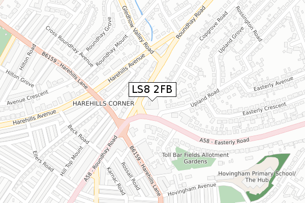
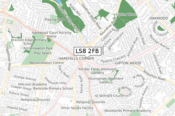
LS8 2FB is located in the Roundhay electoral ward, within the metropolitan district of Leeds and the English Parliamentary constituency of Leeds North East. The Sub Integrated Care Board (ICB) Location is NHS West Yorkshire ICB - 15F and the police force is West Yorkshire. This postcode has been in use since August 2019.


GetTheData
Source: OS Open Zoomstack (Ordnance Survey)
Licence: Open Government Licence (requires attribution)
Attribution: Contains OS data © Crown copyright and database right 2024
Source: Open Postcode Geo
Licence: Open Government Licence (requires attribution)
Attribution: Contains OS data © Crown copyright and database right 2024; Contains Royal Mail data © Royal Mail copyright and database right 2024; Source: Office for National Statistics licensed under the Open Government Licence v.3.0
| Easting | 432071 |
| Northing | 435915 |
| Latitude | 53.818546 |
| Longitude | -1.514352 |
GetTheData
Source: Open Postcode Geo
Licence: Open Government Licence
| Country | England |
| Postcode District | LS8 |
| ➜ LS8 open data dashboard ➜ See where LS8 is on a map ➜ Where is Leeds? | |
GetTheData
Source: Land Registry Price Paid Data
Licence: Open Government Licence
| Ward | Roundhay |
| Constituency | Leeds North East |
GetTheData
Source: ONS Postcode Database
Licence: Open Government Licence
| January 2024 | Drugs | On or near Parking Area | 178m |
| January 2024 | Drugs | On or near Parking Area | 178m |
| January 2024 | Drugs | On or near Parking Area | 178m |
| ➜ Get more crime data in our Crime section | |||
GetTheData
Source: data.police.uk
Licence: Open Government Licence
| Easterly Road | Harehills | 80m |
| Roundhay Rd Copgrove Road (Roundhay Road) | Harehills | 86m |
| Harehills Lane (Roundhay Road) | Harehills | 98m |
| Harehills Lane Hill Top Mount (Harehills Lane) | Harehills | 144m |
| Harehills Lane Roundhay Rd (Harehills Lane) | Harehills | 147m |
| Leeds Station | 3.4km |
| Burley Park Station | 4.2km |
| Cross Gates Station | 4.4km |
GetTheData
Source: NaPTAN
Licence: Open Government Licence
GetTheData
Source: ONS Postcode Database
Licence: Open Government Licence


➜ Get more ratings from the Food Standards Agency
GetTheData
Source: Food Standards Agency
Licence: FSA terms & conditions
| Last Collection | |||
|---|---|---|---|
| Location | Mon-Fri | Sat | Distance |
| Harehills P.o. | 17:30 | 12:15 | 191m |
| Gledhow Valley Road | 17:45 | 11:30 | 200m |
| Easterley Road South | 18:30 | 11:15 | 305m |
GetTheData
Source: Dracos
Licence: Creative Commons Attribution-ShareAlike
| Facility | Distance |
|---|---|
| Fitness 2000 Leeds (Closed) Roundhay Road, Leeds Health and Fitness Gym | 174m |
| Bangladesh Centre Leeds Roundhay Road, Leeds Sports Hall | 513m |
| Bilal Sports Centre 60 Ashton Rd, Harehills, Leeds Sports Hall | 565m |
GetTheData
Source: Active Places
Licence: Open Government Licence
| School | Phase of Education | Distance |
|---|---|---|
| Hovingham Primary School Hovingham Avenue, Leeds, LS8 3QY | Primary | 436m |
| Bankside Primary School Shepherds Lane, Leeds, LS8 5AW | Primary | 670m |
| St Augustine's Catholic Primary School, A Voluntary Academy St Wilfrid's Circus, Leeds, LS8 3PF | Primary | 727m |
GetTheData
Source: Edubase
Licence: Open Government Licence
The below table lists the International Territorial Level (ITL) codes (formerly Nomenclature of Territorial Units for Statistics (NUTS) codes) and Local Administrative Units (LAU) codes for LS8 2FB:
| ITL 1 Code | Name |
|---|---|
| TLE | Yorkshire and The Humber |
| ITL 2 Code | Name |
| TLE4 | West Yorkshire |
| ITL 3 Code | Name |
| TLE42 | Leeds |
| LAU 1 Code | Name |
| E08000035 | Leeds |
GetTheData
Source: ONS Postcode Directory
Licence: Open Government Licence
The below table lists the Census Output Area (OA), Lower Layer Super Output Area (LSOA), and Middle Layer Super Output Area (MSOA) for LS8 2FB:
| Code | Name | |
|---|---|---|
| OA | E00058717 | |
| LSOA | E01011647 | Leeds 037D |
| MSOA | E02002366 | Leeds 037 |
GetTheData
Source: ONS Postcode Directory
Licence: Open Government Licence
| LS8 4HT | Roundhay Road | 86m |
| LS8 4HY | Brookfield Avenue | 125m |
| LS8 4HX | Harehills Avenue | 125m |
| LS8 2SQ | Upland Road | 136m |
| LS8 4HZ | Harehills Lane | 151m |
| LS8 4JA | Harehills Lane | 161m |
| LS8 3AA | Easterly Road | 164m |
| LS8 4HU | Harehills Avenue | 166m |
| LS8 3AB | Easterly Grove | 169m |
| LS8 2SS | Chirton Grove | 182m |
GetTheData
Source: Open Postcode Geo; Land Registry Price Paid Data
Licence: Open Government Licence