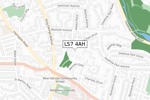
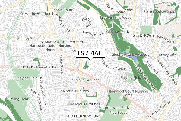
LS7 4AH is located in the Chapel Allerton electoral ward, within the metropolitan district of Leeds and the English Parliamentary constituency of Leeds North East. The Sub Integrated Care Board (ICB) Location is NHS West Yorkshire ICB - 15F and the police force is West Yorkshire. This postcode has been in use since March 2019.


GetTheData
Source: OS Open Zoomstack (Ordnance Survey)
Licence: Open Government Licence (requires attribution)
Attribution: Contains OS data © Crown copyright and database right 2024
Source: Open Postcode Geo
Licence: Open Government Licence (requires attribution)
Attribution: Contains OS data © Crown copyright and database right 2024; Contains Royal Mail data © Royal Mail copyright and database right 2024; Source: Office for National Statistics licensed under the Open Government Licence v.3.0
| Easting | 431045 |
| Northing | 436704 |
| Latitude | 53.825699 |
| Longitude | -1.529856 |
GetTheData
Source: Open Postcode Geo
Licence: Open Government Licence
| Country | England |
| Postcode District | LS7 |
| ➜ LS7 open data dashboard ➜ See where LS7 is on a map ➜ Where is Leeds? | |
GetTheData
Source: Land Registry Price Paid Data
Licence: Open Government Licence
| Ward | Chapel Allerton |
| Constituency | Leeds North East |
GetTheData
Source: ONS Postcode Database
Licence: Open Government Licence
4, MANSION GATE COURT, CHAPEL ALLERTON, LEEDS, LS7 4AH 2022 27 SEP £837,500 |
3, MANSION GATE COURT, LEEDS, LS7 4AH 2020 21 JAN £549,950 |
5, MANSION GATE COURT, CHAPEL ALLERTON, LEEDS, LS7 4AH 2019 7 AUG £549,950 |
4, MANSION GATE COURT, CHAPEL ALLERTON, LEEDS, LS7 4AH 2019 31 JUL £549,950 |
GetTheData
Source: HM Land Registry Price Paid Data
Licence: Contains HM Land Registry data © Crown copyright and database right 2024. This data is licensed under the Open Government Licence v3.0.
| November 2023 | Criminal damage and arson | On or near Methley Lane | 475m |
| August 2023 | Violence and sexual offences | On or near Hospital | 339m |
| August 2023 | Violence and sexual offences | On or near Hospital | 339m |
| ➜ Get more crime data in our Crime section | |||
GetTheData
Source: data.police.uk
Licence: Open Government Licence
| Harehills Lane Harrogate Rd (Harehills Lane) | Chapel Allerton | 196m |
| Harrogate Road Potternewton Ln (Harrogate Road) | Chapel Allerton | 256m |
| Harrogate Rd Potternewton Lane (Harrogate Road) | Chapel Allerton | 261m |
| Harrogate Road Brantford St (Harrogate Road) | Chapel Allerton | 332m |
| Harehills Lane Roxholme Grove (Harehills Lane) | Chapel Allerton | 371m |
| Burley Park Station | 3.5km |
| Leeds Station | 3.6km |
| Headingley Station | 4.3km |
GetTheData
Source: NaPTAN
Licence: Open Government Licence
| Percentage of properties with Next Generation Access | 100.0% |
| Percentage of properties with Superfast Broadband | 100.0% |
| Percentage of properties with Ultrafast Broadband | 100.0% |
| Percentage of properties with Full Fibre Broadband | 0.0% |
Superfast Broadband is between 30Mbps and 300Mbps
Ultrafast Broadband is > 300Mbps
| Percentage of properties unable to receive 2Mbps | 0.0% |
| Percentage of properties unable to receive 5Mbps | 0.0% |
| Percentage of properties unable to receive 10Mbps | 0.0% |
| Percentage of properties unable to receive 30Mbps | 0.0% |
GetTheData
Source: Ofcom
Licence: Ofcom Terms of Use (requires attribution)
GetTheData
Source: ONS Postcode Database
Licence: Open Government Licence


➜ Get more ratings from the Food Standards Agency
GetTheData
Source: Food Standards Agency
Licence: FSA terms & conditions
| Last Collection | |||
|---|---|---|---|
| Location | Mon-Fri | Sat | Distance |
| Alberta Avenue | 17:30 | 11:15 | 161m |
| Montreal Avenue P.o. | 17:30 | 12:00 | 366m |
| Woodlands | 17:30 | 11:15 | 429m |
GetTheData
Source: Dracos
Licence: Creative Commons Attribution-ShareAlike
| Facility | Distance |
|---|---|
| New Horizon Community School Newton Hill Road, Leeds Sports Hall | 219m |
| Southerns Stadium Roxholme Road, Chapel Allerton, Leeds Grass Pitches, Artificial Grass Pitch | 573m |
| Chapel Allerton Methodist Church Town Street, Chapel Allerton, Leeds Sports Hall | 604m |
GetTheData
Source: Active Places
Licence: Open Government Licence
| School | Phase of Education | Distance |
|---|---|---|
| Al Kauthar Girls Academy Newton Hill House, Newton Hill Road, Leeds, LS7 4JE | Not applicable | 219m |
| Chapel Allerton Primary School Harrogate Road, Leeds, LS7 3PD | Primary | 522m |
| Bracken Edge Primary School Bracken Edge Primary School, Newton Garth, Off Newton Road, Leeds, LS7 4HE | Primary | 609m |
GetTheData
Source: Edubase
Licence: Open Government Licence
The below table lists the International Territorial Level (ITL) codes (formerly Nomenclature of Territorial Units for Statistics (NUTS) codes) and Local Administrative Units (LAU) codes for LS7 4AH:
| ITL 1 Code | Name |
|---|---|
| TLE | Yorkshire and The Humber |
| ITL 2 Code | Name |
| TLE4 | West Yorkshire |
| ITL 3 Code | Name |
| TLE42 | Leeds |
| LAU 1 Code | Name |
| E08000035 | Leeds |
GetTheData
Source: ONS Postcode Directory
Licence: Open Government Licence
The below table lists the Census Output Area (OA), Lower Layer Super Output Area (LSOA), and Middle Layer Super Output Area (MSOA) for LS7 4AH:
| Code | Name | |
|---|---|---|
| OA | E00057193 | |
| LSOA | E01011353 | Leeds 034D |
| MSOA | E02002363 | Leeds 034 |
GetTheData
Source: ONS Postcode Directory
Licence: Open Government Licence
| LS7 4LU | Manitoba Place | 94m |
| LS7 4LS | Vancouver Place | 100m |
| LS7 4SX | Mansion Gate | 112m |
| LS7 4LP | Edmonton Place | 114m |
| LS7 4JS | Gledhow Park View | 126m |
| LS7 4SY | Mansion Gate Drive | 135m |
| LS7 4SS | Mansion Gate Mews | 140m |
| LS7 4LW | Montreal Avenue | 152m |
| LS7 4LH | King George Avenue | 162m |
| LS7 4LL | Ontario Place | 174m |
GetTheData
Source: Open Postcode Geo; Land Registry Price Paid Data
Licence: Open Government Licence