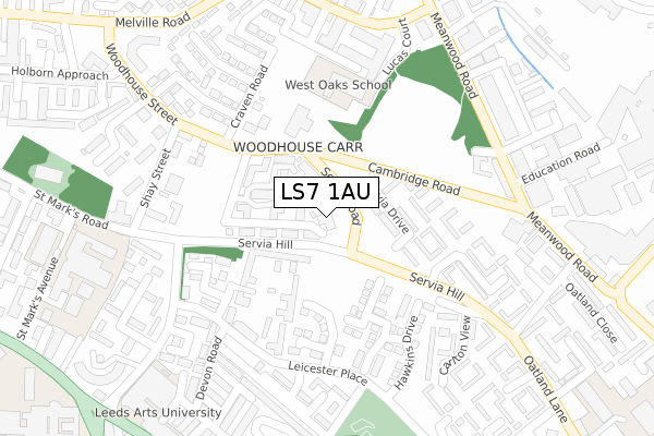
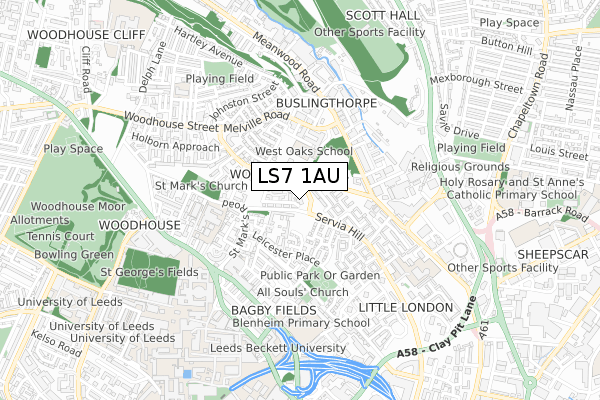
LS7 1AU is located in the Little London & Woodhouse electoral ward, within the metropolitan district of Leeds and the English Parliamentary constituency of Leeds Central. The Sub Integrated Care Board (ICB) Location is NHS West Yorkshire ICB - 15F and the police force is West Yorkshire. This postcode has been in use since November 2017.


GetTheData
Source: OS Open Zoomstack (Ordnance Survey)
Licence: Open Government Licence (requires attribution)
Attribution: Contains OS data © Crown copyright and database right 2024
Source: Open Postcode Geo
Licence: Open Government Licence (requires attribution)
Attribution: Contains OS data © Crown copyright and database right 2024; Contains Royal Mail data © Royal Mail copyright and database right 2024; Source: Office for National Statistics licensed under the Open Government Licence v.3.0
| Easting | 429930 |
| Northing | 435099 |
| Latitude | 53.811339 |
| Longitude | -1.546950 |
GetTheData
Source: Open Postcode Geo
Licence: Open Government Licence
| Country | England |
| Postcode District | LS7 |
| ➜ LS7 open data dashboard ➜ See where LS7 is on a map ➜ Where is Leeds? | |
GetTheData
Source: Land Registry Price Paid Data
Licence: Open Government Licence
| Ward | Little London & Woodhouse |
| Constituency | Leeds Central |
GetTheData
Source: ONS Postcode Database
Licence: Open Government Licence
| January 2024 | Burglary | On or near Petrol Station | 493m |
| January 2024 | Other theft | On or near Petrol Station | 493m |
| January 2024 | Shoplifting | On or near Petrol Station | 493m |
| ➜ Get more crime data in our Crime section | |||
GetTheData
Source: data.police.uk
Licence: Open Government Licence
| Woodhouse Street North West Rd (Woodhouse Street) | Woodhouse | 127m |
| Servia Hill St Marks Road (Servia Hill) | Woodhouse | 165m |
| Woodhouse St Craven Road (Woodhouse Street) | Woodhouse | 180m |
| Servia Hill Servia Gardens (Servia Hill) | Little London | 191m |
| St Marks Road Servia Hill (St Marks Road) | Woodhouse | 237m |
| Leeds Station | 1.7km |
| Burley Park Station | 2km |
| Headingley Station | 3.2km |
GetTheData
Source: NaPTAN
Licence: Open Government Licence
| Percentage of properties with Next Generation Access | 100.0% |
| Percentage of properties with Superfast Broadband | 100.0% |
| Percentage of properties with Ultrafast Broadband | 100.0% |
| Percentage of properties with Full Fibre Broadband | 100.0% |
Superfast Broadband is between 30Mbps and 300Mbps
Ultrafast Broadband is > 300Mbps
| Percentage of properties unable to receive 2Mbps | 0.0% |
| Percentage of properties unable to receive 5Mbps | 0.0% |
| Percentage of properties unable to receive 10Mbps | 0.0% |
| Percentage of properties unable to receive 30Mbps | 0.0% |
GetTheData
Source: Ofcom
Licence: Ofcom Terms of Use (requires attribution)
GetTheData
Source: ONS Postcode Database
Licence: Open Government Licence


➜ Get more ratings from the Food Standards Agency
GetTheData
Source: Food Standards Agency
Licence: FSA terms & conditions
| Last Collection | |||
|---|---|---|---|
| Location | Mon-Fri | Sat | Distance |
| Woodhouse Street P.o. | 18:30 | 12:00 | 321m |
| Meanwood Road/Stocks Street | 17:30 | 12:00 | 324m |
| Oatland Road/Close | 17:30 | 12:00 | 379m |
GetTheData
Source: Dracos
Licence: Creative Commons Attribution-ShareAlike
| Facility | Distance |
|---|---|
| Little London Park Cambridge Road, Leeds Grass Pitches | 118m |
| Notre Dame Catholic Sixth Form College St. Marks Avenue, Leeds Sports Hall | 382m |
| Blenheim Primary School Lofthouse Place, Leeds Grass Pitches | 483m |
GetTheData
Source: Active Places
Licence: Open Government Licence
| School | Phase of Education | Distance |
|---|---|---|
| West Oaks School Crowther Place, Leeds, LS6 2ST | Not applicable | 203m |
| Notre Dame Catholic Sixth Form College St Mark's Avenue, Leeds, LS2 9BL | 16 plus | 397m |
| Leeds Arts University Blenheim Walk, Leeds, LS2 9AQ | Not applicable | 397m |
GetTheData
Source: Edubase
Licence: Open Government Licence
The below table lists the International Territorial Level (ITL) codes (formerly Nomenclature of Territorial Units for Statistics (NUTS) codes) and Local Administrative Units (LAU) codes for LS7 1AU:
| ITL 1 Code | Name |
|---|---|
| TLE | Yorkshire and The Humber |
| ITL 2 Code | Name |
| TLE4 | West Yorkshire |
| ITL 3 Code | Name |
| TLE42 | Leeds |
| LAU 1 Code | Name |
| E08000035 | Leeds |
GetTheData
Source: ONS Postcode Directory
Licence: Open Government Licence
The below table lists the Census Output Area (OA), Lower Layer Super Output Area (LSOA), and Middle Layer Super Output Area (MSOA) for LS7 1AU:
| Code | Name | |
|---|---|---|
| OA | E00169748 | |
| LSOA | E01033005 | Leeds 055H |
| MSOA | E02002384 | Leeds 055 |
GetTheData
Source: ONS Postcode Directory
Licence: Open Government Licence
| LS6 2QH | Northwest Business Park | 87m |
| LS7 1NN | Servia Drive | 113m |
| LS7 1LL | Duxbury Rise | 140m |
| LS7 1NW | Servia Gardens | 200m |
| LS2 9BS | Dene House Court | 214m |
| LS7 1LJ | Hawkins Drive | 220m |
| LS7 1LH | Livinia Grove | 229m |
| LS7 1NL | Servia Hill | 235m |
| LS6 2QB | 246m | |
| LS6 2QD | 246m |
GetTheData
Source: Open Postcode Geo; Land Registry Price Paid Data
Licence: Open Government Licence