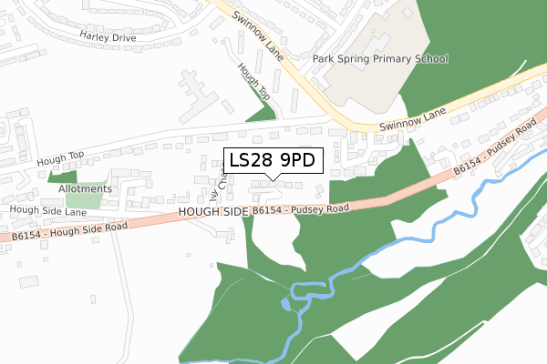
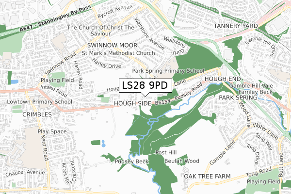
LS28 9PD is located in the Pudsey electoral ward, within the metropolitan district of Leeds and the English Parliamentary constituency of Pudsey. The Sub Integrated Care Board (ICB) Location is NHS West Yorkshire ICB - 15F and the police force is West Yorkshire. This postcode has been in use since September 2019.


GetTheData
Source: OS Open Zoomstack (Ordnance Survey)
Licence: Open Government Licence (requires attribution)
Attribution: Contains OS data © Crown copyright and database right 2024
Source: Open Postcode Geo
Licence: Open Government Licence (requires attribution)
Attribution: Contains OS data © Crown copyright and database right 2024; Contains Royal Mail data © Royal Mail copyright and database right 2024; Source: Office for National Statistics licensed under the Open Government Licence v.3.0
| Easting | 423841 |
| Northing | 433478 |
| Latitude | 53.797083 |
| Longitude | -1.639544 |
GetTheData
Source: Open Postcode Geo
Licence: Open Government Licence
| Country | England |
| Postcode District | LS28 |
| ➜ LS28 open data dashboard ➜ See where LS28 is on a map ➜ Where is Leeds? | |
GetTheData
Source: Land Registry Price Paid Data
Licence: Open Government Licence
| Ward | Pudsey |
| Constituency | Pudsey |
GetTheData
Source: ONS Postcode Database
Licence: Open Government Licence
12, SOUTH SIDE RIDGE, PUDSEY, LS28 9PD 2021 19 MAR £584,950 |
2021 5 MAR £569,950 |
4, SOUTH SIDE RIDGE, PUDSEY, LS28 9PD 2020 18 DEC £619,950 |
7, SOUTH SIDE RIDGE, PUDSEY, LS28 9PD 2020 27 NOV £609,995 |
9, SOUTH SIDE RIDGE, PUDSEY, LS28 9PD 2020 5 NOV £699,950 |
10, SOUTH SIDE RIDGE, PUDSEY, LS28 9PD 2020 27 OCT £580,000 |
1, SOUTH SIDE RIDGE, PUDSEY, LS28 9PD 2020 21 MAY £580,950 |
6, SOUTH SIDE RIDGE, PUDSEY, LS28 9PD 2020 19 FEB £549,950 |
5, SOUTH SIDE RIDGE, PUDSEY, LS28 9PD 2019 19 DEC £549,950 |
2, SOUTH SIDE RIDGE, PUDSEY, LS28 9PD 2019 1 NOV £609,950 |
GetTheData
Source: HM Land Registry Price Paid Data
Licence: Contains HM Land Registry data © Crown copyright and database right 2024. This data is licensed under the Open Government Licence v3.0.
| September 2023 | Burglary | On or near Hough Side Lane | 444m |
| July 2023 | Vehicle crime | On or near Hough Side Lane | 444m |
| March 2023 | Vehicle crime | On or near Hough Side Lane | 444m |
| ➜ Get more crime data in our Crime section | |||
GetTheData
Source: data.police.uk
Licence: Open Government Licence
| Hough Side Rd Hough Side Lane (Pudsey Road) | Pudsey | 220m |
| Swinnow La Wellstone Avenue (Swinnow Lane) | Pudsey | 244m |
| Hough Side Rd Hough Side Lane (Hough Side Road) | Pudsey | 252m |
| Swinnow La Wellstone Avenue (Swinnow Lane) | Pudsey | 279m |
| Swinnow Ln Hough End (Swinnow Lane) | Pudsey | 287m |
| Bramley (West Yorks) Station | 0.9km |
| New Pudsey Station | 2.8km |
| Kirkstall Forge Station | 3.2km |
GetTheData
Source: NaPTAN
Licence: Open Government Licence
GetTheData
Source: ONS Postcode Database
Licence: Open Government Licence


➜ Get more ratings from the Food Standards Agency
GetTheData
Source: Food Standards Agency
Licence: FSA terms & conditions
| Last Collection | |||
|---|---|---|---|
| Location | Mon-Fri | Sat | Distance |
| Wellstone Rise Post Office | 17:30 | 11:45 | 423m |
| Hough End | 17:30 | 11:15 | 673m |
| Harley Drive | 17:30 | 11:15 | 675m |
GetTheData
Source: Dracos
Licence: Creative Commons Attribution-ShareAlike
| Facility | Distance |
|---|---|
| Park Spring Primary School Swinnow Lane, Leeds Grass Pitches | 299m |
| Houghside Centre Hough Top, Swinnow, Leeds Grass Pitches | 373m |
| Swinnow Community Centre Swinnow Lane, Leeds Sports Hall | 500m |
GetTheData
Source: Active Places
Licence: Open Government Licence
| School | Phase of Education | Distance |
|---|---|---|
| Park Spring Primary School Swinnow Lane, Leeds, LS13 4QT | Primary | 252m |
| Swinnow Primary School Swinnow Road, Leeds, LS13 4PG | Primary | 806m |
| Lowtown Primary School Kent Road, Pudsey, LS28 9BB | Primary | 952m |
GetTheData
Source: Edubase
Licence: Open Government Licence
The below table lists the International Territorial Level (ITL) codes (formerly Nomenclature of Territorial Units for Statistics (NUTS) codes) and Local Administrative Units (LAU) codes for LS28 9PD:
| ITL 1 Code | Name |
|---|---|
| TLE | Yorkshire and The Humber |
| ITL 2 Code | Name |
| TLE4 | West Yorkshire |
| ITL 3 Code | Name |
| TLE42 | Leeds |
| LAU 1 Code | Name |
| E08000035 | Leeds |
GetTheData
Source: ONS Postcode Directory
Licence: Open Government Licence
The below table lists the Census Output Area (OA), Lower Layer Super Output Area (LSOA), and Middle Layer Super Output Area (MSOA) for LS28 9PD:
| Code | Name | |
|---|---|---|
| OA | E00058527 | |
| LSOA | E01011614 | Leeds 068E |
| MSOA | E02002397 | Leeds 068 |
GetTheData
Source: ONS Postcode Directory
Licence: Open Government Licence
| LS28 9LG | Ivy Chase | 116m |
| LS13 4QD | Harewood Way | 158m |
| LS13 4QW | Hough Top | 168m |
| LS13 4QT | Swinnow Lane | 193m |
| LS13 4QU | Swinnow Lane | 213m |
| LS28 9JL | Hough Side Close | 273m |
| LS13 4EQ | Wellstone Avenue | 286m |
| LS13 4EU | Ridge View | 300m |
| LS13 4QX | Swinnow Lane | 301m |
| LS13 4EH | Wellstone Avenue | 315m |
GetTheData
Source: Open Postcode Geo; Land Registry Price Paid Data
Licence: Open Government Licence