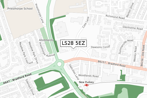
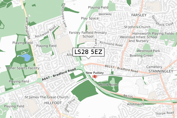
LS28 5EZ is located in the Calverley & Farsley electoral ward, within the metropolitan district of Leeds and the English Parliamentary constituency of Pudsey. The Sub Integrated Care Board (ICB) Location is NHS West Yorkshire ICB - 15F and the police force is West Yorkshire. This postcode has been in use since May 2018.


GetTheData
Source: OS Open Zoomstack (Ordnance Survey)
Licence: Open Government Licence (requires attribution)
Attribution: Contains OS data © Crown copyright and database right 2024
Source: Open Postcode Geo
Licence: Open Government Licence (requires attribution)
Attribution: Contains OS data © Crown copyright and database right 2024; Contains Royal Mail data © Royal Mail copyright and database right 2024; Source: Office for National Statistics licensed under the Open Government Licence v.3.0
| Easting | 421018 |
| Northing | 434551 |
| Latitude | 53.806847 |
| Longitude | -1.682328 |
GetTheData
Source: Open Postcode Geo
Licence: Open Government Licence
| Country | England |
| Postcode District | LS28 |
| ➜ LS28 open data dashboard ➜ See where LS28 is on a map ➜ Where is Pudsey? | |
GetTheData
Source: Land Registry Price Paid Data
Licence: Open Government Licence
| Ward | Calverley & Farsley |
| Constituency | Pudsey |
GetTheData
Source: ONS Postcode Database
Licence: Open Government Licence
| July 2022 | Burglary | On or near Woodlands Road | 208m |
| June 2022 | Bicycle theft | On or near Theatre/Concert Hall | 87m |
| June 2022 | Public order | On or near Woodlands Grove | 127m |
| ➜ Get more crime data in our Crime section | |||
GetTheData
Source: data.police.uk
Licence: Open Government Licence
| Bradford Road Ruskin St (Bradford Road) | Farsley | 177m |
| Bradford Road Ruskin St (Bradford Road) | Farsley | 190m |
| Stanningley By-pass New Pudsey Stn (Stanningley By-pass) | Pudsey | 214m |
| Dawsons Corner (Bradford Road) | Pudsey | 243m |
| Richmond Rd Fairfield Drive (Richmond Road) | Farsley | 291m |
| New Pudsey Station | 0.3km |
| Bramley (West Yorks) Station | 3km |
| Apperley Bridge Station | 4.2km |
GetTheData
Source: NaPTAN
Licence: Open Government Licence
➜ Broadband speed and availability dashboard for LS28 5EZ
| Percentage of properties with Next Generation Access | 100.0% |
| Percentage of properties with Superfast Broadband | 100.0% |
| Percentage of properties with Ultrafast Broadband | 100.0% |
| Percentage of properties with Full Fibre Broadband | 100.0% |
Superfast Broadband is between 30Mbps and 300Mbps
Ultrafast Broadband is > 300Mbps
| Median download speed | 100.0Mbps |
| Average download speed | 100.0Mbps |
| Maximum download speed | 100.00Mbps |
Ofcom does not currently provide upload speed data for LS28 5EZ. This is because there are less than four broadband connections in this postcode.
| Percentage of properties unable to receive 2Mbps | 0.0% |
| Percentage of properties unable to receive 5Mbps | 0.0% |
| Percentage of properties unable to receive 10Mbps | 0.0% |
| Percentage of properties unable to receive 30Mbps | 0.0% |
➜ Broadband speed and availability dashboard for LS28 5EZ
GetTheData
Source: Ofcom
Licence: Ofcom Terms of Use (requires attribution)
GetTheData
Source: ONS Postcode Database
Licence: Open Government Licence


➜ Get more ratings from the Food Standards Agency
GetTheData
Source: Food Standards Agency
Licence: FSA terms & conditions
| Last Collection | |||
|---|---|---|---|
| Location | Mon-Fri | Sat | Distance |
| Woodhall Park P.o. | 18:00 | 11:45 | 396m |
| 153 Bradford Road | 17:30 | 11:45 | 437m |
| Rockwood Road | 17:30 | 11:00 | 692m |
GetTheData
Source: Dracos
Licence: Creative Commons Attribution-ShareAlike
| Facility | Distance |
|---|---|
| Farsley Fairfield Primary School Cote Lane, Farsley, Pudsey Grass Pitches | 291m |
| Co-op Academy Priesthorpe Priesthorpe Lane, Farsley, Pudsey Sports Hall, Grass Pitches, Health and Fitness Gym, Artificial Grass Pitch, Outdoor Tennis Courts | 472m |
| Woodhall Park Woodhall Close, Stanningley, Pudsey Grass Pitches | 651m |
GetTheData
Source: Active Places
Licence: Open Government Licence
| School | Phase of Education | Distance |
|---|---|---|
| Farsley Farfield Primary School Cote Lane, Farsley, Pudsey, LS28 5ED | Primary | 290m |
| Co-op Academy Priesthorpe Priesthorpe Lane, Farsley, Pudsey, LS28 5SG | Secondary | 543m |
| Farsley Westroyd Primary School and Nursery Frances Street, Farsley, Pudsey, Leeds, LS28 5BH | Primary | 733m |
GetTheData
Source: Edubase
Licence: Open Government Licence
The below table lists the International Territorial Level (ITL) codes (formerly Nomenclature of Territorial Units for Statistics (NUTS) codes) and Local Administrative Units (LAU) codes for LS28 5EZ:
| ITL 1 Code | Name |
|---|---|
| TLE | Yorkshire and The Humber |
| ITL 2 Code | Name |
| TLE4 | West Yorkshire |
| ITL 3 Code | Name |
| TLE42 | Leeds |
| LAU 1 Code | Name |
| E08000035 | Leeds |
GetTheData
Source: ONS Postcode Directory
Licence: Open Government Licence
The below table lists the Census Output Area (OA), Lower Layer Super Output Area (LSOA), and Middle Layer Super Output Area (MSOA) for LS28 5EZ:
| Code | Name | |
|---|---|---|
| OA | E00058418 | |
| LSOA | E01011595 | Leeds 066B |
| MSOA | E02002395 | Leeds 066 |
GetTheData
Source: ONS Postcode Directory
Licence: Open Government Licence
| LS28 6QB | Bradford Road | 108m |
| LS28 6QQ | Woodlands Grove | 110m |
| LS28 6QE | Woodlands Avenue | 147m |
| LS28 6QD | Woodlands Terrace | 187m |
| LS28 5TU | Dawsons Meadow | 191m |
| LS28 5GN | Station Square | 201m |
| LS28 7TF | Priesthorpe Avenue | 219m |
| LS28 7TG | Priesthorpe Avenue | 230m |
| LS28 6PZ | Ruskin Street | 239m |
| LS28 5TA | Dawsons Corner | 242m |
GetTheData
Source: Open Postcode Geo; Land Registry Price Paid Data
Licence: Open Government Licence