LS26 9FR maps, stats, and open data
LS26 9FR is located in the Kippax & Methley electoral ward, within the metropolitan district of Leeds and the English Parliamentary constituency of Elmet and Rothwell. The Sub Integrated Care Board (ICB) Location is NHS West Yorkshire ICB - 15F and the police force is West Yorkshire. This postcode has been in use since November 2017.
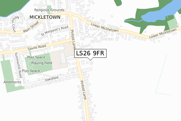
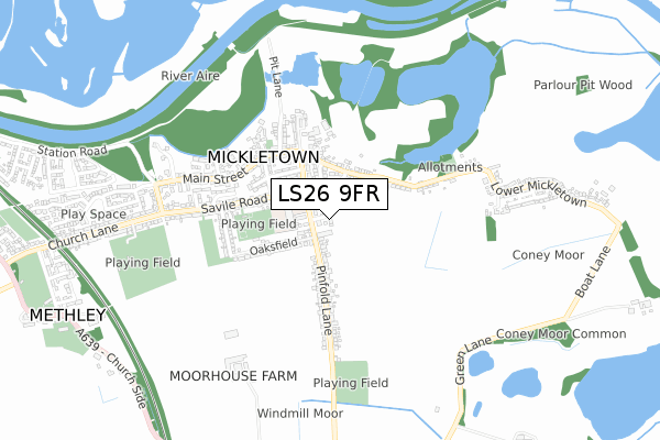
LS26 9FR maps


Licence: Open Government Licence (requires attribution)
Attribution: Contains OS data © Crown copyright and database right 2025
Source: Open Postcode Geo
Licence: Open Government Licence (requires attribution)
Attribution: Contains OS data © Crown copyright and database right 2025; Contains Royal Mail data © Royal Mail copyright and database right 2025; Source: Office for National Statistics licensed under the Open Government Licence v.3.0
LS26 9FR geodata
| Easting | 440119 |
| Northing | 427034 |
| Latitude | 53.738172 |
| Longitude | -1.393266 |
Where is LS26 9FR?
| Country | England |
| Postcode District | LS26 |
Politics
| Ward | Kippax & Methley |
|---|---|
| Constituency | Elmet And Rothwell |
House Prices
Sales of detached houses in LS26 9FR
1, FOXHOLES PLACE, METHLEY, LEEDS, LS26 9FR 2021 22 MAR £425,000 |
2019 2 APR £355,000 |
3, FOXHOLES PLACE, METHLEY, LEEDS, LS26 9FR 2018 24 AUG £310,000 |
6, FOXHOLES PLACE, METHLEY, LEEDS, LS26 9FR 2018 15 JUN £310,000 |
5, FOXHOLES PLACE, METHLEY, LEEDS, LS26 9FR 2017 21 DEC £310,000 |
4, FOXHOLES PLACE, METHLEY, LEEDS, LS26 9FR 2017 30 NOV £299,950 |
2017 17 NOV £310,000 |
Licence: Contains HM Land Registry data © Crown copyright and database right 2025. This data is licensed under the Open Government Licence v3.0.
Transport
Nearest bus stops to LS26 9FR
| Pinfold Lane Oaksfield (Pinfold Lane) | Mickletown | 69m |
| Pinfold Lane Taylor Grove (Pinfold Lane) | Mickletown | 104m |
| Pinfold Lane Oaksfield (Pinfold Lane) | Mickletown | 138m |
| Mickletown School (Savile Road) | Mickletown | 171m |
| Mickletown School (Savile Road) | Mickletown | 180m |
Nearest railway stations to LS26 9FR
| Castleford Station | 3km |
| Woodlesford Station | 3.9km |
| Normanton Station | 4.6km |
Broadband
Broadband access in LS26 9FR (2020 data)
| Percentage of properties with Next Generation Access | 100.0% |
| Percentage of properties with Superfast Broadband | 100.0% |
| Percentage of properties with Ultrafast Broadband | 0.0% |
| Percentage of properties with Full Fibre Broadband | 0.0% |
Superfast Broadband is between 30Mbps and 300Mbps
Ultrafast Broadband is > 300Mbps
Broadband speed in LS26 9FR (2019 data)
Download
| Median download speed | 58.9Mbps |
| Average download speed | 53.2Mbps |
| Maximum download speed | 80.00Mbps |
Upload
| Median upload speed | 14.8Mbps |
| Average upload speed | 13.3Mbps |
| Maximum upload speed | 20.00Mbps |
Broadband limitations in LS26 9FR (2020 data)
| Percentage of properties unable to receive 2Mbps | 0.0% |
| Percentage of properties unable to receive 5Mbps | 0.0% |
| Percentage of properties unable to receive 10Mbps | 0.0% |
| Percentage of properties unable to receive 30Mbps | 0.0% |
Deprivation
40% of English postcodes are less deprived than LS26 9FR:Food Standards Agency
Three nearest food hygiene ratings to LS26 9FR (metres)


➜ Get more ratings from the Food Standards Agency
Nearest post box to LS26 9FR
| Last Collection | |||
|---|---|---|---|
| Location | Mon-Fri | Sat | Distance |
| Pinfold Lane | 16:30 | 11:00 | 248m |
| Mickletown P.o. | 17:00 | 11:15 | 335m |
| Wilson Row/Lower Mickletown | 16:30 | 11:00 | 617m |
Environment
| Risk of LS26 9FR flooding from rivers and sea | Low |
LS26 9FR ITL and LS26 9FR LAU
The below table lists the International Territorial Level (ITL) codes (formerly Nomenclature of Territorial Units for Statistics (NUTS) codes) and Local Administrative Units (LAU) codes for LS26 9FR:
| ITL 1 Code | Name |
|---|---|
| TLE | Yorkshire and The Humber |
| ITL 2 Code | Name |
| TLE4 | West Yorkshire |
| ITL 3 Code | Name |
| TLE42 | Leeds |
| LAU 1 Code | Name |
| E08000035 | Leeds |
LS26 9FR census areas
The below table lists the Census Output Area (OA), Lower Layer Super Output Area (LSOA), and Middle Layer Super Output Area (MSOA) for LS26 9FR:
| Code | Name | |
|---|---|---|
| OA | E00057421 | |
| LSOA | E01011394 | Leeds 103D |
| MSOA | E02002432 | Leeds 103 |
Nearest postcodes to LS26 9FR
| LS26 9AD | Taylor Grove | 85m |
| LS26 9LA | Pinfold Close | 113m |
| LS26 9JY | Ings Drive | 127m |
| LS26 9AA | Pinfold Lane | 145m |
| LS26 9JZ | Ings View | 171m |
| LS26 9JL | Fir Tree View | 180m |
| LS26 9JH | Lower Mickletown | 206m |
| LS26 9AE | Oaksfield | 236m |
| LS26 9JR | Greenfield Terrace | 254m |
| LS26 9JS | Pinfold Lane | 255m |