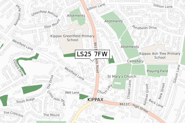
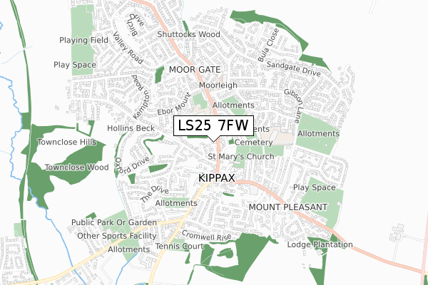
LS25 7FW is located in the Kippax & Methley electoral ward, within the metropolitan district of Leeds and the English Parliamentary constituency of Elmet and Rothwell. The Sub Integrated Care Board (ICB) Location is NHS West Yorkshire ICB - 15F and the police force is West Yorkshire. This postcode has been in use since November 2019.


GetTheData
Source: OS Open Zoomstack (Ordnance Survey)
Licence: Open Government Licence (requires attribution)
Attribution: Contains OS data © Crown copyright and database right 2024
Source: Open Postcode Geo
Licence: Open Government Licence (requires attribution)
Attribution: Contains OS data © Crown copyright and database right 2024; Contains Royal Mail data © Royal Mail copyright and database right 2024; Source: Office for National Statistics licensed under the Open Government Licence v.3.0
| Easting | 441548 |
| Northing | 430448 |
| Latitude | 53.768743 |
| Longitude | -1.371146 |
GetTheData
Source: Open Postcode Geo
Licence: Open Government Licence
| Country | England |
| Postcode District | LS25 |
| ➜ LS25 open data dashboard ➜ See where LS25 is on a map ➜ Where is Kippax? | |
GetTheData
Source: Land Registry Price Paid Data
Licence: Open Government Licence
| Ward | Kippax & Methley |
| Constituency | Elmet And Rothwell |
GetTheData
Source: ONS Postcode Database
Licence: Open Government Licence
| November 2023 | Public order | On or near Parking Area | 284m |
| August 2023 | Violence and sexual offences | On or near Parking Area | 284m |
| August 2023 | Shoplifting | On or near Parking Area | 284m |
| ➜ Get more crime data in our Crime section | |||
GetTheData
Source: data.police.uk
Licence: Open Government Licence
| Leeds Rd Church Lane (Leeds Road) | Kippax | 26m |
| Leeds Rd Church Lane (Leeds Road) | Kippax | 48m |
| Kippax Cross Hills (Leeds Road) | Kippax | 205m |
| Cross Hills (High Street) | Kippax | 207m |
| Kippax Cross Hills (Butt Hill) | Kippax | 221m |
| East Garforth Station | 2.6km |
| Garforth Station | 3.2km |
| Micklefield Station | 3.7km |
GetTheData
Source: NaPTAN
Licence: Open Government Licence
GetTheData
Source: ONS Postcode Database
Licence: Open Government Licence


➜ Get more ratings from the Food Standards Agency
GetTheData
Source: Food Standards Agency
Licence: FSA terms & conditions
| Last Collection | |||
|---|---|---|---|
| Location | Mon-Fri | Sat | Distance |
| Great Preston P.o. | 17:00 | 11:30 | 1,470m |
| Whitehouse Lane | 17:00 | 11:30 | 1,626m |
| Brigeshaw Lane | 16:00 | 11:15 | 1,683m |
GetTheData
Source: Dracos
Licence: Creative Commons Attribution-ShareAlike
| Facility | Distance |
|---|---|
| St Marys Church Hall Church Lane, Kippax, Leeds Sports Hall | 171m |
| Kippax Greenfield Primary School Ebor Mount, Kippax, Leeds Grass Pitches | 175m |
| Kippax Ash Tree Primary School Gibson Lane, Kippax, Leeds Grass Pitches | 360m |
GetTheData
Source: Active Places
Licence: Open Government Licence
| School | Phase of Education | Distance |
|---|---|---|
| Kippax Greenfield Primary School Ebor Mount, Kippax, Leeds, LS25 7PA | Primary | 216m |
| Kippax Ash Tree Primary School Gibson Lane, Kippax, Leeds, LS25 7JL | Primary | 349m |
| Kippax North Primary School Brexdale Avenue, Kippax, Leeds, LS25 7EJ | Primary | 1.3km |
GetTheData
Source: Edubase
Licence: Open Government Licence
The below table lists the International Territorial Level (ITL) codes (formerly Nomenclature of Territorial Units for Statistics (NUTS) codes) and Local Administrative Units (LAU) codes for LS25 7FW:
| ITL 1 Code | Name |
|---|---|
| TLE | Yorkshire and The Humber |
| ITL 2 Code | Name |
| TLE4 | West Yorkshire |
| ITL 3 Code | Name |
| TLE42 | Leeds |
| LAU 1 Code | Name |
| E08000035 | Leeds |
GetTheData
Source: ONS Postcode Directory
Licence: Open Government Licence
The below table lists the Census Output Area (OA), Lower Layer Super Output Area (LSOA), and Middle Layer Super Output Area (MSOA) for LS25 7FW:
| Code | Name | |
|---|---|---|
| OA | E00056933 | |
| LSOA | E01011305 | Leeds 089D |
| MSOA | E02002418 | Leeds 089 |
GetTheData
Source: ONS Postcode Directory
Licence: Open Government Licence
| LS25 7LX | Green Square | 43m |
| LS25 7HE | Robinson Lane | 66m |
| LS25 7HF | Church Lane | 123m |
| LS25 7HD | West View | 132m |
| LS25 7HQ | Leeds Road | 146m |
| LS25 7LY | Westfield Lane | 152m |
| LS25 7LU | Westfield Lane | 158m |
| LS25 7HH | Rutland Drive | 164m |
| LS25 7HB | East View | 164m |
| LS25 7HG | Leeds Road | 183m |
GetTheData
Source: Open Postcode Geo; Land Registry Price Paid Data
Licence: Open Government Licence