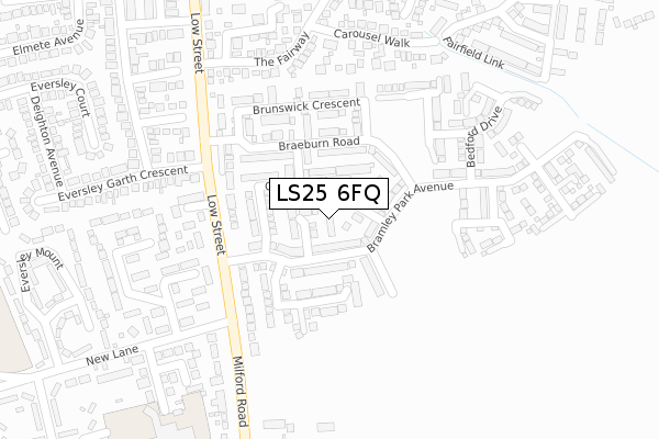
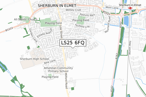
LS25 6FQ is located in the Sherburn in Elmet electoral ward, within the unitary authority of North Yorkshire and the English Parliamentary constituency of Selby and Ainsty. The Sub Integrated Care Board (ICB) Location is NHS Humber and North Yorkshire ICB - 03Q and the police force is North Yorkshire. This postcode has been in use since September 2017.


GetTheData
Source: OS Open Zoomstack (Ordnance Survey)
Licence: Open Government Licence (requires attribution)
Attribution: Contains OS data © Crown copyright and database right 2024
Source: Open Postcode Geo
Licence: Open Government Licence (requires attribution)
Attribution: Contains OS data © Crown copyright and database right 2024; Contains Royal Mail data © Royal Mail copyright and database right 2024; Source: Office for National Statistics licensed under the Open Government Licence v.3.0
| Easting | 449645 |
| Northing | 433001 |
| Latitude | 53.790982 |
| Longitude | -1.247905 |
GetTheData
Source: Open Postcode Geo
Licence: Open Government Licence
| Country | England |
| Postcode District | LS25 |
| ➜ LS25 open data dashboard ➜ See where LS25 is on a map ➜ Where is Sherburn in Elmet? | |
GetTheData
Source: Land Registry Price Paid Data
Licence: Open Government Licence
| Ward | Sherburn In Elmet |
| Constituency | Selby And Ainsty |
GetTheData
Source: ONS Postcode Database
Licence: Open Government Licence
| May 2023 | Public order | On or near Eversley Mount | 463m |
| April 2023 | Public order | On or near Eversley Mount | 463m |
| April 2023 | Criminal damage and arson | On or near Eversley Mount | 463m |
| ➜ Get more crime data in our Crime section | |||
GetTheData
Source: data.police.uk
Licence: Open Government Licence
| New Lane (Low Street) | Sherburn In Elmet | 206m |
| New Lane (Milford Road) | Sherburn In Elmet | 216m |
| The Fairway (Low Street) | Sherburn In Elmet | 315m |
| Sherburn Park (Low Street) | Sherburn In Elmet | 394m |
| Deighton Avenue (Eversley Court) | Sherburn In Elmet | 514m |
| South Milford Station | 1km |
| Sherburn-in-Elmet Station | 1.2km |
| Church Fenton Station | 4.2km |
GetTheData
Source: NaPTAN
Licence: Open Government Licence
➜ Broadband speed and availability dashboard for LS25 6FQ
| Percentage of properties with Next Generation Access | 100.0% |
| Percentage of properties with Superfast Broadband | 100.0% |
| Percentage of properties with Ultrafast Broadband | 0.0% |
| Percentage of properties with Full Fibre Broadband | 0.0% |
Superfast Broadband is between 30Mbps and 300Mbps
Ultrafast Broadband is > 300Mbps
| Median download speed | 39.1Mbps |
| Average download speed | 33.0Mbps |
| Maximum download speed | 55.00Mbps |
| Median upload speed | 9.8Mbps |
| Average upload speed | 7.8Mbps |
| Maximum upload speed | 10.00Mbps |
| Percentage of properties unable to receive 2Mbps | 0.0% |
| Percentage of properties unable to receive 5Mbps | 0.0% |
| Percentage of properties unable to receive 10Mbps | 0.0% |
| Percentage of properties unable to receive 30Mbps | 0.0% |
➜ Broadband speed and availability dashboard for LS25 6FQ
GetTheData
Source: Ofcom
Licence: Ofcom Terms of Use (requires attribution)
GetTheData
Source: ONS Postcode Database
Licence: Open Government Licence


➜ Get more ratings from the Food Standards Agency
GetTheData
Source: Food Standards Agency
Licence: FSA terms & conditions
| Last Collection | |||
|---|---|---|---|
| Location | Mon-Fri | Sat | Distance |
| Highfields | 17:00 | 09:00 | 615m |
| Common Lane/Mill Lane | 16:15 | 09:45 | 1,323m |
| South Milford P.o. | 17:30 | 11:00 | 1,448m |
GetTheData
Source: Dracos
Licence: Creative Commons Attribution-ShareAlike
| Facility | Distance |
|---|---|
| Athelstan Community Primary School Milford Road, Sherburn In Elmet, Leeds Grass Pitches | 402m |
| Sherburn High School Garden Lane, Sherburn In Elmet, Leeds Health and Fitness Gym, Grass Pitches, Sports Hall, Swimming Pool, Artificial Grass Pitch | 620m |
| Sherburn Eversley Cricket Club Church View, Sherburn In Elmet, Leeds Grass Pitches | 650m |
GetTheData
Source: Active Places
Licence: Open Government Licence
| School | Phase of Education | Distance |
|---|---|---|
| Sherburn in Elmet, Athelstan Community Primary School Milford Road, Sherburn-in-Elmet, Leeds, LS25 6QN | Primary | 402m |
| Sherburn High School Garden Lane, Sherburn-in-Elmet, Leeds, LS25 6AS | Secondary | 620m |
| Sherburn Hungate Primary School North Crescent, Sherburn-in-Elmet, Leeds, LS25 6DD | Primary | 1km |
GetTheData
Source: Edubase
Licence: Open Government Licence
The below table lists the International Territorial Level (ITL) codes (formerly Nomenclature of Territorial Units for Statistics (NUTS) codes) and Local Administrative Units (LAU) codes for LS25 6FQ:
| ITL 1 Code | Name |
|---|---|
| TLE | Yorkshire and The Humber |
| ITL 2 Code | Name |
| TLE2 | North Yorkshire |
| ITL 3 Code | Name |
| TLE22 | North Yorkshire CC |
| LAU 1 Code | Name |
| E07000169 | Selby |
GetTheData
Source: ONS Postcode Directory
Licence: Open Government Licence
The below table lists the Census Output Area (OA), Lower Layer Super Output Area (LSOA), and Middle Layer Super Output Area (MSOA) for LS25 6FQ:
| Code | Name | |
|---|---|---|
| OA | E00142219 | |
| LSOA | E01027915 | Selby 004C |
| MSOA | E02005812 | Selby 004 |
GetTheData
Source: ONS Postcode Directory
Licence: Open Government Licence
| LS25 6AE | High Trees Court | 210m |
| LS25 6HT | Beechwood Close | 233m |
| LS25 6LR | Prospect Avenue | 234m |
| LS25 6LP | Carousel Walk | 275m |
| LS25 6BB | Low Street | 280m |
| LS25 6AF | Milford Road | 286m |
| LS25 6HX | Beechwood Croft | 304m |
| LS25 6AZ | Rose Crescent | 308m |
| LS25 6LN | The Fairway | 313m |
| LS25 6LW | Showfield Close | 322m |
GetTheData
Source: Open Postcode Geo; Land Registry Price Paid Data
Licence: Open Government Licence