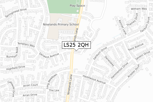
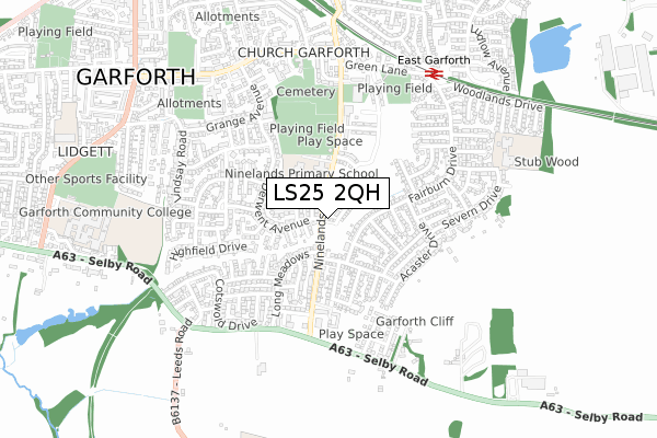
LS25 2QH is located in the Garforth & Swillington electoral ward, within the metropolitan district of Leeds and the English Parliamentary constituency of Elmet and Rothwell. The Sub Integrated Care Board (ICB) Location is NHS West Yorkshire ICB - 15F and the police force is West Yorkshire. This postcode has been in use since October 2019.


GetTheData
Source: OS Open Zoomstack (Ordnance Survey)
Licence: Open Government Licence (requires attribution)
Attribution: Contains OS data © Crown copyright and database right 2024
Source: Open Postcode Geo
Licence: Open Government Licence (requires attribution)
Attribution: Contains OS data © Crown copyright and database right 2024; Contains Royal Mail data © Royal Mail copyright and database right 2024; Source: Office for National Statistics licensed under the Open Government Licence v.3.0
| Easting | 441127 |
| Northing | 432498 |
| Latitude | 53.787201 |
| Longitude | -1.377260 |
GetTheData
Source: Open Postcode Geo
Licence: Open Government Licence
| Country | England |
| Postcode District | LS25 |
| ➜ LS25 open data dashboard ➜ See where LS25 is on a map ➜ Where is Garforth? | |
GetTheData
Source: Land Registry Price Paid Data
Licence: Open Government Licence
| Ward | Garforth & Swillington |
| Constituency | Elmet And Rothwell |
GetTheData
Source: ONS Postcode Database
Licence: Open Government Licence
3, ALLERTON RISE, GARFORTH, LEEDS, LS25 2QH 2019 27 SEP £317,950 |
2, ALLERTON RISE, GARFORTH, LEEDS, LS25 2QH 2019 27 SEP £349,950 |
1, ALLERTON RISE, GARFORTH, LEEDS, LS25 2QH 2019 20 SEP £349,950 |
GetTheData
Source: HM Land Registry Price Paid Data
Licence: Contains HM Land Registry data © Crown copyright and database right 2024. This data is licensed under the Open Government Licence v3.0.
| December 2023 | Burglary | On or near Kennet Lane | 341m |
| June 2022 | Violence and sexual offences | On or near Paddock Close | 71m |
| June 2022 | Violence and sexual offences | On or near Paddock Close | 71m |
| ➜ Get more crime data in our Crime section | |||
GetTheData
Source: data.police.uk
Licence: Open Government Licence
| Ninelands Lane Derwent Ave (Ninelands Lane) | Garforth | 42m |
| Ninelands Lane Hazelwood Ave (Ninelands Lane) | Garforth | 86m |
| Fairburn Dr Eastwood Grove (Fairburn Drive) | Garforth | 119m |
| Ninelands Lane Hazelwood Ave (Ninelands Lane) | Garforth | 134m |
| Fairburn Dr Eastwood Grove (Fairburn Drive) | Garforth | 147m |
| East Garforth Station | 0.7km |
| Garforth Station | 1.1km |
| Micklefield Station | 3.3km |
GetTheData
Source: NaPTAN
Licence: Open Government Licence
GetTheData
Source: ONS Postcode Database
Licence: Open Government Licence


➜ Get more ratings from the Food Standards Agency
GetTheData
Source: Food Standards Agency
Licence: FSA terms & conditions
| Last Collection | |||
|---|---|---|---|
| Location | Mon-Fri | Sat | Distance |
| Ninelands P.o. | 17:30 | 11:45 | 117m |
| Church Lane/Grange Avenue | 17:45 | 10:00 | 664m |
| By Police Station Lidgett Lane | 18:00 | 10:15 | 913m |
GetTheData
Source: Dracos
Licence: Creative Commons Attribution-ShareAlike
| Facility | Distance |
|---|---|
| Ninelands Primary School Ninelands Lane, Garforth, Leeds Grass Pitches | 224m |
| Glebelands Recreation Ground Ninelands Lane, Garforth, Leeds Grass Pitches | 410m |
| Garforth Leisure Centre Ninelands Lane, Garforth, Leeds Sports Hall, Health and Fitness Gym, Squash Courts, Studio | 486m |
GetTheData
Source: Active Places
Licence: Open Government Licence
| School | Phase of Education | Distance |
|---|---|---|
| Ninelands Primary School Ninelands Lane, Garforth, Leeds, LS25 1NT | Primary | 206m |
| Green Lane Primary Academy Ribblesdale Avenue, Garforth, Leeds, LS25 2JX | Primary | 718m |
| Garforth Academy Lidgett Lane, Garforth, Leeds, LS25 1LJ | Secondary | 912m |
GetTheData
Source: Edubase
Licence: Open Government Licence
The below table lists the International Territorial Level (ITL) codes (formerly Nomenclature of Territorial Units for Statistics (NUTS) codes) and Local Administrative Units (LAU) codes for LS25 2QH:
| ITL 1 Code | Name |
|---|---|
| TLE | Yorkshire and The Humber |
| ITL 2 Code | Name |
| TLE4 | West Yorkshire |
| ITL 3 Code | Name |
| TLE42 | Leeds |
| LAU 1 Code | Name |
| E08000035 | Leeds |
GetTheData
Source: ONS Postcode Directory
Licence: Open Government Licence
The below table lists the Census Output Area (OA), Lower Layer Super Output Area (LSOA), and Middle Layer Super Output Area (MSOA) for LS25 2QH:
| Code | Name | |
|---|---|---|
| OA | E00057419 | |
| LSOA | E01011401 | Leeds 077C |
| MSOA | E02002406 | Leeds 077 |
GetTheData
Source: ONS Postcode Directory
Licence: Open Government Licence
| LS25 1HZ | Medway Avenue | 81m |
| LS25 1JA | Paddock Close | 87m |
| LS25 1NH | Ninelands Spur | 136m |
| LS25 1HY | Glebelands Close | 157m |
| LS25 1HX | Meriden Avenue | 168m |
| LS25 2AS | Eastwood Grove | 196m |
| LS25 1HS | Derwent Avenue | 213m |
| LS25 2AN | Ninelands Lane | 214m |
| LS25 2AW | Hazelwood Avenue | 220m |
| LS25 1HU | Holman Avenue | 223m |
GetTheData
Source: Open Postcode Geo; Land Registry Price Paid Data
Licence: Open Government Licence