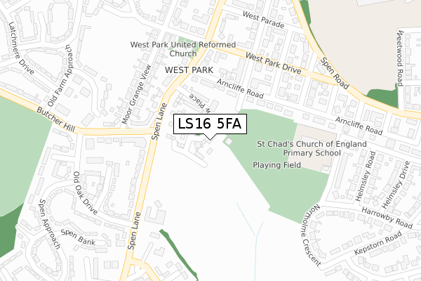
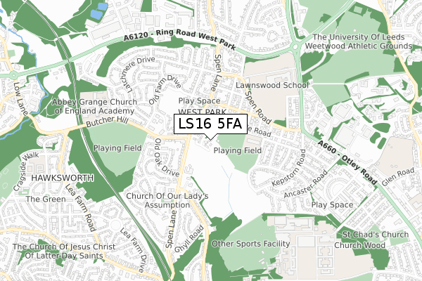
LS16 5FA is located in the Weetwood electoral ward, within the metropolitan district of Leeds and the English Parliamentary constituency of Leeds North West. The Sub Integrated Care Board (ICB) Location is NHS West Yorkshire ICB - 15F and the police force is West Yorkshire. This postcode has been in use since April 2020.


GetTheData
Source: OS Open Zoomstack (Ordnance Survey)
Licence: Open Government Licence (requires attribution)
Attribution: Contains OS data © Crown copyright and database right 2024
Source: Open Postcode Geo
Licence: Open Government Licence (requires attribution)
Attribution: Contains OS data © Crown copyright and database right 2024; Contains Royal Mail data © Royal Mail copyright and database right 2024; Source: Office for National Statistics licensed under the Open Government Licence v.3.0
| Easting | 426325 |
| Northing | 437474 |
| Latitude | 53.832879 |
| Longitude | -1.601493 |
GetTheData
Source: Open Postcode Geo
Licence: Open Government Licence
| Country | England |
| Postcode District | LS16 |
| ➜ LS16 open data dashboard ➜ See where LS16 is on a map ➜ Where is Leeds? | |
GetTheData
Source: Land Registry Price Paid Data
Licence: Open Government Licence
| Ward | Weetwood |
| Constituency | Leeds North West |
GetTheData
Source: ONS Postcode Database
Licence: Open Government Licence
2, WEST GROVE, WEST PARK, LEEDS, LS16 5FA 2020 6 MAR £412,500 |
1, WEST GROVE, WEST PARK, LEEDS, LS16 5FA 2020 6 MAR £417,500 |
GetTheData
Source: HM Land Registry Price Paid Data
Licence: Contains HM Land Registry data © Crown copyright and database right 2024. This data is licensed under the Open Government Licence v3.0.
| November 2023 | Violence and sexual offences | On or near Spen Approach | 487m |
| October 2023 | Violence and sexual offences | On or near West Parade | 314m |
| July 2023 | Vehicle crime | On or near West Parade | 314m |
| ➜ Get more crime data in our Crime section | |||
GetTheData
Source: data.police.uk
Licence: Open Government Licence
| Spen Lane Butcher Hill (Spen Lane) | West Park | 136m |
| Spen Lane Butcher Hill (Spen Lane) | West Park | 158m |
| Butcher Hill Old Oak Drive (Butcher Hill) | West Park | 285m |
| Butcher Hill Old Oak Drive (Butcher Hill) | West Park | 293m |
| Old Oak Drive Butcher Hill (Old Oak Drive) | West Park | 320m |
| Kirkstall Forge Station | 1.7km |
| Headingley Station | 1.7km |
| Horsforth Station | 2.5km |
GetTheData
Source: NaPTAN
Licence: Open Government Licence
GetTheData
Source: ONS Postcode Database
Licence: Open Government Licence


➜ Get more ratings from the Food Standards Agency
GetTheData
Source: Food Standards Agency
Licence: FSA terms & conditions
| Last Collection | |||
|---|---|---|---|
| Location | Mon-Fri | Sat | Distance |
| Butcher Hill P.o. | 17:45 | 12:15 | 301m |
| Greenhead Road | 17:30 | 12:00 | 344m |
| Queenswood Green/Drive | 17:30 | 11:45 | 368m |
GetTheData
Source: Dracos
Licence: Creative Commons Attribution-ShareAlike
| Facility | Distance |
|---|---|
| West Park Playing Fields Arncliffe Road, West Park, Leeds Grass Pitches | 44m |
| Lawnswood School Otley Road, West Park, Leeds Health and Fitness Gym, Sports Hall, Grass Pitches, Studio | 503m |
| Butcher Hill Playing Fields Butcher Hill, Leeds Grass Pitches | 540m |
GetTheData
Source: Active Places
Licence: Open Government Licence
| School | Phase of Education | Distance |
|---|---|---|
| St Chad's Church of England Primary School Northolme Avenue, West Park, Leeds, LS16 5QR | Primary | 248m |
| Abbey Grange Church of England Academy Butcher Hill, Leeds, LS16 5EA | Secondary | 472m |
| Lawnswood School Ring Road, West Park, Leeds, LS16 5AG | Secondary | 539m |
GetTheData
Source: Edubase
Licence: Open Government Licence
The below table lists the International Territorial Level (ITL) codes (formerly Nomenclature of Territorial Units for Statistics (NUTS) codes) and Local Administrative Units (LAU) codes for LS16 5FA:
| ITL 1 Code | Name |
|---|---|
| TLE | Yorkshire and The Humber |
| ITL 2 Code | Name |
| TLE4 | West Yorkshire |
| ITL 3 Code | Name |
| TLE42 | Leeds |
| LAU 1 Code | Name |
| E08000035 | Leeds |
GetTheData
Source: ONS Postcode Directory
Licence: Open Government Licence
The below table lists the Census Output Area (OA), Lower Layer Super Output Area (LSOA), and Middle Layer Super Output Area (MSOA) for LS16 5FA:
| Code | Name | |
|---|---|---|
| OA | E00169583 | |
| LSOA | E01011685 | Leeds 109A |
| MSOA | E02006852 | Leeds 109 |
GetTheData
Source: ONS Postcode Directory
Licence: Open Government Licence
| LS16 5BD | Spen Lane | 164m |
| LS16 5QB | North Parade | 174m |
| LS16 5AP | Arncliffe Road | 182m |
| LS16 5BH | Moor Grange View | 190m |
| LS16 5BQ | Butcher Hill | 194m |
| LS16 5BG | Butcher Hill | 209m |
| LS16 5EJ | Spen Lane | 227m |
| LS16 5BJ | Moor Grange View | 231m |
| LS16 5AS | West Park Drive | 241m |
| LS16 5AR | Thornfield Road | 243m |
GetTheData
Source: Open Postcode Geo; Land Registry Price Paid Data
Licence: Open Government Licence