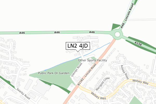
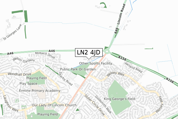
LN2 4JD is located in the Minster electoral ward, within the local authority district of Lincoln and the English Parliamentary constituency of Lincoln. The Sub Integrated Care Board (ICB) Location is NHS Lincolnshire ICB - 71E and the police force is Lincolnshire. This postcode has been in use since May 2018.


GetTheData
Source: OS Open Zoomstack (Ordnance Survey)
Licence: Open Government Licence (requires attribution)
Attribution: Contains OS data © Crown copyright and database right 2024
Source: Open Postcode Geo
Licence: Open Government Licence (requires attribution)
Attribution: Contains OS data © Crown copyright and database right 2024; Contains Royal Mail data © Royal Mail copyright and database right 2024; Source: Office for National Statistics licensed under the Open Government Licence v.3.0
| Easting | 498998 |
| Northing | 373939 |
| Latitude | 53.253260 |
| Longitude | -0.517608 |
GetTheData
Source: Open Postcode Geo
Licence: Open Government Licence
| Country | England |
| Postcode District | LN2 |
| ➜ LN2 open data dashboard ➜ See where LN2 is on a map ➜ Where is Lincoln? | |
GetTheData
Source: Land Registry Price Paid Data
Licence: Open Government Licence
| Ward | Minster |
| Constituency | Lincoln |
GetTheData
Source: ONS Postcode Database
Licence: Open Government Licence
60, FLAVIAN ROAD, LINCOLN, LN2 4JD 2021 25 JUN £369,950 |
62, FLAVIAN ROAD, LINCOLN, LN2 4JD 2021 28 MAY £282,950 |
56, FLAVIAN ROAD, LINCOLN, LN2 4JD 2018 4 JUN £334,950 |
58, FLAVIAN ROAD, LINCOLN, LN2 4JD 2018 6 APR £245,950 |
GetTheData
Source: HM Land Registry Price Paid Data
Licence: Contains HM Land Registry data © Crown copyright and database right 2024. This data is licensed under the Open Government Licence v3.0.
| June 2022 | Criminal damage and arson | On or near Lincoln Road | 139m |
| June 2022 | Shoplifting | On or near Supermarket | 267m |
| June 2022 | Shoplifting | On or near Supermarket | 267m |
| ➜ Get more crime data in our Crime section | |||
GetTheData
Source: data.police.uk
Licence: Open Government Licence
| Letter Box (Lincoln Road) | Lincoln | 153m |
| Letter Box (Lincoln Road) | Lincoln | 157m |
| Marigold Close (Wolsey Way) | Nettleham Fields | 234m |
| Marigold Close (Wolsey Way) | Nettleham Fields | 240m |
| Waitrose (Nettleham Road) | Nettleham Fields | 280m |
| Lincoln Central Station | 3.4km |
GetTheData
Source: NaPTAN
Licence: Open Government Licence
| Percentage of properties with Next Generation Access | 100.0% |
| Percentage of properties with Superfast Broadband | 100.0% |
| Percentage of properties with Ultrafast Broadband | 100.0% |
| Percentage of properties with Full Fibre Broadband | 100.0% |
Superfast Broadband is between 30Mbps and 300Mbps
Ultrafast Broadband is > 300Mbps
| Percentage of properties unable to receive 2Mbps | 0.0% |
| Percentage of properties unable to receive 5Mbps | 0.0% |
| Percentage of properties unable to receive 10Mbps | 0.0% |
| Percentage of properties unable to receive 30Mbps | 0.0% |
GetTheData
Source: Ofcom
Licence: Ofcom Terms of Use (requires attribution)
GetTheData
Source: ONS Postcode Database
Licence: Open Government Licence


➜ Get more ratings from the Food Standards Agency
GetTheData
Source: Food Standards Agency
Licence: FSA terms & conditions
| Last Collection | |||
|---|---|---|---|
| Location | Mon-Fri | Sat | Distance |
| Lincoln Road | 17:30 | 12:45 | 163m |
| Wolsey Way | 17:30 | 12:15 | 1,175m |
| Lee Road | 17:30 | 11:30 | 1,582m |
GetTheData
Source: Dracos
Licence: Creative Commons Attribution-ShareAlike
| Facility | Distance |
|---|---|
| Energie Fitness (Lincoln) Flavian Road, Lincoln Health and Fitness Gym, Studio | 110m |
| King George V Playing Field (Lincoln) Macaulay Drive, Lincoln Grass Pitches | 621m |
| The Sudbrooke Drive Community Centre Sudbrooke Drive, Lincoln Grass Pitches, Sports Hall | 889m |
GetTheData
Source: Active Places
Licence: Open Government Licence
| School | Phase of Education | Distance |
|---|---|---|
| Ermine Primary Academy Redbourne Drive, Lincoln, LN2 2HG | Primary | 741m |
| Our Lady of Lincoln Catholic Primary School A Voluntary Academy Laughton Way, Lincoln, LN2 2HE | Primary | 794m |
| Springwell Alternative Academy Lincoln Macaulay Drive, Lincoln, LN2 4EL | Not applicable | 967m |
GetTheData
Source: Edubase
Licence: Open Government Licence
The below table lists the International Territorial Level (ITL) codes (formerly Nomenclature of Territorial Units for Statistics (NUTS) codes) and Local Administrative Units (LAU) codes for LN2 4JD:
| ITL 1 Code | Name |
|---|---|
| TLF | East Midlands (England) |
| ITL 2 Code | Name |
| TLF3 | Lincolnshire |
| ITL 3 Code | Name |
| TLF30 | Lincolnshire CC |
| LAU 1 Code | Name |
| E07000138 | Lincoln |
GetTheData
Source: ONS Postcode Directory
Licence: Open Government Licence
The below table lists the Census Output Area (OA), Lower Layer Super Output Area (LSOA), and Middle Layer Super Output Area (MSOA) for LN2 4JD:
| Code | Name | |
|---|---|---|
| OA | E00132848 | |
| LSOA | E01026165 | Lincoln 002D |
| MSOA | E02005443 | Lincoln 002 |
GetTheData
Source: ONS Postcode Directory
Licence: Open Government Licence
| LN2 2NF | Lincoln Road | 227m |
| LN2 4UE | Blackthorn Close | 257m |
| LN2 4SZ | Marigold Close | 264m |
| LN2 4SU | Aster Close | 292m |
| LN2 4UB | Azalea Road | 297m |
| LN2 4HB | Browning Drive | 370m |
| LN2 4DT | Searby Road | 373m |
| LN2 4UD | Bellflower Close | 380m |
| LN2 4UP | Langdale Close | 398m |
| LN2 4TE | Thistle Close | 416m |
GetTheData
Source: Open Postcode Geo; Land Registry Price Paid Data
Licence: Open Government Licence