Property/Postcode Data Search:
LN1 2QU maps, stats, and open data
LN1 2QU is located in the Torksey electoral ward, within the local authority district of West Lindsey and the English Parliamentary constituency of Gainsborough. The Sub Integrated Care Board (ICB) Location is NHS Lincolnshire ICB - 71E and the police force is Lincolnshire. This postcode has been in use since September 2018.
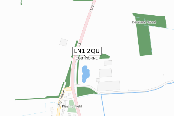
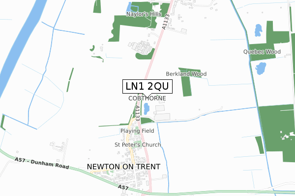
LN1 2QU maps


Source: OS Open Zoomstack (Ordnance Survey)
Licence: Open Government Licence (requires attribution)
Attribution: Contains OS data © Crown copyright and database right 2025
Source: Open Postcode Geo
Licence: Open Government Licence (requires attribution)
Attribution: Contains OS data © Crown copyright and database right 2025; Contains Royal Mail data © Royal Mail copyright and database right 2025; Source: Office for National Statistics licensed under the Open Government Licence v.3.0
Licence: Open Government Licence (requires attribution)
Attribution: Contains OS data © Crown copyright and database right 2025
Source: Open Postcode Geo
Licence: Open Government Licence (requires attribution)
Attribution: Contains OS data © Crown copyright and database right 2025; Contains Royal Mail data © Royal Mail copyright and database right 2025; Source: Office for National Statistics licensed under the Open Government Licence v.3.0
LN1 2QU geodata
| Easting | 483376 |
| Northing | 374807 |
| Latitude | 53.263740 |
| Longitude | -0.751467 |
Where is LN1 2QU?
| Country | England |
| Postcode District | LN1 |
Politics
| Ward | Torksey |
|---|---|
| Constituency | Gainsborough |
Transport
Nearest bus stops to LN1 2QU
| Demand Responsive Area | Newton On Trent | 537m |
| Dunham Close (Dunham Road) | Newton On Trent | 650m |
| Dunham Close (Dunham Road) | Newton On Trent | 677m |
| Demand Responsive Area | Laughterton | 922m |
| Home Farm Close (A1133) | Laughterton | 1,208m |
Deprivation
55.3% of English postcodes are less deprived than LN1 2QU:Food Standards Agency
Three nearest food hygiene ratings to LN1 2QU (metres)
Post Office Stores

6 High Street
487m
Newton On Trent C E Primary School
High Street
847m
The Courtyard Tea Room

Hall Farm
849m
➜ Get more ratings from the Food Standards Agency
Nearest post box to LN1 2QU
| Last Collection | |||
|---|---|---|---|
| Location | Mon-Fri | Sat | Distance |
| Church Laneham | 16:30 | 11:00 | 2,653m |
| North Clifton | 16:00 | 09:30 | 2,838m |
| Thorney | 16:00 | 10:00 | 3,080m |
Environment
| Risk of LN1 2QU flooding from rivers and sea | Medium |
LN1 2QU ITL and LN1 2QU LAU
The below table lists the International Territorial Level (ITL) codes (formerly Nomenclature of Territorial Units for Statistics (NUTS) codes) and Local Administrative Units (LAU) codes for LN1 2QU:
| ITL 1 Code | Name |
|---|---|
| TLF | East Midlands (England) |
| ITL 2 Code | Name |
| TLF3 | Lincolnshire |
| ITL 3 Code | Name |
| TLF30 | Lincolnshire CC |
| LAU 1 Code | Name |
| E07000142 | West Lindsey |
LN1 2QU census areas
The below table lists the Census Output Area (OA), Lower Layer Super Output Area (LSOA), and Middle Layer Super Output Area (MSOA) for LN1 2QU:
| Code | Name | |
|---|---|---|
| OA | E00134179 | |
| LSOA | E01026409 | West Lindsey 007C |
| MSOA | E02005498 | West Lindsey 007 |
Nearest postcodes to LN1 2QU
| LN1 2WF | Church Yard | 336m |
| LN1 2JS | High Street | 426m |
| LN1 2GJ | Orchard Close | 548m |
| LN1 2NN | The Grove | 628m |
| LN1 2JP | High Street | 690m |
| LN1 2FY | Cockerels Roost | 701m |
| LN1 2JR | Dunham Road | 702m |
| LN1 2YU | The Brambles | 739m |
| LN1 2BF | Trent Lane | 741m |
| LN1 2JG | The Paddocks | 758m |