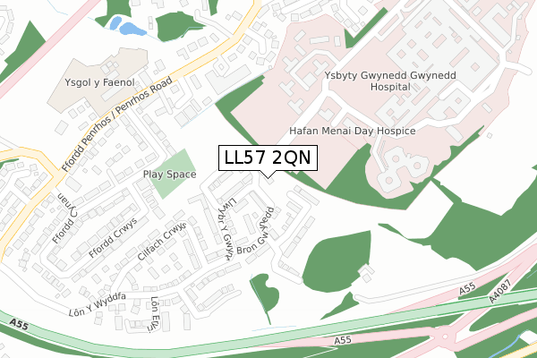
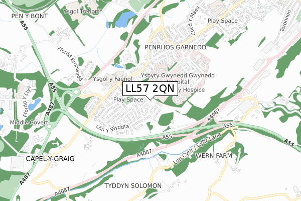
LL57 2QN is located in the Y Faenol electoral ward, within the unitary authority of Gwynedd and the Welsh Parliamentary constituency of Arfon. The Local Health Board is Betsi Cadwaladr University and the police force is North Wales. This postcode has been in use since November 2019.


GetTheData
Source: OS Open Zoomstack (Ordnance Survey)
Licence: Open Government Licence (requires attribution)
Attribution: Contains OS data © Crown copyright and database right 2024
Source: Open Postcode Geo
Licence: Open Government Licence (requires attribution)
Attribution: Contains OS data © Crown copyright and database right 2024; Contains Royal Mail data © Royal Mail copyright and database right 2024; Source: Office for National Statistics licensed under the Open Government Licence v.3.0
| Easting | 255524 |
| Northing | 369956 |
| Latitude | 53.206997 |
| Longitude | -4.164715 |
GetTheData
Source: Open Postcode Geo
Licence: Open Government Licence
| Country | Wales |
| Postcode District | LL57 |
| ➜ LL57 open data dashboard ➜ See where LL57 is on a map ➜ Where is Bangor? | |
GetTheData
Source: Land Registry Price Paid Data
Licence: Open Government Licence
| Ward | Y Faenol |
| Constituency | Arfon |
GetTheData
Source: ONS Postcode Database
Licence: Open Government Licence
| January 2024 | Anti-social behaviour | On or near Hospital | 398m |
| January 2024 | Violence and sexual offences | On or near Hospital | 398m |
| January 2024 | Violence and sexual offences | On or near Hospital | 398m |
| ➜ Get more crime data in our Crime section | |||
GetTheData
Source: data.police.uk
Licence: Open Government Licence
| Ysgol Y Faenol (Penrhos Road) | Bangor | 245m |
| Capel Y Graig Q (Penrhos Road) | Bangor | 246m |
| Capel Y Graig (Penrhos Road) | Bangor | 258m |
| Ysgol Y Faenol (Penrhos Road) | Bangor | 294m |
| Ysbyty Gwynedd (Grounds) | Bangor | 354m |
| Bangor (Gwynedd) Station | 2.6km |
| Llanfairpwll Station | 3.4km |
GetTheData
Source: NaPTAN
Licence: Open Government Licence
| Percentage of properties with Next Generation Access | 0.0% |
| Percentage of properties with Superfast Broadband | 0.0% |
| Percentage of properties with Ultrafast Broadband | 0.0% |
| Percentage of properties with Full Fibre Broadband | 0.0% |
Superfast Broadband is between 30Mbps and 300Mbps
Ultrafast Broadband is > 300Mbps
| Percentage of properties unable to receive 2Mbps | 0.0% |
| Percentage of properties unable to receive 5Mbps | 0.0% |
| Percentage of properties unable to receive 10Mbps | 0.0% |
| Percentage of properties unable to receive 30Mbps | 0.0% |
GetTheData
Source: Ofcom
Licence: Ofcom Terms of Use (requires attribution)
GetTheData
Source: ONS Postcode Database
Licence: Open Government Licence


➜ Get more ratings from the Food Standards Agency
GetTheData
Source: Food Standards Agency
Licence: FSA terms & conditions
| Last Collection | |||
|---|---|---|---|
| Location | Mon-Fri | Sat | Distance |
| Penrhosgarnedd | 16:50 | 11:00 | 228m |
| Tesco Stores | 17:30 | 12:00 | 738m |
| Capel Craig | 16:48 | 07:15 | 816m |
GetTheData
Source: Dracos
Licence: Creative Commons Attribution-ShareAlike
| School | Phase of Education | Distance |
|---|---|---|
| Ysgol Y Faenol Penrhosgarnedd, Bangor, Gwynedd, LL57 2NN | Not applicable | 322m |
| Ysgol Friars Lon Y Bryn, Bangor, Gwynedd, LL57 2LN | Not applicable | 1.5km |
| Ysgol Cae Top Ffordd Eithinog, Bangor, LL57 2GZ | Not applicable | 1.6km |
GetTheData
Source: Edubase
Licence: Open Government Licence
The below table lists the International Territorial Level (ITL) codes (formerly Nomenclature of Territorial Units for Statistics (NUTS) codes) and Local Administrative Units (LAU) codes for LL57 2QN:
| ITL 1 Code | Name |
|---|---|
| TLL | Wales |
| ITL 2 Code | Name |
| TLL1 | West Wales and The Valleys |
| ITL 3 Code | Name |
| TLL12 | Gwynedd |
| LAU 1 Code | Name |
| W06000002 | Gwynedd |
GetTheData
Source: ONS Postcode Directory
Licence: Open Government Licence
The below table lists the Census Output Area (OA), Lower Layer Super Output Area (LSOA), and Middle Layer Super Output Area (MSOA) for LL57 2QN:
| Code | Name | |
|---|---|---|
| OA | W00000519 | |
| LSOA | W01000102 | Gwynedd 002E |
| MSOA | W02000011 | Gwynedd 002 |
GetTheData
Source: ONS Postcode Directory
Licence: Open Government Licence
| LL57 2NH | 165m | |
| LL57 2NG | Alotan Crescent | 218m |
| LL57 2NR | Ffordd Cynan | 225m |
| LL57 2QA | Cilfach Crwys | 244m |
| LL57 2QB | Min Y Grug | 260m |
| LL57 2NL | 265m | |
| LL57 2PB | Ffordd Cynan | 283m |
| LL57 2QE | Lon Y Wyddfa | 287m |
| LL57 2NE | Bryngarnedd Terrace | 297m |
| LL57 2NT | Ffordd Crwys | 319m |
GetTheData
Source: Open Postcode Geo; Land Registry Price Paid Data
Licence: Open Government Licence