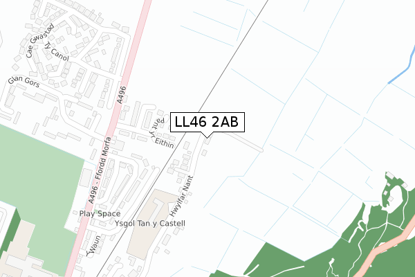
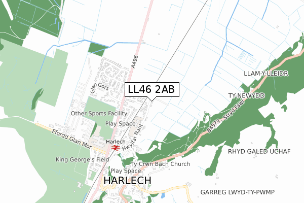
LL46 2AB is located in the Harlech a Llanbedr electoral ward, within the unitary authority of Gwynedd and the Welsh Parliamentary constituency of Dwyfor Meirionnydd. The Local Health Board is Betsi Cadwaladr University and the police force is North Wales. This postcode has been in use since September 2019.


GetTheData
Source: OS Open Zoomstack (Ordnance Survey)
Licence: Open Government Licence (requires attribution)
Attribution: Contains OS data © Crown copyright and database right 2024
Source: Open Postcode Geo
Licence: Open Government Licence (requires attribution)
Attribution: Contains OS data © Crown copyright and database right 2024; Contains Royal Mail data © Royal Mail copyright and database right 2024; Source: Office for National Statistics licensed under the Open Government Licence v.3.0
| Easting | 258387 |
| Northing | 331816 |
| Latitude | 52.865155 |
| Longitude | -4.105118 |
GetTheData
Source: Open Postcode Geo
Licence: Open Government Licence
| Country | Wales |
| Postcode District | LL46 |
| ➜ LL46 open data dashboard ➜ See where LL46 is on a map ➜ Where is Harlech? | |
GetTheData
Source: Land Registry Price Paid Data
Licence: Open Government Licence
| Ward | Harlech A Llanbedr |
| Constituency | Dwyfor Meirionnydd |
GetTheData
Source: ONS Postcode Database
Licence: Open Government Licence
| November 2023 | Public order | On or near Petrol Station | 220m |
| April 2023 | Public order | On or near Cae Gwastad | 412m |
| October 2022 | Violence and sexual offences | On or near Cae Gwastad | 412m |
| ➜ Get more crime data in our Crime section | |||
GetTheData
Source: data.police.uk
Licence: Open Government Licence
| Bron Yr Hwlfa (A496) | Harlech | 227m |
| Bron Yr Hwlfa (A496) | Harlech | 235m |
| Railway Station (Ffordd Morfa) | Harlech | 584m |
| Railway Station (Ffordd Morfa) | Harlech | 588m |
| High Street (Ffordd Isaf) | Harlech | 897m |
| Harlech Station | 0.5km |
| Llandanwg Station | 3.5km |
| Tygwyn Station | 3.7km |
GetTheData
Source: NaPTAN
Licence: Open Government Licence
GetTheData
Source: ONS Postcode Database
Licence: Open Government Licence


➜ Get more ratings from the Food Standards Agency
GetTheData
Source: Food Standards Agency
Licence: FSA terms & conditions
| Last Collection | |||
|---|---|---|---|
| Location | Mon-Fri | Sat | Distance |
| Harlech Post Office | 16:15 | 10:30 | 721m |
| Llanbedr Post Office | 15:45 | 10:00 | 4,948m |
| Glanwern Talsarnau | 16:23 | 09:30 | 5,047m |
GetTheData
Source: Dracos
Licence: Creative Commons Attribution-ShareAlike
| School | Phase of Education | Distance |
|---|---|---|
| Ysgol Ardudwy Ffordd Y Traeth, Harlech, Gwynedd, LL46 2UH | Not applicable | 553m |
| Ysgol Tanycastell Harlech, Gwynedd, LL46 2SW | Not applicable | 956m |
| Ysgol Talsarnau Talsarnau, Gwynedd, LL47 6TA | Not applicable | 4.8km |
GetTheData
Source: Edubase
Licence: Open Government Licence
The below table lists the International Territorial Level (ITL) codes (formerly Nomenclature of Territorial Units for Statistics (NUTS) codes) and Local Administrative Units (LAU) codes for LL46 2AB:
| ITL 1 Code | Name |
|---|---|
| TLL | Wales |
| ITL 2 Code | Name |
| TLL1 | West Wales and The Valleys |
| ITL 3 Code | Name |
| TLL12 | Gwynedd |
| LAU 1 Code | Name |
| W06000002 | Gwynedd |
GetTheData
Source: ONS Postcode Directory
Licence: Open Government Licence
The below table lists the Census Output Area (OA), Lower Layer Super Output Area (LSOA), and Middle Layer Super Output Area (MSOA) for LL46 2AB:
| Code | Name | |
|---|---|---|
| OA | W00000384 | |
| LSOA | W01000074 | Gwynedd 013B |
| MSOA | W02000022 | Gwynedd 013 |
GetTheData
Source: ONS Postcode Directory
Licence: Open Government Licence
| LL46 2UJ | Ael Y Glyn | 94m |
| LL46 2UN | Y Waun | 269m |
| LL46 2SQ | Glan Gors | 303m |
| LL46 2NZ | Ty Canol | 323m |
| LL46 2UE | 348m | |
| LL46 2NJ | Glan Gors | 356m |
| LL46 2GZ | Ffordd Gwylan Bach | 378m |
| LL46 2UL | 415m | |
| LL46 2GX | Llys Bach | 430m |
| LL46 2GS | Ffordd Ty Canol | 445m |
GetTheData
Source: Open Postcode Geo; Land Registry Price Paid Data
Licence: Open Government Licence