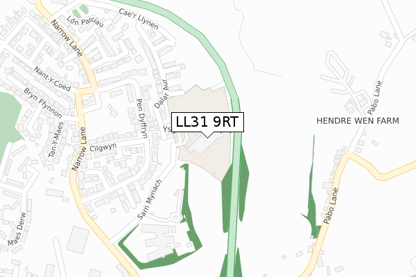
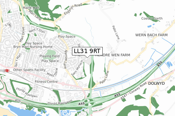
LL31 9RT is located in the Glyn y Marl electoral ward, within the unitary authority of Conwy and the Welsh Parliamentary constituency of Aberconwy. The Local Health Board is Betsi Cadwaladr University and the police force is North Wales. This postcode has been in use since February 2018.


GetTheData
Source: OS Open Zoomstack (Ordnance Survey)
Licence: Open Government Licence (requires attribution)
Attribution: Contains OS data © Crown copyright and database right 2024
Source: Open Postcode Geo
Licence: Open Government Licence (requires attribution)
Attribution: Contains OS data © Crown copyright and database right 2024; Contains Royal Mail data © Royal Mail copyright and database right 2024; Source: Office for National Statistics licensed under the Open Government Licence v.3.0
| Easting | 280650 |
| Northing | 378051 |
| Latitude | 53.285965 |
| Longitude | -3.791759 |
GetTheData
Source: Open Postcode Geo
Licence: Open Government Licence
| Country | Wales |
| Postcode District | LL31 |
| ➜ LL31 open data dashboard ➜ See where LL31 is on a map ➜ Where is Conwy? | |
GetTheData
Source: Land Registry Price Paid Data
Licence: Open Government Licence
| Ward | Glyn Y Marl |
| Constituency | Aberconwy |
GetTheData
Source: ONS Postcode Database
Licence: Open Government Licence
| March 2023 | Violence and sexual offences | On or near Tan-Y-Maes | 364m |
| February 2023 | Violence and sexual offences | On or near Tan-Y-Maes | 364m |
| June 2022 | Violence and sexual offences | On or near Cilgwyn | 216m |
| ➜ Get more crime data in our Crime section | |||
GetTheData
Source: data.police.uk
Licence: Open Government Licence
| Cilgwyn (Pen Dyffryn) | Llandudno Junction | 146m |
| Cilgwyn (Pen Dyffryn) | Llandudno Junction | 152m |
| Wag Offices (Narrow Lane) | Llandudno Junction | 200m |
| Narrow Lane (Pen Dyffryn) | Llandudno Junction | 317m |
| Narrow Lane (Pen Dyffryn) | Llandudno Junction | 323m |
| Llandudno Junction Station | 1.2km |
| Glan Conwy Station | 2.1km |
| Conwy Station | 2.7km |
GetTheData
Source: NaPTAN
Licence: Open Government Licence
GetTheData
Source: ONS Postcode Database
Licence: Open Government Licence


➜ Get more ratings from the Food Standards Agency
GetTheData
Source: Food Standards Agency
Licence: FSA terms & conditions
| Last Collection | |||
|---|---|---|---|
| Location | Mon-Fri | Sat | Distance |
| Dolwyd | 15:30 | 07:30 | 1,326m |
| Tesco Llandudno Junction | 17:20 | 11:30 | 1,475m |
| Victoria Drive | 17:10 | 11:15 | 1,511m |
GetTheData
Source: Dracos
Licence: Creative Commons Attribution-ShareAlike
| School | Phase of Education | Distance |
|---|---|---|
| Mochdre Infants C.P. School Station Road, Mochdre, Conwy, LL28 5EF | Not applicable | 1.9km |
| Ysgol Deganwy Park Drive, Deganwy, Conwy, LL31 9YB | Not applicable | 2.1km |
| Ysgol Cystennin The Old Highway, Mochdre, Colwyn Bay, Conwy, LL28 5AU | Not applicable | 2.2km |
GetTheData
Source: Edubase
Licence: Open Government Licence
The below table lists the International Territorial Level (ITL) codes (formerly Nomenclature of Territorial Units for Statistics (NUTS) codes) and Local Administrative Units (LAU) codes for LL31 9RT:
| ITL 1 Code | Name |
|---|---|
| TLL | Wales |
| ITL 2 Code | Name |
| TLL1 | West Wales and The Valleys |
| ITL 3 Code | Name |
| TLL13 | Conwy and Denbighshire |
| LAU 1 Code | Name |
| W06000003 | Conwy |
GetTheData
Source: ONS Postcode Directory
Licence: Open Government Licence
The below table lists the Census Output Area (OA), Lower Layer Super Output Area (LSOA), and Middle Layer Super Output Area (MSOA) for LL31 9RT:
| Code | Name | |
|---|---|---|
| OA | W00000938 | |
| LSOA | W01000177 | Conwy 011E |
| MSOA | W02000037 | Conwy 011 |
GetTheData
Source: ONS Postcode Directory
Licence: Open Government Licence
| LL31 9AT | Pendyffryn | 212m |
| LL31 9AU | Cilgwyn | 232m |
| LL31 9AS | Pendyffryn | 234m |
| LL31 9BB | Narrow Lane | 307m |
| LL31 9FG | Lon Gwaenfynydd | 314m |
| LL31 9JE | Pabo Lane | 316m |
| LL31 9SZ | Narrow Lane | 322m |
| LL31 9TX | Tan Y Maes | 383m |
| LL31 9UX | Maes Canol | 408m |
| LL31 9JD | Narrow Lane | 417m |
GetTheData
Source: Open Postcode Geo; Land Registry Price Paid Data
Licence: Open Government Licence