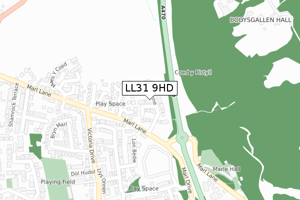
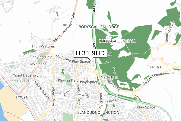
LL31 9HD is located in the Glyn y Marl electoral ward, within the unitary authority of Conwy and the Welsh Parliamentary constituency of Aberconwy. The Local Health Board is Betsi Cadwaladr University and the police force is North Wales. This postcode has been in use since April 2019.


GetTheData
Source: OS Open Zoomstack (Ordnance Survey)
Licence: Open Government Licence (requires attribution)
Attribution: Contains OS data © Crown copyright and database right 2024
Source: Open Postcode Geo
Licence: Open Government Licence (requires attribution)
Attribution: Contains OS data © Crown copyright and database right 2024; Contains Royal Mail data © Royal Mail copyright and database right 2024; Source: Office for National Statistics licensed under the Open Government Licence v.3.0
| Easting | 279590 |
| Northing | 378999 |
| Latitude | 53.294242 |
| Longitude | -3.808010 |
GetTheData
Source: Open Postcode Geo
Licence: Open Government Licence
| Country | Wales |
| Postcode District | LL31 |
| ➜ LL31 open data dashboard ➜ See where LL31 is on a map ➜ Where is Conwy? | |
GetTheData
Source: Land Registry Price Paid Data
Licence: Open Government Licence
| Ward | Glyn Y Marl |
| Constituency | Aberconwy |
GetTheData
Source: ONS Postcode Database
Licence: Open Government Licence
2021 3 SEP £280,000 |
43, LLYS WYNNE, LLANDUDNO JUNCTION, LL31 9HD 2020 22 MAY £240,000 |
42, LLYS WYNNE, LLANDUDNO JUNCTION, LL31 9HD 2020 15 MAY £295,000 |
40, LLYS WYNNE, LLANDUDNO JUNCTION, LL31 9HD 2020 27 MAR £240,000 |
41, LLYS WYNNE, LLANDUDNO JUNCTION, LL31 9HD 2020 27 MAR £240,000 |
31, LLYS WYNNE, LLANDUDNO JUNCTION, LL31 9HD 2020 28 FEB £290,000 |
37, LLYS WYNNE, LLANDUDNO JUNCTION, LL31 9HD 2020 21 FEB £265,500 |
36, LLYS WYNNE, LLANDUDNO JUNCTION, LL31 9HD 2020 14 FEB £240,000 |
35, LLYS WYNNE, LLANDUDNO JUNCTION, LL31 9HD 2020 7 FEB £240,000 |
34, LLYS WYNNE, LLANDUDNO JUNCTION, LL31 9HD 2020 24 JAN £240,000 |
GetTheData
Source: HM Land Registry Price Paid Data
Licence: Contains HM Land Registry data © Crown copyright and database right 2024. This data is licensed under the Open Government Licence v3.0.
| June 2022 | Violence and sexual offences | On or near Woodlands | 110m |
| June 2022 | Anti-social behaviour | On or near Woodlands | 110m |
| June 2022 | Violence and sexual offences | On or near Sports/Recreation Area | 139m |
| ➜ Get more crime data in our Crime section | |||
GetTheData
Source: data.police.uk
Licence: Open Government Licence
| Woodlands (Marl Lane) | Tywyn | 131m |
| Bryn Marl (Victoria Drive) | Llandudno Junction | 217m |
| Bryn Marl (Victoria Drive) | Llandudno Junction | 225m |
| Marl Hall Caravan Park (Marl Drive) | Llandudno Junction | 253m |
| Dol Hudol (Victoria Drive) | Llandudno Junction | 296m |
| Llandudno Junction Station | 1.1km |
| Deganwy Station | 1.7km |
| Conwy Station | 2.2km |
GetTheData
Source: NaPTAN
Licence: Open Government Licence
| Percentage of properties with Next Generation Access | 100.0% |
| Percentage of properties with Superfast Broadband | 100.0% |
| Percentage of properties with Ultrafast Broadband | 63.0% |
| Percentage of properties with Full Fibre Broadband | 63.0% |
Superfast Broadband is between 30Mbps and 300Mbps
Ultrafast Broadband is > 300Mbps
| Percentage of properties unable to receive 2Mbps | 0.0% |
| Percentage of properties unable to receive 5Mbps | 0.0% |
| Percentage of properties unable to receive 10Mbps | 0.0% |
| Percentage of properties unable to receive 30Mbps | 0.0% |
GetTheData
Source: Ofcom
Licence: Ofcom Terms of Use (requires attribution)
GetTheData
Source: ONS Postcode Database
Licence: Open Government Licence


➜ Get more ratings from the Food Standards Agency
GetTheData
Source: Food Standards Agency
Licence: FSA terms & conditions
| Last Collection | |||
|---|---|---|---|
| Location | Mon-Fri | Sat | Distance |
| Victoria Drive | 17:10 | 11:15 | 274m |
| Tesco Llandudno Junction | 17:20 | 11:30 | 1,275m |
| Castle Street | 17:15 | 12:15 | 1,971m |
GetTheData
Source: Dracos
Licence: Creative Commons Attribution-ShareAlike
| School | Phase of Education | Distance |
|---|---|---|
| Ysgol Deganwy Park Drive, Deganwy, Conwy, LL31 9YB | Not applicable | 899m |
| St David's College Llandudno, Conwy, LL30 1RD | Not applicable | 1.8km |
| Ysgol Aberconwy Morfa Drive, Conwy, LL32 8ED | Not applicable | 2.1km |
GetTheData
Source: Edubase
Licence: Open Government Licence
The below table lists the International Territorial Level (ITL) codes (formerly Nomenclature of Territorial Units for Statistics (NUTS) codes) and Local Administrative Units (LAU) codes for LL31 9HD:
| ITL 1 Code | Name |
|---|---|
| TLL | Wales |
| ITL 2 Code | Name |
| TLL1 | West Wales and The Valleys |
| ITL 3 Code | Name |
| TLL13 | Conwy and Denbighshire |
| LAU 1 Code | Name |
| W06000003 | Conwy |
GetTheData
Source: ONS Postcode Directory
Licence: Open Government Licence
The below table lists the Census Output Area (OA), Lower Layer Super Output Area (LSOA), and Middle Layer Super Output Area (MSOA) for LL31 9HD:
| Code | Name | |
|---|---|---|
| OA | W00000875 | |
| LSOA | W01000166 | Conwy 006D |
| MSOA | W02000032 | Conwy 006 |
GetTheData
Source: ONS Postcode Directory
Licence: Open Government Licence
| LL31 9HB | Woodlands | 98m |
| LL31 9FE | Lon Bedw | 150m |
| LL31 9FF | Llys Ywen | 166m |
| LL31 9BF | Chapelfield | 178m |
| LL31 9GF | Lon Lafant | 213m |
| LL31 9BX | Victoria Drive | 242m |
| LL31 9NQ | Maes Y Coed | 295m |
| LL31 9BZ | Bryn Marl | 313m |
| LL31 9LZ | Marl Gardens | 315m |
| LL31 9PH | Dol Hudol | 330m |
GetTheData
Source: Open Postcode Geo; Land Registry Price Paid Data
Licence: Open Government Licence