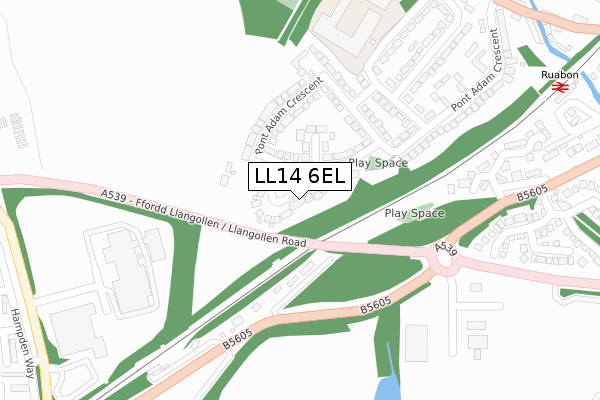
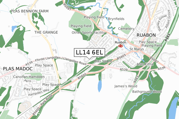
LL14 6EL is located in the Penycae and Ruabon South electoral ward, within the unitary authority of Wrexham and the Welsh Parliamentary constituency of Clwyd South. The Local Health Board is Betsi Cadwaladr University and the police force is North Wales. This postcode has been in use since February 2018.


GetTheData
Source: OS Open Zoomstack (Ordnance Survey)
Licence: Open Government Licence (requires attribution)
Attribution: Contains OS data © Crown copyright and database right 2024
Source: Open Postcode Geo
Licence: Open Government Licence (requires attribution)
Attribution: Contains OS data © Crown copyright and database right 2024; Contains Royal Mail data © Royal Mail copyright and database right 2024; Source: Office for National Statistics licensed under the Open Government Licence v.3.0
| Easting | 329619 |
| Northing | 343642 |
| Latitude | 52.985489 |
| Longitude | -3.049816 |
GetTheData
Source: Open Postcode Geo
Licence: Open Government Licence
| Country | Wales |
| Postcode District | LL14 |
| ➜ LL14 open data dashboard ➜ See where LL14 is on a map | |
GetTheData
Source: Land Registry Price Paid Data
Licence: Open Government Licence
| Ward | Penycae And Ruabon South |
| Constituency | Clwyd South |
GetTheData
Source: ONS Postcode Database
Licence: Open Government Licence
| September 2023 | Violence and sexual offences | On or near Parking Area | 446m |
| September 2023 | Burglary | On or near Spinney Walk | 493m |
| September 2023 | Public order | On or near Spinney Walk | 493m |
| ➜ Get more crime data in our Crime section | |||
GetTheData
Source: data.police.uk
Licence: Open Government Licence
| Pont Adam Playground (Pont Adam Crescent) | Ruabon | 162m |
| Plas Newydd (Pont Adam Crescent) | Ruabon | 327m |
| Plas Newydd (Pont Adam Crescent) | Ruabon | 327m |
| Plas Bennion Road (Llangollen Road) | Plas Madoc | 454m |
| Railway Station (Station Road) | Ruabon | 495m |
| Ruabon Station | 0.5km |
GetTheData
Source: NaPTAN
Licence: Open Government Licence
➜ Broadband speed and availability dashboard for LL14 6EL
| Percentage of properties with Next Generation Access | 100.0% |
| Percentage of properties with Superfast Broadband | 100.0% |
| Percentage of properties with Ultrafast Broadband | 0.0% |
| Percentage of properties with Full Fibre Broadband | 0.0% |
Superfast Broadband is between 30Mbps and 300Mbps
Ultrafast Broadband is > 300Mbps
| Median download speed | 39.4Mbps |
| Average download speed | 36.9Mbps |
| Maximum download speed | 58.14Mbps |
| Median upload speed | 9.8Mbps |
| Average upload speed | 7.6Mbps |
| Maximum upload speed | 16.19Mbps |
| Percentage of properties unable to receive 2Mbps | 0.0% |
| Percentage of properties unable to receive 5Mbps | 0.0% |
| Percentage of properties unable to receive 10Mbps | 0.0% |
| Percentage of properties unable to receive 30Mbps | 0.0% |
➜ Broadband speed and availability dashboard for LL14 6EL
GetTheData
Source: Ofcom
Licence: Ofcom Terms of Use (requires attribution)
GetTheData
Source: ONS Postcode Database
Licence: Open Government Licence


➜ Get more ratings from the Food Standards Agency
GetTheData
Source: Food Standards Agency
Licence: FSA terms & conditions
| Last Collection | |||
|---|---|---|---|
| Location | Mon-Fri | Sat | Distance |
| Alwyn | 10:45 | 10:00 | 516m |
| Park St | 09:00 | 08:15 | 718m |
| Plas Isa (Rhosymedre) | 16:15 | 10:45 | 1,155m |
GetTheData
Source: Dracos
Licence: Creative Commons Attribution-ShareAlike
| School | Phase of Education | Distance |
|---|---|---|
| Ysgol Rhiwabon Ruabon, Wrexham, LL14 6BT | Not applicable | 359m |
| St Mary's Primary (Ruabon) School Park Street, Ruabon, Wrexham, LL14 6LE | Not applicable | 838m |
| Ysgol Maesyllan Maesyllan Lane, Ruabon, Wrexham, LL14 6AE | Not applicable | 958m |
GetTheData
Source: Edubase
Licence: Open Government Licence
The below table lists the International Territorial Level (ITL) codes (formerly Nomenclature of Territorial Units for Statistics (NUTS) codes) and Local Administrative Units (LAU) codes for LL14 6EL:
| ITL 1 Code | Name |
|---|---|
| TLL | Wales |
| ITL 2 Code | Name |
| TLL2 | East Wales |
| ITL 3 Code | Name |
| TLL23 | Flintshire and Wrexham |
| LAU 1 Code | Name |
| W06000006 | Wrexham |
GetTheData
Source: ONS Postcode Directory
Licence: Open Government Licence
The below table lists the Census Output Area (OA), Lower Layer Super Output Area (LSOA), and Middle Layer Super Output Area (MSOA) for LL14 6EL:
| Code | Name | |
|---|---|---|
| OA | W00002174 | |
| LSOA | W01000407 | Wrexham 016C |
| MSOA | W02000093 | Wrexham 016 |
GetTheData
Source: ONS Postcode Directory
Licence: Open Government Licence
| LL14 6EH | Pont Adam Crescent | 109m |
| LL14 6EG | Pont Adam Crescent | 123m |
| LL14 6RW | Llangollen Road | 131m |
| LL14 6EF | Pont Adam Crescent | 207m |
| LL14 6EE | Pont Adam Crescent | 294m |
| LL14 6DP | Wynnstay Yard | 299m |
| LL14 6ED | Pont Adam Crescent | 321m |
| LL14 6EJ | Wynnstay Gardens | 351m |
| LL14 6TA | Cil Y Coed | 374m |
| LL14 6TB | Llwyn Bach | 429m |
GetTheData
Source: Open Postcode Geo; Land Registry Price Paid Data
Licence: Open Government Licence