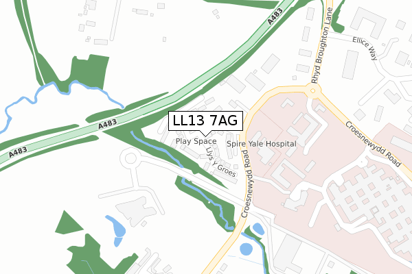
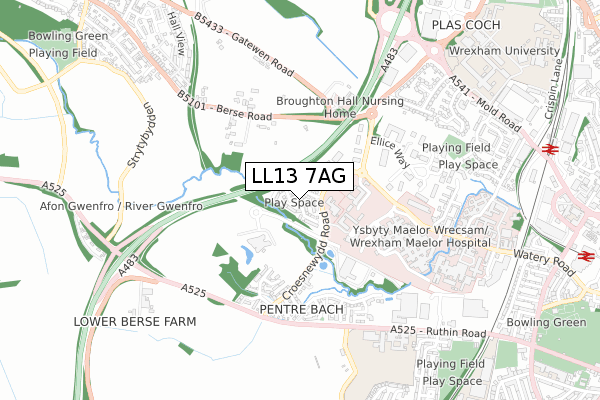
LL13 7AG is located in the Brynyffynnon electoral ward, within the unitary authority of Wrexham and the Welsh Parliamentary constituency of Wrexham. The Local Health Board is Betsi Cadwaladr University and the police force is North Wales. This postcode has been in use since January 2018.


GetTheData
Source: OS Open Zoomstack (Ordnance Survey)
Licence: Open Government Licence (requires attribution)
Attribution: Contains OS data © Crown copyright and database right 2024
Source: Open Postcode Geo
Licence: Open Government Licence (requires attribution)
Attribution: Contains OS data © Crown copyright and database right 2024; Contains Royal Mail data © Royal Mail copyright and database right 2024; Source: Office for National Statistics licensed under the Open Government Licence v.3.0
| Easting | 331908 |
| Northing | 350590 |
| Latitude | 53.048233 |
| Longitude | -3.017195 |
GetTheData
Source: Open Postcode Geo
Licence: Open Government Licence
| Country | Wales |
| Postcode District | LL13 |
| ➜ LL13 open data dashboard ➜ See where LL13 is on a map ➜ Where is Wrexham? | |
GetTheData
Source: Land Registry Price Paid Data
Licence: Open Government Licence
| Ward | Brynyffynnon |
| Constituency | Wrexham |
GetTheData
Source: ONS Postcode Database
Licence: Open Government Licence
2022 14 JUL £278,000 |
2021 8 OCT £249,000 |
2021 24 SEP £310,000 |
2021 29 JUN £249,000 |
2021 18 JUN £295,000 |
2021 14 JUN £298,000 |
2021 15 JAN £260,000 |
2020 14 DEC £240,000 |
2020 28 FEB £270,000 |
79, LLYS Y GROES, WREXHAM, LL13 7AG 2019 8 MAR £259,000 |
GetTheData
Source: HM Land Registry Price Paid Data
Licence: Contains HM Land Registry data © Crown copyright and database right 2024. This data is licensed under the Open Government Licence v3.0.
| June 2022 | Violence and sexual offences | On or near Further/Higher Educational Building | 209m |
| June 2022 | Criminal damage and arson | On or near Eglwys Teg | 367m |
| June 2022 | Violence and sexual offences | On or near Rhyd Broughton Lane | 373m |
| ➜ Get more crime data in our Crime section | |||
GetTheData
Source: data.police.uk
Licence: Open Government Licence
| Medical Institute (Croes Newydd Road) | Bryn Offa | 327m |
| Rhyd Broughton (Berse Road) | Wrexham | 347m |
| Rhyd Broughton (Berse Road) | Wrexham | 356m |
| Medical Institute (Croes Newydd Road) | Bryn Offa | 390m |
| Tax Office (Rhyd Broughton Lane) | Wrexham | 393m |
| Wrexham General Station | 1km |
| Wrexham Central Station | 1.2km |
| Gwersyllt Station | 2.7km |
GetTheData
Source: NaPTAN
Licence: Open Government Licence
| Percentage of properties with Next Generation Access | 0.0% |
| Percentage of properties with Superfast Broadband | 0.0% |
| Percentage of properties with Ultrafast Broadband | 0.0% |
| Percentage of properties with Full Fibre Broadband | 0.0% |
Superfast Broadband is between 30Mbps and 300Mbps
Ultrafast Broadband is > 300Mbps
| Median download speed | 8.9Mbps |
| Average download speed | 9.2Mbps |
| Maximum download speed | 39.99Mbps |
| Median upload speed | 1.0Mbps |
| Average upload speed | 1.0Mbps |
| Maximum upload speed | 9.99Mbps |
| Percentage of properties unable to receive 2Mbps | 0.0% |
| Percentage of properties unable to receive 5Mbps | 0.0% |
| Percentage of properties unable to receive 10Mbps | 0.0% |
| Percentage of properties unable to receive 30Mbps | 100.0% |
GetTheData
Source: Ofcom
Licence: Ofcom Terms of Use (requires attribution)
GetTheData
Source: ONS Postcode Database
Licence: Open Government Licence


➜ Get more ratings from the Food Standards Agency
GetTheData
Source: Food Standards Agency
Licence: FSA terms & conditions
| Last Collection | |||
|---|---|---|---|
| Location | Mon-Fri | Sat | Distance |
| Turf Hotel | 16:00 | 11:30 | 971m |
| Caego New Broughton | 17:30 | 09:45 | 1,052m |
| Wrexham Sorting Office | 18:30 | 13:30 | 1,087m |
GetTheData
Source: Dracos
Licence: Creative Commons Attribution-ShareAlike
| School | Phase of Education | Distance |
|---|---|---|
| Ysgol Clywedog Ruthin Road, Wrexham, LL13 7UB | Not applicable | 701m |
| Woodlands Children's Development Centre 7 Pierces Square, Wrecsam, LL13 7NE | Not applicable | 1.3km |
| Ysgol Plas Coch Ffordd Stansty, Plas Coch, Wrexham, LL11 2BU | Not applicable | 1.4km |
GetTheData
Source: Edubase
Licence: Open Government Licence
The below table lists the International Territorial Level (ITL) codes (formerly Nomenclature of Territorial Units for Statistics (NUTS) codes) and Local Administrative Units (LAU) codes for LL13 7AG:
| ITL 1 Code | Name |
|---|---|
| TLL | Wales |
| ITL 2 Code | Name |
| TLL2 | East Wales |
| ITL 3 Code | Name |
| TLL23 | Flintshire and Wrexham |
| LAU 1 Code | Name |
| W06000006 | Wrexham |
GetTheData
Source: ONS Postcode Directory
Licence: Open Government Licence
The below table lists the Census Output Area (OA), Lower Layer Super Output Area (LSOA), and Middle Layer Super Output Area (MSOA) for LL13 7AG:
| Code | Name | |
|---|---|---|
| OA | W00010024 | |
| LSOA | W01000349 | Wrexham 011A |
| MSOA | W02000088 | Wrexham 011 |
GetTheData
Source: ONS Postcode Directory
Licence: Open Government Licence
| LL13 7YP | 223m | |
| LL11 3BZ | Eglwys Teg | 369m |
| LL11 3BN | Croesnewydd Road | 378m |
| LL11 3BQ | Pendinas | 386m |
| LL11 3DN | Bryn Coch | 423m |
| LL11 6SL | Berse Road | 428m |
| LL11 3DL | Bro Deg | 471m |
| LL11 3DX | Dol Isaf | 476m |
| LL11 3BX | Trem Y Llyn | 481m |
| LL11 3DH | Cae Mawr | 491m |
GetTheData
Source: Open Postcode Geo; Land Registry Price Paid Data
Licence: Open Government Licence