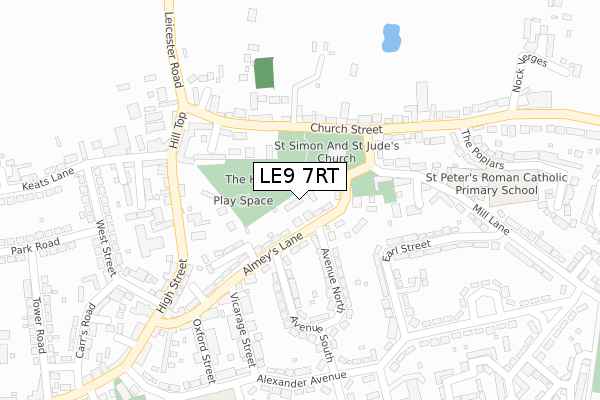
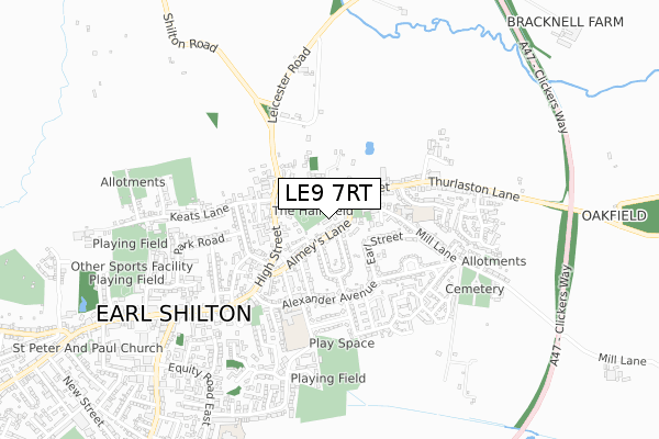
LE9 7RT is located in the Earl Shilton electoral ward, within the local authority district of Hinckley and Bosworth and the English Parliamentary constituency of Bosworth. The Sub Integrated Care Board (ICB) Location is NHS Leicester, Leicestershire and Rutland ICB - 04V and the police force is Leicestershire. This postcode has been in use since October 2019.


GetTheData
Source: OS Open Zoomstack (Ordnance Survey)
Licence: Open Government Licence (requires attribution)
Attribution: Contains OS data © Crown copyright and database right 2025
Source: Open Postcode Geo
Licence: Open Government Licence (requires attribution)
Attribution: Contains OS data © Crown copyright and database right 2025; Contains Royal Mail data © Royal Mail copyright and database right 2025; Source: Office for National Statistics licensed under the Open Government Licence v.3.0
| Easting | 445874 |
| Northing | 298074 |
| Latitude | 52.578571 |
| Longitude | -1.324451 |
GetTheData
Source: Open Postcode Geo
Licence: Open Government Licence
| Country | England |
| Postcode District | LE9 |
➜ See where LE9 is on a map ➜ Where is Earl Shilton? | |
GetTheData
Source: Land Registry Price Paid Data
Licence: Open Government Licence
| Ward | Earl Shilton |
| Constituency | Bosworth |
GetTheData
Source: ONS Postcode Database
Licence: Open Government Licence
44, WESTFIELD AVENUE, EARL SHILTON, LEICESTER, LE9 7RT 2024 28 JUN £375,000 |
30, WESTFIELD AVENUE, EARL SHILTON, LEICESTER, LE9 7RT 2024 31 MAY £340,000 |
38, WESTFIELD AVENUE, EARL SHILTON, LEICESTER, LE9 7RT 2023 3 NOV £370,950 |
32, WESTFIELD AVENUE, EARL SHILTON, LEICESTER, LE9 7RT 2023 31 MAR £412,950 |
2023 30 MAR £304,950 |
34, WESTFIELD AVENUE, EARL SHILTON, LEICESTER, LE9 7RT 2023 30 MAR £414,950 |
36, WESTFIELD AVENUE, EARL SHILTON, LEICESTER, LE9 7RT 2023 28 FEB £349,950 |
74, WESTFIELD AVENUE, EARL SHILTON, LEICESTER, LE9 7RT 2022 26 AUG £319,950 |
72, WESTFIELD AVENUE, EARL SHILTON, LEICESTER, LE9 7RT 2022 5 AUG £334,950 |
62, WESTFIELD AVENUE, EARL SHILTON, LEICESTER, LE9 7RT 2022 30 JUN £349,950 |
GetTheData
Source: HM Land Registry Price Paid Data
Licence: Contains HM Land Registry data © Crown copyright and database right 2025. This data is licensed under the Open Government Licence v3.0.
| New Street (Hinckley Road) | Earl Shilton | 470m |
| Mountfield Road (Wood Street) | Earl Shilton | 490m |
| Mountfield Road (Wood Street) | Earl Shilton | 502m |
| New Street (Hinckley Road) | Earl Shilton | 506m |
| Park House Grange (Park Road) | Earl Shilton | 627m |
| Hinckley Station | 5.8km |
GetTheData
Source: NaPTAN
Licence: Open Government Licence
GetTheData
Source: ONS Postcode Database
Licence: Open Government Licence


➜ Get more ratings from the Food Standards Agency
GetTheData
Source: Food Standards Agency
Licence: FSA terms & conditions
| Last Collection | |||
|---|---|---|---|
| Location | Mon-Fri | Sat | Distance |
| Doctors Fields | 17:30 | 09:15 | 766m |
| Shentons Oak | 17:45 | 11:30 | 3,702m |
| Barwell Lane | 17:45 | 11:30 | 3,774m |
GetTheData
Source: Dracos
Licence: Creative Commons Attribution-ShareAlike
The below table lists the International Territorial Level (ITL) codes (formerly Nomenclature of Territorial Units for Statistics (NUTS) codes) and Local Administrative Units (LAU) codes for LE9 7RT:
| ITL 1 Code | Name |
|---|---|
| TLF | East Midlands (England) |
| ITL 2 Code | Name |
| TLF2 | Leicestershire, Rutland and Northamptonshire |
| ITL 3 Code | Name |
| TLF22 | Leicestershire CC and Rutland |
| LAU 1 Code | Name |
| E07000132 | Hinckley and Bosworth |
GetTheData
Source: ONS Postcode Directory
Licence: Open Government Licence
The below table lists the Census Output Area (OA), Lower Layer Super Output Area (LSOA), and Middle Layer Super Output Area (MSOA) for LE9 7RT:
| Code | Name | |
|---|---|---|
| OA | E00131143 | |
| LSOA | E01025843 | Hinckley and Bosworth 006E |
| MSOA | E02005382 | Hinckley and Bosworth 006 |
GetTheData
Source: ONS Postcode Directory
Licence: Open Government Licence
| LE9 7PB | Heath Lane | 386m |
| LE9 7PE | Heath Lane | 402m |
| LE9 7LW | Mountfield Road | 409m |
| LE9 7PG | Heath Lane South | 455m |
| LE9 7DN | High Tor West | 468m |
| LE9 7PL | Gartree Crescent | 470m |
| LE9 7LB | Hinckley Road | 470m |
| LE9 7NP | The Cloisters | 472m |
| LE9 7LG | Hinckley Road | 486m |
| LE9 7LZ | Bird Close | 500m |
GetTheData
Source: Open Postcode Geo; Land Registry Price Paid Data
Licence: Open Government Licence