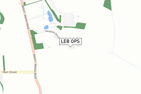
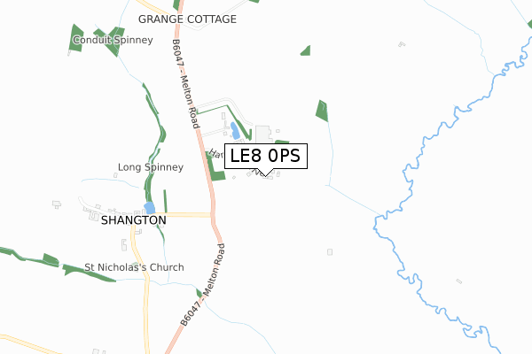
LE8 0PS is located in the Kibworths electoral ward, within the local authority district of Harborough and the English Parliamentary constituency of Harborough. The Sub Integrated Care Board (ICB) Location is NHS Leicester, Leicestershire and Rutland ICB - 03W and the police force is Leicestershire. This postcode has been in use since August 2018.


GetTheData
Source: OS Open Zoomstack (Ordnance Survey)
Licence: Open Government Licence (requires attribution)
Attribution: Contains OS data © Crown copyright and database right 2024
Source: Open Postcode Geo
Licence: Open Government Licence (requires attribution)
Attribution: Contains OS data © Crown copyright and database right 2024; Contains Royal Mail data © Royal Mail copyright and database right 2024; Source: Office for National Statistics licensed under the Open Government Licence v.3.0
| Easting | 472111 |
| Northing | 296470 |
| Latitude | 52.561313 |
| Longitude | -0.937674 |
GetTheData
Source: Open Postcode Geo
Licence: Open Government Licence
| Country | England |
| Postcode District | LE8 |
| ➜ LE8 open data dashboard ➜ See where LE8 is on a map ➜ Where is Shangton? | |
GetTheData
Source: Land Registry Price Paid Data
Licence: Open Government Licence
| Ward | Kibworths |
| Constituency | Harborough |
GetTheData
Source: ONS Postcode Database
Licence: Open Government Licence
GetTheData
Source: ONS Postcode Database
Licence: Open Government Licence
| Last Collection | |||
|---|---|---|---|
| Location | Mon-Fri | Sat | Distance |
| Three Gates | 15:45 | 08:00 | 1,925m |
| High Street | 17:30 | 12:30 | 4,902m |
| Buller Street | 17:00 | 08:45 | 5,175m |
GetTheData
Source: Dracos
Licence: Creative Commons Attribution-ShareAlike
| Facility | Distance |
|---|---|
| Langton Community Hall Stonton Road, Church Langton Sports Hall | 3km |
| Langtons Cricket Ground Main Street, East Langton Grass Pitches | 3.8km |
| Kibworth C Of E Primary School Hillcrest Avenue, Kibworth, Leicester Grass Pitches | 4.7km |
GetTheData
Source: Active Places
Licence: Open Government Licence
| School | Phase of Education | Distance |
|---|---|---|
| Church Langton Church of England Primary School Stonton Road, Church Langton, Market Harborough, LE16 7SZ | Primary | 3.1km |
| Kibworth Church of England Primary School Hillcrest Avenue, Kibworth, Leicester, LE8 0NH | Primary | 4.7km |
| Kibworth Mead Academy Smeeton Road, Kibworth, Leicester, LE8 0LG | Secondary | 5km |
GetTheData
Source: Edubase
Licence: Open Government Licence
The below table lists the International Territorial Level (ITL) codes (formerly Nomenclature of Territorial Units for Statistics (NUTS) codes) and Local Administrative Units (LAU) codes for LE8 0PS:
| ITL 1 Code | Name |
|---|---|
| TLF | East Midlands (England) |
| ITL 2 Code | Name |
| TLF2 | Leicestershire, Rutland and Northamptonshire |
| ITL 3 Code | Name |
| TLF22 | Leicestershire CC and Rutland |
| LAU 1 Code | Name |
| E07000131 | Harborough |
GetTheData
Source: ONS Postcode Directory
Licence: Open Government Licence
The below table lists the Census Output Area (OA), Lower Layer Super Output Area (LSOA), and Middle Layer Super Output Area (MSOA) for LE8 0PS:
| Code | Name | |
|---|---|---|
| OA | E00130837 | |
| LSOA | E01025784 | Harborough 005E |
| MSOA | E02005371 | Harborough 005 |
GetTheData
Source: ONS Postcode Directory
Licence: Open Government Licence
| LE8 0PG | Main Street | 658m |
| LE8 0PL | Melton Road | 778m |
| LE8 0PN | Shangton Road | 1907m |
| LE7 9EQ | Kibworth Road | 1922m |
| LE16 7UG | Main Street | 1973m |
| LE8 0PD | Cranoe Road | 1996m |
| LE8 0PJ | Main Street | 2111m |
| LE8 0PH | Main Street | 2832m |
| LE16 7ST | Adelphi Row | 2933m |
| LE7 9ER | Three Gates Lane | 2943m |
GetTheData
Source: Open Postcode Geo; Land Registry Price Paid Data
Licence: Open Government Licence