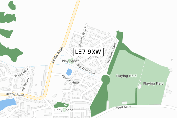
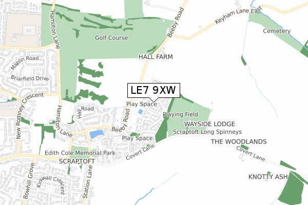
LE7 9XW is located in the Thurnby & Houghton electoral ward, within the local authority district of Harborough and the English Parliamentary constituency of Rutland and Melton. The Sub Integrated Care Board (ICB) Location is NHS Leicester, Leicestershire and Rutland ICB - 03W and the police force is Leicestershire. This postcode has been in use since February 2019.


GetTheData
Source: OS Open Zoomstack (Ordnance Survey)
Licence: Open Government Licence (requires attribution)
Attribution: Contains OS data © Crown copyright and database right 2025
Source: Open Postcode Geo
Licence: Open Government Licence (requires attribution)
Attribution: Contains OS data © Crown copyright and database right 2025; Contains Royal Mail data © Royal Mail copyright and database right 2025; Source: Office for National Statistics licensed under the Open Government Licence v.3.0
| Easting | 465264 |
| Northing | 305964 |
| Latitude | 52.647513 |
| Longitude | -1.036794 |
GetTheData
Source: Open Postcode Geo
Licence: Open Government Licence
| Country | England |
| Postcode District | LE7 |
➜ See where LE7 is on a map ➜ Where is Leicester? | |
GetTheData
Source: Land Registry Price Paid Data
Licence: Open Government Licence
| Ward | Thurnby & Houghton |
| Constituency | Rutland And Melton |
GetTheData
Source: ONS Postcode Database
Licence: Open Government Licence
2024 12 DEC £283,500 |
2024 4 OCT £315,000 |
19, FOX GROVE, SCRAPTOFT, LEICESTER, LE7 9XW 2019 4 OCT £265,000 |
2019 26 APR £268,000 |
2019 29 MAR £268,000 |
GetTheData
Source: HM Land Registry Price Paid Data
Licence: Contains HM Land Registry data © Crown copyright and database right 2025. This data is licensed under the Open Government Licence v3.0.
| Mitchell Grove (Malsbury Avenue) | Scraptoft | 387m |
| Hinks Avenue (Beeby Road) | Scraptoft | 453m |
| Stocks Road (Church Hill) | Scraptoft | 601m |
| Southfield Close (Station Lane) | Scraptoft | 716m |
| Southfield Close (Station Lane) | Scraptoft | 730m |
GetTheData
Source: NaPTAN
Licence: Open Government Licence
| Percentage of properties with Next Generation Access | 100.0% |
| Percentage of properties with Superfast Broadband | 100.0% |
| Percentage of properties with Ultrafast Broadband | 100.0% |
| Percentage of properties with Full Fibre Broadband | 100.0% |
Superfast Broadband is between 30Mbps and 300Mbps
Ultrafast Broadband is > 300Mbps
| Percentage of properties unable to receive 2Mbps | 0.0% |
| Percentage of properties unable to receive 5Mbps | 0.0% |
| Percentage of properties unable to receive 10Mbps | 0.0% |
| Percentage of properties unable to receive 30Mbps | 0.0% |
GetTheData
Source: Ofcom
Licence: Ofcom Terms of Use (requires attribution)
GetTheData
Source: ONS Postcode Database
Licence: Open Government Licence


➜ Get more ratings from the Food Standards Agency
GetTheData
Source: Food Standards Agency
Licence: FSA terms & conditions
| Last Collection | |||
|---|---|---|---|
| Location | Mon-Fri | Sat | Distance |
| Main Street | 16:45 | 09:30 | 677m |
| Grantham Road | 17:00 | 12:00 | 1,454m |
| Main Street | 17:15 | 12:00 | 2,121m |
GetTheData
Source: Dracos
Licence: Creative Commons Attribution-ShareAlike
The below table lists the International Territorial Level (ITL) codes (formerly Nomenclature of Territorial Units for Statistics (NUTS) codes) and Local Administrative Units (LAU) codes for LE7 9XW:
| ITL 1 Code | Name |
|---|---|
| TLF | East Midlands (England) |
| ITL 2 Code | Name |
| TLF2 | Leicestershire, Rutland and Northamptonshire |
| ITL 3 Code | Name |
| TLF22 | Leicestershire CC and Rutland |
| LAU 1 Code | Name |
| E07000131 | Harborough |
GetTheData
Source: ONS Postcode Directory
Licence: Open Government Licence
The below table lists the Census Output Area (OA), Lower Layer Super Output Area (LSOA), and Middle Layer Super Output Area (MSOA) for LE7 9XW:
| Code | Name | |
|---|---|---|
| OA | E00170639 | |
| LSOA | E01032598 | Harborough 011D |
| MSOA | E02006816 | Harborough 011 |
GetTheData
Source: ONS Postcode Directory
Licence: Open Government Licence
| LE7 9TQ | Cricketers Close | 83m |
| LE7 9TN | Pavilion Road | 121m |
| LE7 9TP | Wickets Close | 140m |
| LE7 9TR | Boundary Close | 187m |
| LE7 9TT | Willows End | 200m |
| LE7 9TS | Fielders Drive | 209m |
| LE7 9FX | Elliotts End | 282m |
| LE7 9FW | Corah Close | 341m |
| LE7 9FQ | Malsbury Avenue | 348m |
| LE7 9FT | Mitchell Grove | 350m |
GetTheData
Source: Open Postcode Geo; Land Registry Price Paid Data
Licence: Open Government Licence