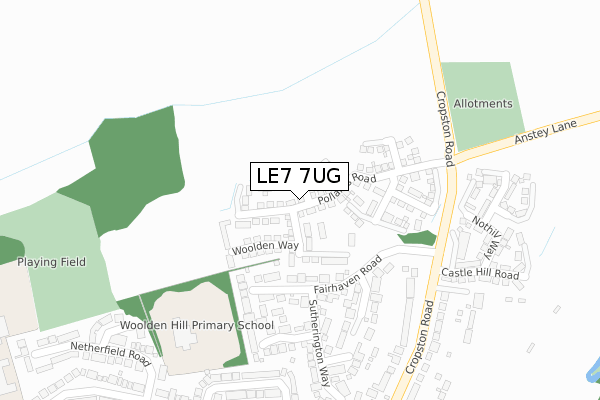
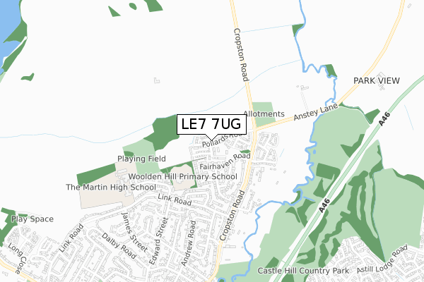
LE7 7UG is located in the Anstey electoral ward, within the local authority district of Charnwood and the English Parliamentary constituency of Charnwood. The Sub Integrated Care Board (ICB) Location is NHS Leicester, Leicestershire and Rutland ICB - 04V and the police force is Leicestershire. This postcode has been in use since March 2018.


GetTheData
Source: OS Open Zoomstack (Ordnance Survey)
Licence: Open Government Licence (requires attribution)
Attribution: Contains OS data © Crown copyright and database right 2025
Source: Open Postcode Geo
Licence: Open Government Licence (requires attribution)
Attribution: Contains OS data © Crown copyright and database right 2025; Contains Royal Mail data © Royal Mail copyright and database right 2025; Source: Office for National Statistics licensed under the Open Government Licence v.3.0
| Easting | 455404 |
| Northing | 309653 |
| Latitude | 52.681768 |
| Longitude | -1.181895 |
GetTheData
Source: Open Postcode Geo
Licence: Open Government Licence
| Country | England |
| Postcode District | LE7 |
➜ See where LE7 is on a map ➜ Where is Anstey? | |
GetTheData
Source: Land Registry Price Paid Data
Licence: Open Government Licence
| Ward | Anstey |
| Constituency | Charnwood |
GetTheData
Source: ONS Postcode Database
Licence: Open Government Licence
2024 22 NOV £590,000 |
2024 4 OCT £395,000 |
2023 23 SEP £508,000 |
2021 24 FEB £315,000 |
2021 19 FEB £410,000 |
1, POLLARDS ROAD, ANSTEY, LEICESTER, LE7 7UG 2020 19 JUN £443,950 |
3, POLLARDS ROAD, ANSTEY, LEICESTER, LE7 7UG 2020 29 MAY £439,950 |
49, POLLARDS ROAD, ANSTEY, LEICESTER, LE7 7UG 2020 17 JAN £334,950 |
2019 27 SEP £390,000 |
30, POLLARDS ROAD, ANSTEY, LEICESTER, LE7 7UG 2019 8 JUL £329,950 |
GetTheData
Source: HM Land Registry Price Paid Data
Licence: Contains HM Land Registry data © Crown copyright and database right 2025. This data is licensed under the Open Government Licence v3.0.
| Fairhaven Road (Cropston Road) | Anstey | 268m |
| Fairhaven Road (Cropston Road) | Anstey | 283m |
| Balladine Road (Link Road) | Anstey | 394m |
| Edward Street (Link Road) | Anstey | 435m |
| Charles Drive (Link Road) | Anstey | 441m |
GetTheData
Source: NaPTAN
Licence: Open Government Licence
| Percentage of properties with Next Generation Access | 100.0% |
| Percentage of properties with Superfast Broadband | 100.0% |
| Percentage of properties with Ultrafast Broadband | 100.0% |
| Percentage of properties with Full Fibre Broadband | 96.3% |
Superfast Broadband is between 30Mbps and 300Mbps
Ultrafast Broadband is > 300Mbps
| Percentage of properties unable to receive 2Mbps | 0.0% |
| Percentage of properties unable to receive 5Mbps | 0.0% |
| Percentage of properties unable to receive 10Mbps | 0.0% |
| Percentage of properties unable to receive 30Mbps | 0.0% |
GetTheData
Source: Ofcom
Licence: Ofcom Terms of Use (requires attribution)
GetTheData
Source: ONS Postcode Database
Licence: Open Government Licence


➜ Get more ratings from the Food Standards Agency
GetTheData
Source: Food Standards Agency
Licence: FSA terms & conditions
| Last Collection | |||
|---|---|---|---|
| Location | Mon-Fri | Sat | Distance |
| Station Road | 16:30 | 09:00 | 1,195m |
| Astill Lodge Post Office | 17:30 | 12:00 | 1,202m |
| Bennion Road | 17:30 | 12:00 | 1,582m |
GetTheData
Source: Dracos
Licence: Creative Commons Attribution-ShareAlike
The below table lists the International Territorial Level (ITL) codes (formerly Nomenclature of Territorial Units for Statistics (NUTS) codes) and Local Administrative Units (LAU) codes for LE7 7UG:
| ITL 1 Code | Name |
|---|---|
| TLF | East Midlands (England) |
| ITL 2 Code | Name |
| TLF2 | Leicestershire, Rutland and Northamptonshire |
| ITL 3 Code | Name |
| TLF22 | Leicestershire CC and Rutland |
| LAU 1 Code | Name |
| E07000130 | Charnwood |
GetTheData
Source: ONS Postcode Directory
Licence: Open Government Licence
The below table lists the Census Output Area (OA), Lower Layer Super Output Area (LSOA), and Middle Layer Super Output Area (MSOA) for LE7 7UG:
| Code | Name | |
|---|---|---|
| OA | E00130267 | |
| LSOA | E01025671 | Charnwood 022B |
| MSOA | E02005366 | Charnwood 022 |
GetTheData
Source: ONS Postcode Directory
Licence: Open Government Licence
| LE7 7TF | Fairhaven Road | 131m |
| LE7 7TG | Longhade Furlong | 185m |
| LE7 7TL | Broadway Furlong | 223m |
| LE7 7TJ | Wooldale Close | 289m |
| LE7 7TH | Sutherington Way | 305m |
| LE7 7BN | Cropston Road | 313m |
| LE7 7BE | Balladine Road | 334m |
| LE7 7BR | Cropston Road | 359m |
| LE7 7BY | Link Road | 368m |
| LE7 7ET | Holgate Close | 377m |
GetTheData
Source: Open Postcode Geo; Land Registry Price Paid Data
Licence: Open Government Licence