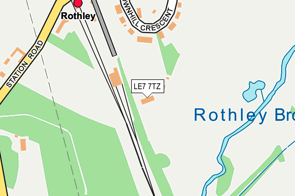
LE7 7TZ is located in the Rothley Brook electoral ward, within the local authority district of Charnwood and the English Parliamentary constituency of Charnwood. The Sub Integrated Care Board (ICB) Location is NHS Leicester, Leicestershire and Rutland ICB - 04V and the police force is Leicestershire. This postcode has been in use since July 2017.


GetTheData
Source: OS OpenMap – Local (Ordnance Survey)
Source: OS VectorMap District (Ordnance Survey)
Licence: Open Government Licence (requires attribution)
| Easting | 457003 |
| Northing | 312028 |
| Latitude | 52.702951 |
| Longitude | -1.157834 |
GetTheData
Source: Open Postcode Geo
Licence: Open Government Licence
| Country | England |
| Postcode District | LE7 |
| ➜ LE7 open data dashboard ➜ See where LE7 is on a map | |
GetTheData
Source: Land Registry Price Paid Data
Licence: Open Government Licence
| Ward | Rothley Brook |
| Constituency | Charnwood |
GetTheData
Source: ONS Postcode Database
Licence: Open Government Licence
| June 2022 | Vehicle crime | On or near Swithland Lane | 266m |
| May 2022 | Anti-social behaviour | On or near Swithland Lane | 266m |
| April 2022 | Drugs | On or near Swithland Lane | 266m |
| ➜ Get more crime data in our Crime section | |||
GetTheData
Source: data.police.uk
Licence: Open Government Licence
| The Wheatsheaf (Leicester Road) | Thurcaston | 977m |
| The Wheatsheaf (Leicester Road) | Thurcaston | 988m |
| Latimer Road (Leicester Road) | Cropston | 1,031m |
| Anstey Lane (Leicester Road) | Thurcaston | 1,053m |
| Latimer Road (Leicester Road) | Cropston | 1,063m |
| Rothley (Great Central Railway) | Rothley | 244m |
| Sileby Station | 4.5km |
GetTheData
Source: NaPTAN
Licence: Open Government Licence
| Percentage of properties with Next Generation Access | 100.0% |
| Percentage of properties with Superfast Broadband | 0.0% |
| Percentage of properties with Ultrafast Broadband | 0.0% |
| Percentage of properties with Full Fibre Broadband | 0.0% |
Superfast Broadband is between 30Mbps and 300Mbps
Ultrafast Broadband is > 300Mbps
| Percentage of properties unable to receive 2Mbps | 0.0% |
| Percentage of properties unable to receive 5Mbps | 0.0% |
| Percentage of properties unable to receive 10Mbps | 0.0% |
| Percentage of properties unable to receive 30Mbps | 100.0% |
GetTheData
Source: Ofcom
Licence: Ofcom Terms of Use (requires attribution)
GetTheData
Source: ONS Postcode Database
Licence: Open Government Licence


➜ Get more ratings from the Food Standards Agency
GetTheData
Source: Food Standards Agency
Licence: FSA terms & conditions
| Last Collection | |||
|---|---|---|---|
| Location | Mon-Fri | Sat | Distance |
| Station Road | 16:30 | 09:00 | 1,670m |
| Cross Lane | 16:40 | 10:45 | 1,868m |
| The Griffin | 16:00 | 09:00 | 2,042m |
GetTheData
Source: Dracos
Licence: Creative Commons Attribution-ShareAlike
| Facility | Distance |
|---|---|
| Rothley Park Golf Club Westfield Lane, Rothley, Leicester Golf | 296m |
| Anstey Town Fc (Closed) Leicester Road, Thurcaston, Leicester Grass Pitches | 796m |
| Rothley Park Cricket Ground Westfield Lane, Rothley, Leicester Grass Pitches | 1km |
GetTheData
Source: Active Places
Licence: Open Government Licence
| School | Phase of Education | Distance |
|---|---|---|
| Richard Hill Church of England Primary School 12 Anstey Lane, Thurcaston, Leicester, LE7 7JA | Primary | 1.3km |
| Rothley Church of England Primary School Burrow Drive, Rothley, Leicester, LE7 7RZ | Primary | 1.9km |
| Swithland St Leonard's Church of England Primary School Main Street, Swithland, Loughborough, LE12 8TQ | Primary | 2km |
GetTheData
Source: Edubase
Licence: Open Government Licence
The below table lists the International Territorial Level (ITL) codes (formerly Nomenclature of Territorial Units for Statistics (NUTS) codes) and Local Administrative Units (LAU) codes for LE7 7TZ:
| ITL 1 Code | Name |
|---|---|
| TLF | East Midlands (England) |
| ITL 2 Code | Name |
| TLF2 | Leicestershire, Rutland and Northamptonshire |
| ITL 3 Code | Name |
| TLF22 | Leicestershire CC and Rutland |
| LAU 1 Code | Name |
| E07000130 | Charnwood |
GetTheData
Source: ONS Postcode Directory
Licence: Open Government Licence
The below table lists the Census Output Area (OA), Lower Layer Super Output Area (LSOA), and Middle Layer Super Output Area (MSOA) for LE7 7TZ:
| Code | Name | |
|---|---|---|
| OA | E00130579 | |
| LSOA | E01025738 | Charnwood 016D |
| MSOA | E02005360 | Charnwood 016 |
GetTheData
Source: ONS Postcode Directory
Licence: Open Government Licence
| LE7 7LA | Brownhill Crescent | 181m |
| LE7 7LH | Westfield Lane | 254m |
| LE7 7LD | Station Road | 302m |
| LE7 7LF | Thurcaston Lane | 407m |
| LE7 7LE | The Ridgeway | 622m |
| LE7 7SG | Swithland Lane | 675m |
| LE7 7JT | Lanesborough Drive | 838m |
| LE7 7SE | Swithland Lane | 841m |
| LE7 7JU | Vinehouse Close | 866m |
| LE7 7JP | Mill Road | 867m |
GetTheData
Source: Open Postcode Geo; Land Registry Price Paid Data
Licence: Open Government Licence