LE5 1EW maps, stats, and open data
LE5 1EW is located in the South Charnwood electoral ward, within the local authority district of Charnwood and the English Parliamentary constituency of Charnwood. The Sub Integrated Care Board (ICB) Location is NHS Leicester, Leicestershire and Rutland ICB - 03W and the police force is Leicestershire. This postcode has been in use since November 2017.
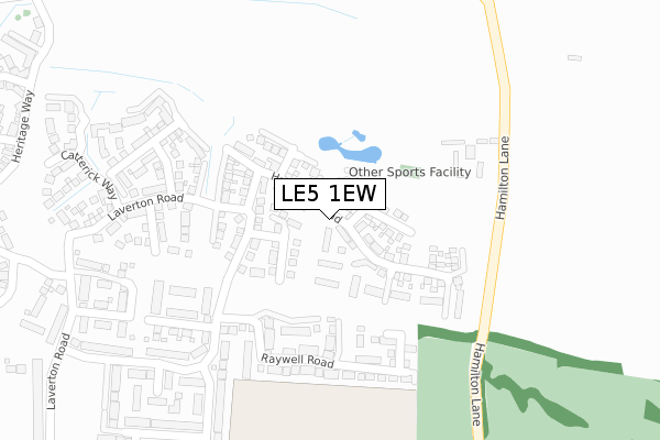
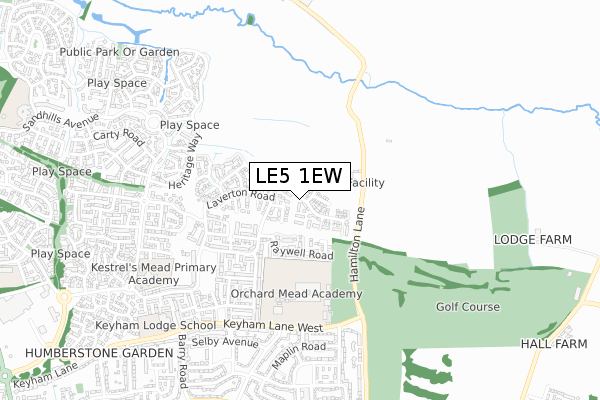
LE5 1EW maps


Licence: Open Government Licence (requires attribution)
Attribution: Contains OS data © Crown copyright and database right 2025
Source: Open Postcode Geo
Licence: Open Government Licence (requires attribution)
Attribution: Contains OS data © Crown copyright and database right 2025; Contains Royal Mail data © Royal Mail copyright and database right 2025; Source: Office for National Statistics licensed under the Open Government Licence v.3.0
LE5 1EW geodata
| Easting | 464237 |
| Northing | 306936 |
| Latitude | 52.656373 |
| Longitude | -1.051782 |
Where is LE5 1EW?
| Country | England |
| Postcode District | LE5 |
Politics
| Ward | South Charnwood |
|---|---|
| Constituency | Charnwood |
House Prices
Sales of detached houses in LE5 1EW
11, HACKNESS ROAD, HAMILTON, LEICESTER, LE5 1EW 2021 26 MAR £350,000 |
43, HACKNESS ROAD, HAMILTON, LEICESTER, LE5 1EW 2020 14 FEB £325,000 |
45, HACKNESS ROAD, HAMILTON, LEICESTER, LE5 1EW 2019 20 DEC £307,000 |
25, HACKNESS ROAD, HAMILTON, LEICESTER, LE5 1EW 2018 23 MAR £312,995 |
21, HACKNESS ROAD, HAMILTON, LEICESTER, LE5 1EW 2018 5 FEB £324,995 |
23, HACKNESS ROAD, HAMILTON, LEICESTER, LE5 1EW 2017 15 DEC £274,995 |
1, HACKNESS ROAD, HAMILTON, LEICESTER, LE5 1EW 2017 15 DEC £316,995 |
3, HACKNESS ROAD, HAMILTON, LEICESTER, LE5 1EW 2017 8 DEC £319,995 |
15, HACKNESS ROAD, HAMILTON, LEICESTER, LE5 1EW 2017 25 OCT £274,995 |
11, HACKNESS ROAD, HAMILTON, LEICESTER, LE5 1EW 2017 29 SEP £274,995 |
Licence: Contains HM Land Registry data © Crown copyright and database right 2025. This data is licensed under the Open Government Licence v3.0.
Transport
Nearest bus stops to LE5 1EW
| Hamilton Community College (Keyham Lane) | Nether Hall | 513m |
| Selby Avenue (Ivychurch Crescent) | Nether Hall | 589m |
| Barry Road (Keyham Lane West) | Nether Hall | 618m |
| Bakers Way (Maidenhead Avnue) | Hamilton | 626m |
| Barkford Close (Hamilton Lane) | Nether Hall | 642m |
Nearest railway stations to LE5 1EW
| Syston Station | 4.7km |
| Leicester Station | 5.7km |
Broadband
Broadband access in LE5 1EW (2020 data)
| Percentage of properties with Next Generation Access | 91.7% |
| Percentage of properties with Superfast Broadband | 91.7% |
| Percentage of properties with Ultrafast Broadband | 91.7% |
| Percentage of properties with Full Fibre Broadband | 0.0% |
Superfast Broadband is between 30Mbps and 300Mbps
Ultrafast Broadband is > 300Mbps
Broadband speed in LE5 1EW (2019 data)
Download
| Median download speed | 50.0Mbps |
| Average download speed | 87.2Mbps |
| Maximum download speed | 350.00Mbps |
Upload
| Median upload speed | 0.6Mbps |
| Average upload speed | 0.6Mbps |
| Maximum upload speed | 0.81Mbps |
Broadband limitations in LE5 1EW (2020 data)
| Percentage of properties unable to receive 2Mbps | 0.0% |
| Percentage of properties unable to receive 5Mbps | 0.0% |
| Percentage of properties unable to receive 10Mbps | 8.3% |
| Percentage of properties unable to receive 30Mbps | 8.3% |
Deprivation
27.6% of English postcodes are less deprived than LE5 1EW:Food Standards Agency
Three nearest food hygiene ratings to LE5 1EW (metres)


➜ Get more ratings from the Food Standards Agency
Nearest post box to LE5 1EW
| Last Collection | |||
|---|---|---|---|
| Location | Mon-Fri | Sat | Distance |
| Grantham Road | 17:00 | 12:00 | 1,042m |
| Main Street | 16:45 | 09:30 | 1,222m |
| Maidenhead Avenue | 16:30 | 11:00 | 1,475m |
LE5 1EW ITL and LE5 1EW LAU
The below table lists the International Territorial Level (ITL) codes (formerly Nomenclature of Territorial Units for Statistics (NUTS) codes) and Local Administrative Units (LAU) codes for LE5 1EW:
| ITL 1 Code | Name |
|---|---|
| TLF | East Midlands (England) |
| ITL 2 Code | Name |
| TLF2 | Leicestershire, Rutland and Northamptonshire |
| ITL 3 Code | Name |
| TLF22 | Leicestershire CC and Rutland |
| LAU 1 Code | Name |
| E07000130 | Charnwood |
LE5 1EW census areas
The below table lists the Census Output Area (OA), Lower Layer Super Output Area (LSOA), and Middle Layer Super Output Area (MSOA) for LE5 1EW:
| Code | Name | |
|---|---|---|
| OA | E00130544 | |
| LSOA | E01025730 | Charnwood 015C |
| MSOA | E02005359 | Charnwood 015 |
Nearest postcodes to LE5 1EW
| LE5 1WG | Laverton Road | 321m |
| LE5 1EL | Carnaby Close | 352m |
| LE5 1ER | Catterick Way | 419m |
| LE5 1WJ | Laverton Road | 509m |
| LE5 1SZ | Bryony Road | 539m |
| LE5 1RT | Keyham Lane West | 541m |
| LE5 1QF | Heritage Way | 543m |
| LE5 1UJ | Burdock Close | 545m |
| LE5 1SR | Seaton Rise | 547m |
| LE5 1SB | Maplin Road | 567m |