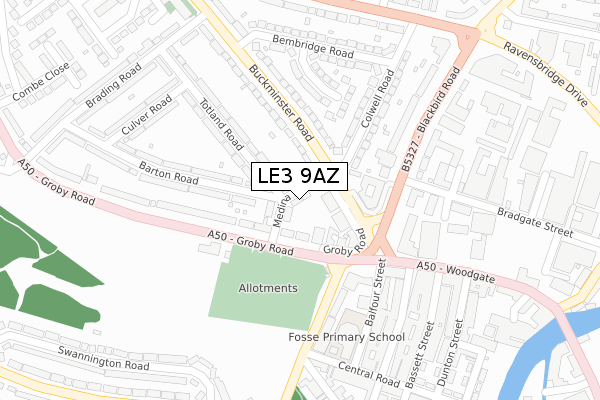
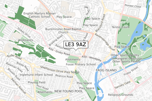
LE3 9AZ is located in the Western electoral ward, within the unitary authority of Leicester and the English Parliamentary constituency of Leicester West. The Sub Integrated Care Board (ICB) Location is NHS Leicester, Leicestershire and Rutland ICB - 04C and the police force is Leicestershire. This postcode has been in use since April 2020.


GetTheData
Source: OS Open Zoomstack (Ordnance Survey)
Licence: Open Government Licence (requires attribution)
Attribution: Contains OS data © Crown copyright and database right 2024
Source: Open Postcode Geo
Licence: Open Government Licence (requires attribution)
Attribution: Contains OS data © Crown copyright and database right 2024; Contains Royal Mail data © Royal Mail copyright and database right 2024; Source: Office for National Statistics licensed under the Open Government Licence v.3.0
| Easting | 456073 |
| Northing | 305720 |
| Latitude | 52.646346 |
| Longitude | -1.172668 |
GetTheData
Source: Open Postcode Geo
Licence: Open Government Licence
| Country | England |
| Postcode District | LE3 |
| ➜ LE3 open data dashboard ➜ See where LE3 is on a map ➜ Where is Leicester? | |
GetTheData
Source: Land Registry Price Paid Data
Licence: Open Government Licence
| Ward | Western |
| Constituency | Leicester West |
GetTheData
Source: ONS Postcode Database
Licence: Open Government Licence
| January 2024 | Criminal damage and arson | On or near Elgin Avenue | 257m |
| January 2024 | Violence and sexual offences | On or near Coates Avenue | 461m |
| January 2024 | Violence and sexual offences | On or near Pindar Road | 462m |
| ➜ Get more crime data in our Crime section | |||
GetTheData
Source: data.police.uk
Licence: Open Government Licence
| Kay Road (Birds Nest Avenue) | New Parks | 58m |
| Kay Road (Birds Nest Avenue) | New Parks | 86m |
| Pindar Road (Aikman Avenue) | New Parks | 146m |
| Pindar Road (Birds Nest Avenue) | New Parks | 148m |
| Kay Road (Aikman Avenue) | New Parks | 159m |
| Leicester Station | 3.6km |
GetTheData
Source: NaPTAN
Licence: Open Government Licence
GetTheData
Source: ONS Postcode Database
Licence: Open Government Licence


➜ Get more ratings from the Food Standards Agency
GetTheData
Source: Food Standards Agency
Licence: FSA terms & conditions
| Last Collection | |||
|---|---|---|---|
| Location | Mon-Fri | Sat | Distance |
| Aikman Avenue | 17:00 | 12:00 | 235m |
| Perth Avenue | 17:00 | 12:00 | 533m |
| Bateman Road | 17:00 | 12:00 | 722m |
GetTheData
Source: Dracos
Licence: Creative Commons Attribution-ShareAlike
| Facility | Distance |
|---|---|
| New Parks Club Aikman Avenue, Leicester Grass Pitches, Sports Hall | 364m |
| Stokes Wood Primary School Blackett Avenue, Leicester Grass Pitches | 506m |
| New Parks Leisure Centre St. Oswald Road, Leicester Swimming Pool, Health and Fitness Gym, Squash Courts | 586m |
GetTheData
Source: Active Places
Licence: Open Government Licence
| School | Phase of Education | Distance |
|---|---|---|
| Parks Primary School New Parks Crescent, Leicester, LE3 9NZ | Primary | 451m |
| Stokes Wood Primary School Blackett Avenue, Leicester, LE3 9BX | Primary | 477m |
| New College Leicester Glenfield Road, Leicester, LE3 6DN | Secondary | 606m |
GetTheData
Source: Edubase
Licence: Open Government Licence
The below table lists the International Territorial Level (ITL) codes (formerly Nomenclature of Territorial Units for Statistics (NUTS) codes) and Local Administrative Units (LAU) codes for LE3 9AZ:
| ITL 1 Code | Name |
|---|---|
| TLF | East Midlands (England) |
| ITL 2 Code | Name |
| TLF2 | Leicestershire, Rutland and Northamptonshire |
| ITL 3 Code | Name |
| TLF21 | Leicester |
| LAU 1 Code | Name |
| E06000016 | Leicester |
GetTheData
Source: ONS Postcode Directory
Licence: Open Government Licence
The below table lists the Census Output Area (OA), Lower Layer Super Output Area (LSOA), and Middle Layer Super Output Area (MSOA) for LE3 9AZ:
| Code | Name | |
|---|---|---|
| OA | E00069289 | |
| LSOA | E01013723 | Leicester 012B |
| MSOA | E02002838 | Leicester 012 |
GetTheData
Source: ONS Postcode Directory
Licence: Open Government Licence
| LE3 9NP | Caledine Road | 57m |
| LE3 9NN | Caledine Road | 61m |
| LE3 9PQ | Kay Road | 83m |
| LE3 9NB | Birds Nest Avenue | 89m |
| LE3 9PX | Aikman Avenue | 102m |
| LE3 9NY | Glazebrook Square | 138m |
| LE3 9NE | Birds Nest Avenue | 142m |
| LE3 9RP | Pindar Road | 162m |
| LE3 9NT | Glazebrook Road | 163m |
| LE3 9NW | Glazebrook Road | 180m |
GetTheData
Source: Open Postcode Geo; Land Registry Price Paid Data
Licence: Open Government Licence