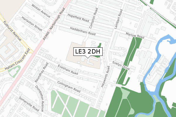
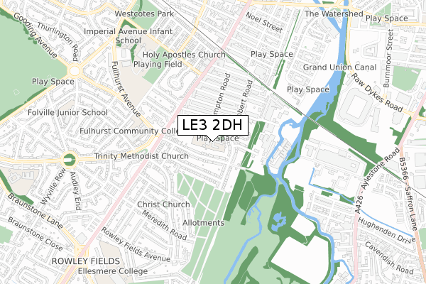
LE3 2DH is located in the Braunstone Park & Rowley Fields electoral ward, within the unitary authority of Leicester and the English Parliamentary constituency of Leicester West. The Sub Integrated Care Board (ICB) Location is NHS Leicester, Leicestershire and Rutland ICB - 04C and the police force is Leicestershire. This postcode has been in use since April 2019.


GetTheData
Source: OS Open Zoomstack (Ordnance Survey)
Licence: Open Government Licence (requires attribution)
Attribution: Contains OS data © Crown copyright and database right 2024
Source: Open Postcode Geo
Licence: Open Government Licence (requires attribution)
Attribution: Contains OS data © Crown copyright and database right 2024; Contains Royal Mail data © Royal Mail copyright and database right 2024; Source: Office for National Statistics licensed under the Open Government Licence v.3.0
| Easting | 457324 |
| Northing | 302648 |
| Latitude | 52.618602 |
| Longitude | -1.154711 |
GetTheData
Source: Open Postcode Geo
Licence: Open Government Licence
| Country | England |
| Postcode District | LE3 |
| ➜ LE3 open data dashboard ➜ See where LE3 is on a map ➜ Where is Leicester? | |
GetTheData
Source: Land Registry Price Paid Data
Licence: Open Government Licence
| Ward | Braunstone Park & Rowley Fields |
| Constituency | Leicester West |
GetTheData
Source: ONS Postcode Database
Licence: Open Government Licence
| December 2023 | Criminal damage and arson | On or near Somerville Road | 406m |
| December 2023 | Vehicle crime | On or near Somerville Road | 406m |
| November 2023 | Vehicle crime | On or near Somerville Road | 406m |
| ➜ Get more crime data in our Crime section | |||
GetTheData
Source: data.police.uk
Licence: Open Government Licence
| Fullhurst Avenue (Narborough Road) | West End | 265m |
| Collingham Road (Roundhay Road) | Leicester | 304m |
| Hopefield Road (Narborough Road) | West End | 307m |
| Fullhurst Avenue (Narborough Road) | West End | 307m |
| Hopefield Road (Narborough Road) | West End | 320m |
| Leicester Station | 2.5km |
| South Wigston Station | 4.3km |
GetTheData
Source: NaPTAN
Licence: Open Government Licence
GetTheData
Source: ONS Postcode Database
Licence: Open Government Licence


➜ Get more ratings from the Food Standards Agency
GetTheData
Source: Food Standards Agency
Licence: FSA terms & conditions
| Last Collection | |||
|---|---|---|---|
| Location | Mon-Fri | Sat | Distance |
| Heyworth Road | 17:00 | 12:00 | 128m |
| Fullhurst Avenue | 17:00 | 12:00 | 397m |
| Imperial Avenue Post Office | 17:00 | 12:00 | 429m |
GetTheData
Source: Dracos
Licence: Creative Commons Attribution-ShareAlike
| Facility | Distance |
|---|---|
| Narborough Road Playing Fields Narborough Road, Leicester Grass Pitches | 254m |
| The Muscle Machine Gym Faircharm Industrial Estate, Evelyn Drive, Leicester Health and Fitness Gym, Studio | 305m |
| Ellesmere College (Closed) Ellesmere Road, Leicester Sports Hall | 438m |
GetTheData
Source: Active Places
Licence: Open Government Licence
| School | Phase of Education | Distance |
|---|---|---|
| St Mary's Fields Primary School 21 Compton Road, Leicester, LE3 2DH | Primary | 0m |
| St Mary's Fields Primary School 21 Compton Road, Leicester, LE3 2DH | Primary | 0m |
| Fullhurst Community College Imperial Avenue, Leicester, LE3 1AH | Secondary | 641m |
GetTheData
Source: Edubase
Licence: Open Government Licence
The below table lists the International Territorial Level (ITL) codes (formerly Nomenclature of Territorial Units for Statistics (NUTS) codes) and Local Administrative Units (LAU) codes for LE3 2DH:
| ITL 1 Code | Name |
|---|---|
| TLF | East Midlands (England) |
| ITL 2 Code | Name |
| TLF2 | Leicestershire, Rutland and Northamptonshire |
| ITL 3 Code | Name |
| TLF21 | Leicester |
| LAU 1 Code | Name |
| E06000016 | Leicester |
GetTheData
Source: ONS Postcode Directory
Licence: Open Government Licence
The below table lists the Census Output Area (OA), Lower Layer Super Output Area (LSOA), and Middle Layer Super Output Area (MSOA) for LE3 2DH:
| Code | Name | |
|---|---|---|
| OA | E00068835 | |
| LSOA | E01013635 | Leicester 029A |
| MSOA | E02002855 | Leicester 029 |
GetTheData
Source: ONS Postcode Directory
Licence: Open Government Licence
| LE3 2DA | Heyworth Road | 99m |
| LE3 2BD | Evesham Road | 112m |
| LE3 2BG | Haddenham Road | 130m |
| LE3 2BE | Evesham Road | 141m |
| LE3 2BA | Collingham Road | 173m |
| LE3 2BH | Haddenham Road | 176m |
| LE3 2BT | Evelyn Drive | 177m |
| LE3 2BS | Mavis Avenue | 189m |
| LE3 2BP | Lambert Road | 191m |
| LE3 2BF | Haddenham Road | 211m |
GetTheData
Source: Open Postcode Geo; Land Registry Price Paid Data
Licence: Open Government Licence