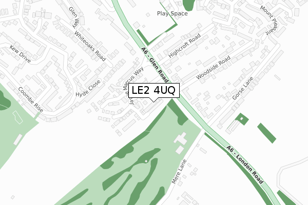
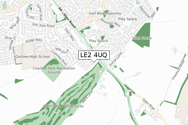
LE2 4UQ is located in the Oadby Brocks Hill electoral ward, within the local authority district of Oadby and Wigston and the English Parliamentary constituency of Harborough. The Sub Integrated Care Board (ICB) Location is NHS Leicester, Leicestershire and Rutland ICB - 03W and the police force is Leicestershire. This postcode has been in use since April 2020.


GetTheData
Source: OS Open Zoomstack (Ordnance Survey)
Licence: Open Government Licence (requires attribution)
Attribution: Contains OS data © Crown copyright and database right 2024
Source: Open Postcode Geo
Licence: Open Government Licence (requires attribution)
Attribution: Contains OS data © Crown copyright and database right 2024; Contains Royal Mail data © Royal Mail copyright and database right 2024; Source: Office for National Statistics licensed under the Open Government Licence v.3.0
| Easting | 463638 |
| Northing | 299134 |
| Latitude | 52.586315 |
| Longitude | -1.062135 |
GetTheData
Source: Open Postcode Geo
Licence: Open Government Licence
| Country | England |
| Postcode District | LE2 |
| ➜ LE2 open data dashboard ➜ See where LE2 is on a map ➜ Where is Oadby? | |
GetTheData
Source: Land Registry Price Paid Data
Licence: Open Government Licence
| Ward | Oadby Brocks Hill |
| Constituency | Harborough |
GetTheData
Source: ONS Postcode Database
Licence: Open Government Licence
12, WAKELING VIEW, OADBY, LEICESTER, LE2 4UQ 2020 28 AUG £387,950 |
11, WAKELING VIEW, OADBY, LEICESTER, LE2 4UQ 2020 28 AUG £364,950 |
8, WAKELING VIEW, OADBY, LEICESTER, LE2 4UQ 2020 30 JUN £366,950 |
10, WAKELING VIEW, OADBY, LEICESTER, LE2 4UQ 2020 30 JUN £387,950 |
9, WAKELING VIEW, OADBY, LEICESTER, LE2 4UQ 2020 26 JUN £389,950 |
6, WAKELING VIEW, OADBY, LEICESTER, LE2 4UQ 2020 29 MAY £312,950 |
4, WAKELING VIEW, OADBY, LEICESTER, LE2 4UQ 2020 29 MAY £472,950 |
2, WAKELING VIEW, OADBY, LEICESTER, LE2 4UQ 2020 29 MAY £313,950 |
13, WAKELING VIEW, OADBY, LEICESTER, LE2 4UQ 2020 27 MAR £365,950 |
15, WAKELING VIEW, OADBY, LEICESTER, LE2 4UQ 2020 27 MAR £385,950 |
GetTheData
Source: HM Land Registry Price Paid Data
Licence: Contains HM Land Registry data © Crown copyright and database right 2024. This data is licensed under the Open Government Licence v3.0.
| July 2023 | Violence and sexual offences | On or near Windsor Close | 443m |
| January 2023 | Violence and sexual offences | On or near Windsor Close | 443m |
| June 2022 | Violence and sexual offences | On or near Hyde Close | 198m |
| ➜ Get more crime data in our Crime section | |||
GetTheData
Source: data.police.uk
Licence: Open Government Licence
| Highcroft Road (Glen Road) | Oadby | 130m |
| Highcroft Road (Glen Road) | Oadby | 144m |
| Gorse Lane (Glen Road) | Oadby | 174m |
| Gorse Lane (Glen Road) | Oadby | 189m |
| Kew Drive (Coombe Rise) | Oadby | 375m |
| South Wigston Station | 4.9km |
| Leicester Station | 6.6km |
GetTheData
Source: NaPTAN
Licence: Open Government Licence
GetTheData
Source: ONS Postcode Database
Licence: Open Government Licence


➜ Get more ratings from the Food Standards Agency
GetTheData
Source: Food Standards Agency
Licence: FSA terms & conditions
| Last Collection | |||
|---|---|---|---|
| Location | Mon-Fri | Sat | Distance |
| Ashbourne Street/Mere Road | 17:30 | 12:00 | 251m |
| Elizabeth Drive | 17:30 | 12:00 | 827m |
| Ashtree Road | 17:30 | 11:30 | 831m |
GetTheData
Source: Dracos
Licence: Creative Commons Attribution-ShareAlike
| Facility | Distance |
|---|---|
| Glen Gorse Golf Club Glen Road, Oadby, Leicester Golf | 147m |
| Coombe Park Coombe Rise, Oadby, Leicester Grass Pitches | 425m |
| Woodland Grange Primary School Beaufort Way, Oadby, Leicester Grass Pitches, Sports Hall | 656m |
GetTheData
Source: Active Places
Licence: Open Government Licence
| School | Phase of Education | Distance |
|---|---|---|
| Woodland Grange Primary School Beaufort Way, Oadby, Leicester, LE2 4TY | Primary | 656m |
| Beauchamp College Ridge Way, Oadby, Leicester, LE2 5TP | Secondary | 726m |
| Gartree High School Ridge Way, Oadby, Leicester, LE2 5TQ | Secondary | 832m |
GetTheData
Source: Edubase
Licence: Open Government Licence
The below table lists the International Territorial Level (ITL) codes (formerly Nomenclature of Territorial Units for Statistics (NUTS) codes) and Local Administrative Units (LAU) codes for LE2 4UQ:
| ITL 1 Code | Name |
|---|---|
| TLF | East Midlands (England) |
| ITL 2 Code | Name |
| TLF2 | Leicestershire, Rutland and Northamptonshire |
| ITL 3 Code | Name |
| TLF22 | Leicestershire CC and Rutland |
| LAU 1 Code | Name |
| E07000135 | Oadby and Wigston |
GetTheData
Source: ONS Postcode Directory
Licence: Open Government Licence
The below table lists the Census Output Area (OA), Lower Layer Super Output Area (LSOA), and Middle Layer Super Output Area (MSOA) for LE2 4UQ:
| Code | Name | |
|---|---|---|
| OA | E00131790 | |
| LSOA | E01025970 | Oadby and Wigston 003A |
| MSOA | E02005412 | Oadby and Wigston 003 |
GetTheData
Source: ONS Postcode Directory
Licence: Open Government Licence
| LE2 4RJ | Glen Road | 141m |
| LE2 5UN | Hyde Close | 177m |
| LE2 4RH | Glen Road | 184m |
| LE2 4RT | Laurel Drive | 222m |
| LE2 5UL | Kensington Close | 233m |
| LE2 4RS | Highcroft Road | 264m |
| LE2 5TW | Coombe Rise | 271m |
| LE2 5YL | Whiteoaks Road | 272m |
| LE2 4RL | Glen Road | 277m |
| LE2 4SE | Woodside Road | 296m |
GetTheData
Source: Open Postcode Geo; Land Registry Price Paid Data
Licence: Open Government Licence