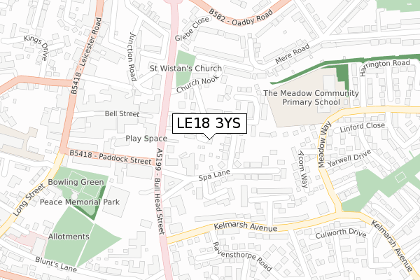
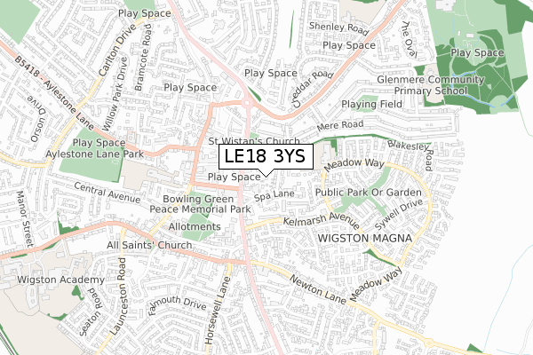
LE18 3YS is located in the Wigston Meadowcourt electoral ward, within the local authority district of Oadby and Wigston and the English Parliamentary constituency of Harborough. The Sub Integrated Care Board (ICB) Location is NHS Leicester, Leicestershire and Rutland ICB - 03W and the police force is Leicestershire. This postcode has been in use since September 2019.


GetTheData
Source: OS Open Zoomstack (Ordnance Survey)
Licence: Open Government Licence (requires attribution)
Attribution: Contains OS data © Crown copyright and database right 2024
Source: Open Postcode Geo
Licence: Open Government Licence (requires attribution)
Attribution: Contains OS data © Crown copyright and database right 2024; Contains Royal Mail data © Royal Mail copyright and database right 2024; Source: Office for National Statistics licensed under the Open Government Licence v.3.0
| Easting | 461820 |
| Northing | 297951 |
| Latitude | 52.575890 |
| Longitude | -1.089185 |
GetTheData
Source: Open Postcode Geo
Licence: Open Government Licence
| Country | England |
| Postcode District | LE18 |
| ➜ LE18 open data dashboard ➜ See where LE18 is on a map ➜ Where is Wigston? | |
GetTheData
Source: Land Registry Price Paid Data
Licence: Open Government Licence
| Ward | Wigston Meadowcourt |
| Constituency | Harborough |
GetTheData
Source: ONS Postcode Database
Licence: Open Government Licence
9, EUROPA ROAD, WIGSTON, LE18 3YS 2021 18 JUN £534,995 |
14, EUROPA ROAD, WIGSTON, LE18 3YS 2021 28 MAY £454,995 |
19, EUROPA ROAD, WIGSTON, LE18 3YS 2021 26 MAR £606,995 |
16, EUROPA ROAD, WIGSTON, LE18 3YS 2021 26 MAR £384,995 |
11, EUROPA ROAD, WIGSTON, LE18 3YS 2021 26 MAR £534,995 |
13, EUROPA ROAD, WIGSTON, LE18 3YS 2021 26 MAR £317,995 |
12, EUROPA ROAD, WIGSTON, LE18 3YS 2021 26 MAR £424,995 |
17, EUROPA ROAD, WIGSTON, LE18 3YS 2021 26 MAR £474,995 |
15, EUROPA ROAD, WIGSTON, LE18 3YS 2021 25 MAR £319,995 |
10, EUROPA ROAD, WIGSTON, LE18 3YS 2021 25 MAR £361,995 |
GetTheData
Source: HM Land Registry Price Paid Data
Licence: Contains HM Land Registry data © Crown copyright and database right 2024. This data is licensed under the Open Government Licence v3.0.
| January 2024 | Criminal damage and arson | On or near Guthlaxton Way | 498m |
| January 2024 | Burglary | On or near Guthlaxton Way | 498m |
| January 2023 | Burglary | On or near Stanbrig | 444m |
| ➜ Get more crime data in our Crime section | |||
GetTheData
Source: data.police.uk
Licence: Open Government Licence
| Bronze Barrow Close (Guthlaxton Way) | Wigston Harcourt | 388m |
| Mablowe Field (Foston Gate) | Wigston Harcourt | 421m |
| Mablowe Field (Foston Gate) | Wigston Harcourt | 427m |
| Bronze Barrow Close (Guthlaxton Way) | Wigston Harcourt | 439m |
| Herrick Way (Guthlaxton Way) | Wigston Harcourt | 531m |
| South Wigston Station | 3.1km |
GetTheData
Source: NaPTAN
Licence: Open Government Licence
GetTheData
Source: ONS Postcode Database
Licence: Open Government Licence


➜ Get more ratings from the Food Standards Agency
GetTheData
Source: Food Standards Agency
Licence: FSA terms & conditions
| Last Collection | |||
|---|---|---|---|
| Location | Mon-Fri | Sat | Distance |
| Homestead Drive | 17:30 | 11:30 | 832m |
| Lulworth Close | 17:30 | 11:30 | 1,217m |
| Welford Road | 17:30 | 11:30 | 1,309m |
GetTheData
Source: Dracos
Licence: Creative Commons Attribution-ShareAlike
| Facility | Distance |
|---|---|
| South Leicester Rfc Welford Road, Wigston Grass Pitches | 931m |
| Horsewell Lane Recreation Ground (Little Hill) Horsewell Lane, Wigston Grass Pitches | 1.1km |
| Wigston Tennis Club Horsewell Lane, Horsewell Lane, Wigston Outdoor Tennis Courts | 1.1km |
GetTheData
Source: Active Places
Licence: Open Government Licence
| School | Phase of Education | Distance |
|---|---|---|
| Thythorn Field Community Primary School Bideford Close, Wigston, LE18 2QU | Primary | 1.2km |
| The Meadow Community Primary School Meadow Way, Wigston Magna, Wigston, LE18 3QZ | Primary | 1.3km |
| Glenmere Community Primary School Estoril Avenue, Wigston, LE18 3RD | Primary | 1.5km |
GetTheData
Source: Edubase
Licence: Open Government Licence
The below table lists the International Territorial Level (ITL) codes (formerly Nomenclature of Territorial Units for Statistics (NUTS) codes) and Local Administrative Units (LAU) codes for LE18 3YS:
| ITL 1 Code | Name |
|---|---|
| TLF | East Midlands (England) |
| ITL 2 Code | Name |
| TLF2 | Leicestershire, Rutland and Northamptonshire |
| ITL 3 Code | Name |
| TLF22 | Leicestershire CC and Rutland |
| LAU 1 Code | Name |
| E07000135 | Oadby and Wigston |
GetTheData
Source: ONS Postcode Directory
Licence: Open Government Licence
The below table lists the Census Output Area (OA), Lower Layer Super Output Area (LSOA), and Middle Layer Super Output Area (MSOA) for LE18 3YS:
| Code | Name | |
|---|---|---|
| OA | E00131938 | |
| LSOA | E01025998 | Oadby and Wigston 007D |
| MSOA | E02005416 | Oadby and Wigston 007 |
GetTheData
Source: ONS Postcode Directory
Licence: Open Government Licence
| LE18 3LN | Blackwell Close | 343m |
| LE18 3UJ | Mablowe Field | 355m |
| LE18 3RZ | Bronze Barrow Close | 390m |
| LE18 3UG | Peakdale | 413m |
| LE18 3UF | Arndale | 414m |
| LE18 3TY | Long Meadow | 445m |
| LE18 3LP | Butt Close | 455m |
| LE18 3TR | Stanbrig | 473m |
| LE18 3RX | Wensleydale Road | 481m |
| LE18 3UD | Simons Close | 487m |
GetTheData
Source: Open Postcode Geo; Land Registry Price Paid Data
Licence: Open Government Licence