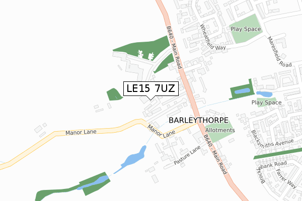
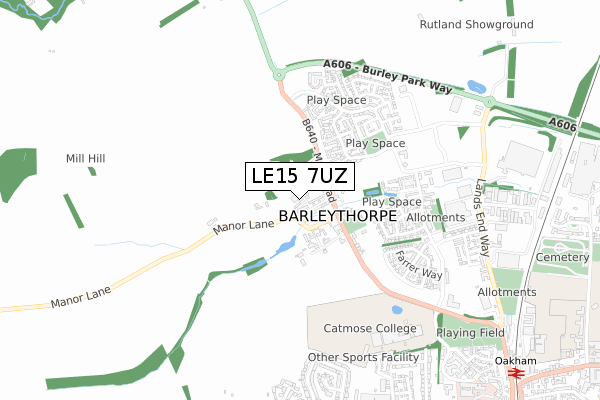
LE15 7UZ is located in the Barleythorpe electoral ward, within the unitary authority of Rutland and the English Parliamentary constituency of Rutland and Melton. The Sub Integrated Care Board (ICB) Location is NHS Leicester, Leicestershire and Rutland ICB - 03W and the police force is Leicestershire. This postcode has been in use since May 2018.


GetTheData
Source: OS Open Zoomstack (Ordnance Survey)
Licence: Open Government Licence (requires attribution)
Attribution: Contains OS data © Crown copyright and database right 2024
Source: Open Postcode Geo
Licence: Open Government Licence (requires attribution)
Attribution: Contains OS data © Crown copyright and database right 2024; Contains Royal Mail data © Royal Mail copyright and database right 2024; Source: Office for National Statistics licensed under the Open Government Licence v.3.0
| Easting | 484776 |
| Northing | 309765 |
| Latitude | 52.678982 |
| Longitude | -0.747485 |
GetTheData
Source: Open Postcode Geo
Licence: Open Government Licence
| Country | England |
| Postcode District | LE15 |
| ➜ LE15 open data dashboard ➜ See where LE15 is on a map ➜ Where is Barleythorpe? | |
GetTheData
Source: Land Registry Price Paid Data
Licence: Open Government Licence
| Ward | Barleythorpe |
| Constituency | Rutland And Melton |
GetTheData
Source: ONS Postcode Database
Licence: Open Government Licence
| June 2022 | Criminal damage and arson | On or near Main Road | 140m |
| June 2022 | Drugs | On or near Stud Road | 497m |
| June 2022 | Violence and sexual offences | On or near Stud Road | 497m |
| ➜ Get more crime data in our Crime section | |||
GetTheData
Source: data.police.uk
Licence: Open Government Licence
| Rutland College (Main Road) | Barleythorpe | 161m |
| Pasture Lane (A606 Main Road) | Barleythorpe | 201m |
| Rutland College (Main Road) | Barleythorpe | 217m |
| Pasture Lane (Main Road) | Barleythorpe | 222m |
| Lands End Way (Bosal Road) | Oakham | 621m |
| Oakham Station | 1.2km |
GetTheData
Source: NaPTAN
Licence: Open Government Licence
➜ Broadband speed and availability dashboard for LE15 7UZ
| Percentage of properties with Next Generation Access | 100.0% |
| Percentage of properties with Superfast Broadband | 100.0% |
| Percentage of properties with Ultrafast Broadband | 0.0% |
| Percentage of properties with Full Fibre Broadband | 0.0% |
Superfast Broadband is between 30Mbps and 300Mbps
Ultrafast Broadband is > 300Mbps
| Median download speed | 20.2Mbps |
| Average download speed | 20.3Mbps |
| Maximum download speed | 29.21Mbps |
| Median upload speed | 2.2Mbps |
| Average upload speed | 2.7Mbps |
| Maximum upload speed | 5.36Mbps |
| Percentage of properties unable to receive 2Mbps | 0.0% |
| Percentage of properties unable to receive 5Mbps | 0.0% |
| Percentage of properties unable to receive 10Mbps | 0.0% |
| Percentage of properties unable to receive 30Mbps | 0.0% |
➜ Broadband speed and availability dashboard for LE15 7UZ
GetTheData
Source: Ofcom
Licence: Ofcom Terms of Use (requires attribution)
GetTheData
Source: ONS Postcode Database
Licence: Open Government Licence


➜ Get more ratings from the Food Standards Agency
GetTheData
Source: Food Standards Agency
Licence: FSA terms & conditions
| Last Collection | |||
|---|---|---|---|
| Location | Mon-Fri | Sat | Distance |
| Barleythorpe | 17:00 | 07:00 | 238m |
| Pillings Road | 17:30 | 08:00 | 852m |
| Cold Overton Road | 17:30 | 11:00 | 927m |
GetTheData
Source: Dracos
Licence: Creative Commons Attribution-ShareAlike
| Facility | Distance |
|---|---|
| Oakham United Fc Main Road, Barleythorpe, Oakham Grass Pitches | 190m |
| Catmose Sports Centre Huntsmans Drive, Oakham Health and Fitness Gym, Grass Pitches, Artificial Grass Pitch, Sports Hall, Swimming Pool, Studio | 657m |
| Oakham Rugby Football Club (Closed) Land's End Way, Oakham Grass Pitches | 690m |
GetTheData
Source: Active Places
Licence: Open Government Licence
| School | Phase of Education | Distance |
|---|---|---|
| Harington School Huntsmans Drive, Catmose Campus, Oakham, LE15 6RP | 16 plus | 677m |
| Catmose College Huntsmans Drive, Oakham, LE15 6RP | Secondary | 931m |
| Brooke Priory School Station Approach, Oakham, LE15 6QW | Not applicable | 1.2km |
GetTheData
Source: Edubase
Licence: Open Government Licence
The below table lists the International Territorial Level (ITL) codes (formerly Nomenclature of Territorial Units for Statistics (NUTS) codes) and Local Administrative Units (LAU) codes for LE15 7UZ:
| ITL 1 Code | Name |
|---|---|
| TLF | East Midlands (England) |
| ITL 2 Code | Name |
| TLF2 | Leicestershire, Rutland and Northamptonshire |
| ITL 3 Code | Name |
| TLF22 | Leicestershire CC and Rutland |
| LAU 1 Code | Name |
| E06000017 | Rutland |
GetTheData
Source: ONS Postcode Directory
Licence: Open Government Licence
The below table lists the Census Output Area (OA), Lower Layer Super Output Area (LSOA), and Middle Layer Super Output Area (MSOA) for LE15 7UZ:
| Code | Name | |
|---|---|---|
| OA | E00069608 | |
| LSOA | E01013801 | Rutland 002C |
| MSOA | E02002864 | Rutland 002 |
GetTheData
Source: ONS Postcode Directory
Licence: Open Government Licence
| LE15 7EG | Manor Lane | 79m |
| LE15 7FD | Clock House Court | 95m |
| LE15 7GJ | Grooms Close | 180m |
| LE15 7TZ | Haybarn Close | 186m |
| LE15 7EE | Main Road | 188m |
| LE15 7EQ | Pasture Lane | 204m |
| LE15 7GL | Horseshoe Close | 224m |
| LE15 7UF | Alder Close | 305m |
| LE15 7UD | Wheatfield Way | 309m |
| LE15 7UL | Blackberry Close | 329m |
GetTheData
Source: Open Postcode Geo; Land Registry Price Paid Data
Licence: Open Government Licence