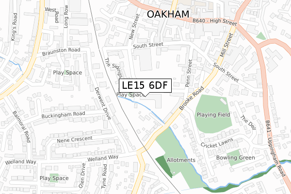
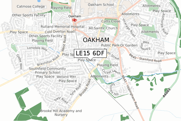
LE15 6DF is located in the Oakham South electoral ward, within the unitary authority of Rutland and the English Parliamentary constituency of Rutland and Melton. The Sub Integrated Care Board (ICB) Location is NHS Leicester, Leicestershire and Rutland ICB - 03W and the police force is Leicestershire. This postcode has been in use since June 2018.


GetTheData
Source: OS Open Zoomstack (Ordnance Survey)
Licence: Open Government Licence (requires attribution)
Attribution: Contains OS data © Crown copyright and database right 2024
Source: Open Postcode Geo
Licence: Open Government Licence (requires attribution)
Attribution: Contains OS data © Crown copyright and database right 2024; Contains Royal Mail data © Royal Mail copyright and database right 2024; Source: Office for National Statistics licensed under the Open Government Licence v.3.0
| Easting | 485894 |
| Northing | 308484 |
| Latitude | 52.667293 |
| Longitude | -0.731287 |
GetTheData
Source: Open Postcode Geo
Licence: Open Government Licence
| Country | England |
| Postcode District | LE15 |
| ➜ LE15 open data dashboard ➜ See where LE15 is on a map ➜ Where is Oakham? | |
GetTheData
Source: Land Registry Price Paid Data
Licence: Open Government Licence
| Ward | Oakham South |
| Constituency | Rutland And Melton |
GetTheData
Source: ONS Postcode Database
Licence: Open Government Licence
| January 2024 | Violence and sexual offences | On or near Parking Area | 435m |
| November 2023 | Violence and sexual offences | On or near Parking Area | 256m |
| November 2023 | Violence and sexual offences | On or near Parking Area | 435m |
| ➜ Get more crime data in our Crime section | |||
GetTheData
Source: data.police.uk
Licence: Open Government Licence
| Tesco (South Street) | Oakham | 160m |
| Bus Station (John Street) | Oakham | 275m |
| Market Place (High Street) | Oakham | 359m |
| Market Place (High Street) | Oakham | 372m |
| Council Offices (Uppingham Road) | Oakham | 411m |
| Oakham Station | 0.6km |
GetTheData
Source: NaPTAN
Licence: Open Government Licence
| Percentage of properties with Next Generation Access | 100.0% |
| Percentage of properties with Superfast Broadband | 100.0% |
| Percentage of properties with Ultrafast Broadband | 100.0% |
| Percentage of properties with Full Fibre Broadband | 100.0% |
Superfast Broadband is between 30Mbps and 300Mbps
Ultrafast Broadband is > 300Mbps
| Percentage of properties unable to receive 2Mbps | 0.0% |
| Percentage of properties unable to receive 5Mbps | 0.0% |
| Percentage of properties unable to receive 10Mbps | 0.0% |
| Percentage of properties unable to receive 30Mbps | 0.0% |
GetTheData
Source: Ofcom
Licence: Ofcom Terms of Use (requires attribution)
GetTheData
Source: ONS Postcode Database
Licence: Open Government Licence


➜ Get more ratings from the Food Standards Agency
GetTheData
Source: Food Standards Agency
Licence: FSA terms & conditions
| Last Collection | |||
|---|---|---|---|
| Location | Mon-Fri | Sat | Distance |
| High Street | 17:30 | 11:00 | 325m |
| High Street | 16:45 | 07:00 | 417m |
| West End Post Office | 17:30 | 11:30 | 483m |
GetTheData
Source: Dracos
Licence: Creative Commons Attribution-ShareAlike
| Facility | Distance |
|---|---|
| Lime Kilms Ground Brooke Road, Oakham Grass Pitches | 268m |
| Oakham Lawn Tennis Club The Vale, Oakham Outdoor Tennis Courts | 388m |
| Catmose Primary Sandringham Close, Oakham Grass Pitches | 608m |
GetTheData
Source: Active Places
Licence: Open Government Licence
| School | Phase of Education | Distance |
|---|---|---|
| The Shires at Oakham 3 Uppingham Road, Oakham, Rutland, Should be blank, LE15 6JB | Not applicable | 358m |
| Oakham School Chapel Close, Oakham, LE15 6DT | Not applicable | 405m |
| Catmose Primary Sandringham Close, Oakham, LE15 6SH | Primary | 618m |
GetTheData
Source: Edubase
Licence: Open Government Licence
The below table lists the International Territorial Level (ITL) codes (formerly Nomenclature of Territorial Units for Statistics (NUTS) codes) and Local Administrative Units (LAU) codes for LE15 6DF:
| ITL 1 Code | Name |
|---|---|
| TLF | East Midlands (England) |
| ITL 2 Code | Name |
| TLF2 | Leicestershire, Rutland and Northamptonshire |
| ITL 3 Code | Name |
| TLF22 | Leicestershire CC and Rutland |
| LAU 1 Code | Name |
| E06000017 | Rutland |
GetTheData
Source: ONS Postcode Directory
Licence: Open Government Licence
The below table lists the Census Output Area (OA), Lower Layer Super Output Area (LSOA), and Middle Layer Super Output Area (MSOA) for LE15 6DF:
| Code | Name | |
|---|---|---|
| OA | E00069624 | |
| LSOA | E01013802 | Rutland 003C |
| MSOA | E02002865 | Rutland 003 |
GetTheData
Source: ONS Postcode Directory
Licence: Open Government Licence
| LE15 6HG | Brooke Road | 112m |
| LE15 6RN | The Sidings | 116m |
| LE15 6SA | Derwent Drive | 145m |
| LE15 6BB | Penn Street | 167m |
| LE15 6DP | Penn Street | 170m |
| LE15 6BQ | South Street | 177m |
| LE15 6RZ | Derwent Drive | 191m |
| LE15 6JN | Crown Gardens | 212m |
| LE15 6BG | South Street | 213m |
| LE15 6BA | New Street | 223m |
GetTheData
Source: Open Postcode Geo; Land Registry Price Paid Data
Licence: Open Government Licence