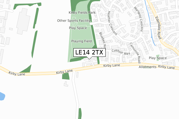
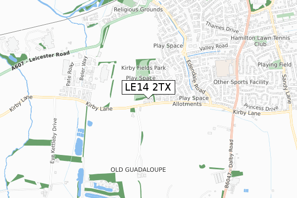
LE14 2TX is located in the Melton Dorian electoral ward, within the local authority district of Melton and the English Parliamentary constituency of Rutland and Melton. The Sub Integrated Care Board (ICB) Location is NHS Leicester, Leicestershire and Rutland ICB - 03W and the police force is Leicestershire. This postcode has been in use since June 2019.


GetTheData
Source: OS Open Zoomstack (Ordnance Survey)
Licence: Open Government Licence (requires attribution)
Attribution: Contains OS data © Crown copyright and database right 2024
Source: Open Postcode Geo
Licence: Open Government Licence (requires attribution)
Attribution: Contains OS data © Crown copyright and database right 2024; Contains Royal Mail data © Royal Mail copyright and database right 2024; Source: Office for National Statistics licensed under the Open Government Licence v.3.0
| Easting | 474281 |
| Northing | 317543 |
| Latitude | 52.750429 |
| Longitude | -0.900934 |
GetTheData
Source: Open Postcode Geo
Licence: Open Government Licence
| Country | England |
| Postcode District | LE14 |
| ➜ LE14 open data dashboard ➜ See where LE14 is on a map ➜ Where is Melton Mowbray? | |
GetTheData
Source: Land Registry Price Paid Data
Licence: Open Government Licence
| Ward | Melton Dorian |
| Constituency | Rutland And Melton |
GetTheData
Source: ONS Postcode Database
Licence: Open Government Licence
3, RYDAL MANOR GARDENS, EYE KETTLEBY, MELTON MOWBRAY, LE14 2TX 2020 14 FEB £440,000 |
1, RYDAL MANOR GARDENS, EYE KETTLEBY, MELTON MOWBRAY, LE14 2TX 2020 10 JAN £562,000 |
2019 11 OCT £624,950 |
HAWTHORN HOUSE, 2, RYDAL MANOR GARDENS, EYE KETTLEBY, MELTON MOWBRAY, LE14 2TX 2019 27 JUN £526,250 |
GetTheData
Source: HM Land Registry Price Paid Data
Licence: Contains HM Land Registry data © Crown copyright and database right 2024. This data is licensed under the Open Government Licence v3.0.
| June 2022 | Anti-social behaviour | On or near Bluebell Row | 130m |
| June 2022 | Violence and sexual offences | On or near Anemone Close | 240m |
| June 2022 | Criminal damage and arson | On or near Foxglove Avenue | 253m |
| ➜ Get more crime data in our Crime section | |||
GetTheData
Source: data.police.uk
Licence: Open Government Licence
| Cowslip Drive (Heather Crescent) | Melton Mowbray | 247m |
| Wren Close (Edendale Road) | Melton Mowbray | 437m |
| Wren Close (Edendale Road) | Melton Mowbray | 443m |
| Valley Road Shops (Valley Road) | Melton Mowbray | 595m |
| Eagles Drive (Swallowdale Road) | Melton Mowbray | 673m |
| Melton Mowbray Station | 1.6km |
GetTheData
Source: NaPTAN
Licence: Open Government Licence
| Percentage of properties with Next Generation Access | 100.0% |
| Percentage of properties with Superfast Broadband | 100.0% |
| Percentage of properties with Ultrafast Broadband | 0.0% |
| Percentage of properties with Full Fibre Broadband | 0.0% |
Superfast Broadband is between 30Mbps and 300Mbps
Ultrafast Broadband is > 300Mbps
| Percentage of properties unable to receive 2Mbps | 0.0% |
| Percentage of properties unable to receive 5Mbps | 0.0% |
| Percentage of properties unable to receive 10Mbps | 0.0% |
| Percentage of properties unable to receive 30Mbps | 0.0% |
GetTheData
Source: Ofcom
Licence: Ofcom Terms of Use (requires attribution)
GetTheData
Source: ONS Postcode Database
Licence: Open Government Licence


➜ Get more ratings from the Food Standards Agency
GetTheData
Source: Food Standards Agency
Licence: FSA terms & conditions
| Last Collection | |||
|---|---|---|---|
| Location | Mon-Fri | Sat | Distance |
| Valley Road Post Office | 17:30 | 11:45 | 598m |
| Warwick Road | 17:00 | 11:30 | 1,301m |
| Craven Street Post Office | 17:30 | 12:00 | 1,460m |
GetTheData
Source: Dracos
Licence: Creative Commons Attribution-ShareAlike
| Facility | Distance |
|---|---|
| Melton & District Indoor Bowls Club Leicester Road, Melton Mowbray Indoor Bowls | 842m |
| Hamilton Lawn Tennis Club Tennis Avenue, Melton Mowbray Outdoor Tennis Courts | 1.1km |
| Long Field Academy Ambleside Way, Melton Mowbray Sports Hall, Grass Pitches | 1.2km |
GetTheData
Source: Active Places
Licence: Open Government Licence
| School | Phase of Education | Distance |
|---|---|---|
| Swallowdale Primary School and Community Centre Dalby Road, Melton Mowbray, LE13 0BJ | Primary | 740m |
| Long Field Spencer Academy Ambleside Way, Melton Mowbray, LE13 0BN | Secondary | 1.2km |
| Saint Francis Catholic Primary School Dalby Road, Melton Mowbray, LE13 0BP | Primary | 1.3km |
GetTheData
Source: Edubase
Licence: Open Government Licence
The below table lists the International Territorial Level (ITL) codes (formerly Nomenclature of Territorial Units for Statistics (NUTS) codes) and Local Administrative Units (LAU) codes for LE14 2TX:
| ITL 1 Code | Name |
|---|---|
| TLF | East Midlands (England) |
| ITL 2 Code | Name |
| TLF2 | Leicestershire, Rutland and Northamptonshire |
| ITL 3 Code | Name |
| TLF22 | Leicestershire CC and Rutland |
| LAU 1 Code | Name |
| E07000133 | Melton |
GetTheData
Source: ONS Postcode Directory
Licence: Open Government Licence
The below table lists the Census Output Area (OA), Lower Layer Super Output Area (LSOA), and Middle Layer Super Output Area (MSOA) for LE14 2TX:
| Code | Name | |
|---|---|---|
| OA | E00131408 | |
| LSOA | E01025896 | Melton 004A |
| MSOA | E02005394 | Melton 004 |
GetTheData
Source: ONS Postcode Directory
Licence: Open Government Licence
| LE13 0FH | Campion Place | 97m |
| LE13 0FG | Bluebell Row | 154m |
| LE13 0FY | Coltfoot Way | 156m |
| LE13 0FR | Harebell Drive | 190m |
| LE13 0FF | Cowslip Drive | 202m |
| LE13 0FJ | Anemone Close | 240m |
| LE13 0FP | Heather Crescent | 269m |
| LE13 0FQ | Foxglove Avenue | 280m |
| LE13 0FZ | Camomile Road | 286m |
| LE13 0FS | Teasel Drive | 300m |
GetTheData
Source: Open Postcode Geo; Land Registry Price Paid Data
Licence: Open Government Licence