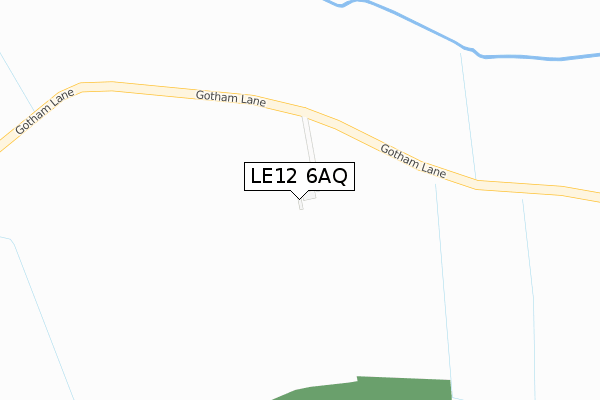
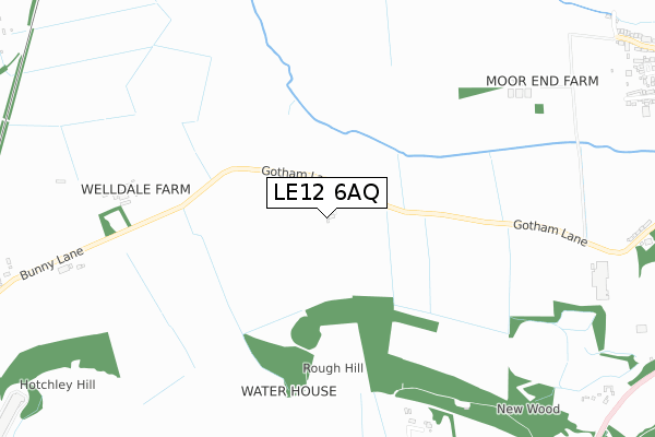
LE12 6AQ is located in the Bunny electoral ward, within the local authority district of Rushcliffe and the English Parliamentary constituency of Rushcliffe. The Sub Integrated Care Board (ICB) Location is NHS Nottingham and Nottinghamshire ICB - 52R and the police force is Nottinghamshire. This postcode has been in use since January 2019.


GetTheData
Source: OS Open Zoomstack (Ordnance Survey)
Licence: Open Government Licence (requires attribution)
Attribution: Contains OS data © Crown copyright and database right 2024
Source: Open Postcode Geo
Licence: Open Government Licence (requires attribution)
Attribution: Contains OS data © Crown copyright and database right 2024; Contains Royal Mail data © Royal Mail copyright and database right 2024; Source: Office for National Statistics licensed under the Open Government Licence v.3.0
| Easting | 456891 |
| Northing | 329078 |
| Latitude | 52.856218 |
| Longitude | -1.156537 |
GetTheData
Source: Open Postcode Geo
Licence: Open Government Licence
| Country | England |
| Postcode District | LE12 |
| ➜ LE12 open data dashboard ➜ See where LE12 is on a map | |
GetTheData
Source: Land Registry Price Paid Data
Licence: Open Government Licence
| Ward | Bunny |
| Constituency | Rushcliffe |
GetTheData
Source: ONS Postcode Database
Licence: Open Government Licence
| Gotham Lane (Loughborough Road) | Bunny | 1,362m |
| Gotham Lane (Loughborough Road) | Bunny | 1,395m |
| Thomas Parkyn Close (Loughborough Road) | Bunny | 1,487m |
| Thomas Parkyn Close (Loughborough Road) | Bunny | 1,512m |
| Ash Lane (Bunny Hill) | Bunny | 1,559m |
GetTheData
Source: NaPTAN
Licence: Open Government Licence
GetTheData
Source: ONS Postcode Database
Licence: Open Government Licence


➜ Get more ratings from the Food Standards Agency
GetTheData
Source: Food Standards Agency
Licence: FSA terms & conditions
| Last Collection | |||
|---|---|---|---|
| Location | Mon-Fri | Sat | Distance |
| Bunny Post Office | 16:30 | 10:00 | 1,449m |
| Bunny Hill | 16:00 | 09:00 | 1,559m |
| Albert Road | 16:30 | 11:30 | 1,935m |
GetTheData
Source: Dracos
Licence: Creative Commons Attribution-ShareAlike
| Facility | Distance |
|---|---|
| Bunny C Of E Primary School Church Street, Bunny, Nottingham Grass Pitches | 1.6km |
| Rushcliffe Golf Club Stocking Lane, East Leake, Loughborough Golf | 2.4km |
| East Leake Leisure Centre Lantern Lane, East Leake, Loughborough Sports Hall, Swimming Pool, Health and Fitness Gym, Artificial Grass Pitch, Grass Pitches, Studio, Outdoor Tennis Courts | 2.5km |
GetTheData
Source: Active Places
Licence: Open Government Licence
| School | Phase of Education | Distance |
|---|---|---|
| Bunny CofE Primary School Church Street, Bunny, Nottingham, NG11 6QW | Primary | 1.6km |
| East Leake Academy Lantern Lane, East Leake, Loughborough, LE12 6QN | Secondary | 2.4km |
| Lantern Lane Primary and Nursery School Lantern Lane, East Leake, Loughborough, LE12 6QN | Primary | 2.5km |
GetTheData
Source: Edubase
Licence: Open Government Licence
The below table lists the International Territorial Level (ITL) codes (formerly Nomenclature of Territorial Units for Statistics (NUTS) codes) and Local Administrative Units (LAU) codes for LE12 6AQ:
| ITL 1 Code | Name |
|---|---|
| TLF | East Midlands (England) |
| ITL 2 Code | Name |
| TLF1 | Derbyshire and Nottinghamshire |
| ITL 3 Code | Name |
| TLF16 | South Nottinghamshire |
| LAU 1 Code | Name |
| E07000176 | Rushcliffe |
GetTheData
Source: ONS Postcode Directory
Licence: Open Government Licence
The below table lists the Census Output Area (OA), Lower Layer Super Output Area (LSOA), and Middle Layer Super Output Area (MSOA) for LE12 6AQ:
| Code | Name | |
|---|---|---|
| OA | E00144762 | |
| LSOA | E01028409 | Rushcliffe 015D |
| MSOA | E02005920 | Rushcliffe 015 |
GetTheData
Source: ONS Postcode Directory
Licence: Open Government Licence
| LE12 6JD | Bunny Lane | 965m |
| NG11 6QJ | Gotham Lane | 1159m |
| LE12 6UX | Ash Lane | 1238m |
| NG11 6QQ | Bunny Hill | 1275m |
| NG11 6QH | Loughborough Road | 1333m |
| NG11 6QU | Main Street | 1348m |
| NG11 6RD | The Paddock | 1350m |
| NG11 6QY | Moor View | 1370m |
| NG11 6QX | Moor Lane | 1393m |
| LE12 6XN | Bunny Hill Top | 1405m |
GetTheData
Source: Open Postcode Geo; Land Registry Price Paid Data
Licence: Open Government Licence