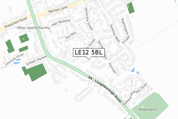
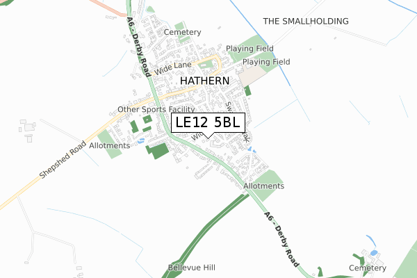
LE12 5BL is located in the Dishley, Hathern & Thorpe Acre electoral ward, within the local authority district of Charnwood and the English Parliamentary constituency of Loughborough. The Sub Integrated Care Board (ICB) Location is NHS Leicester, Leicestershire and Rutland ICB - 04V and the police force is Leicestershire. This postcode has been in use since October 2018.


GetTheData
Source: OS Open Zoomstack (Ordnance Survey)
Licence: Open Government Licence (requires attribution)
Attribution: Contains OS data © Crown copyright and database right 2024
Source: Open Postcode Geo
Licence: Open Government Licence (requires attribution)
Attribution: Contains OS data © Crown copyright and database right 2024; Contains Royal Mail data © Royal Mail copyright and database right 2024; Source: Office for National Statistics licensed under the Open Government Licence v.3.0
| Easting | 450306 |
| Northing | 321986 |
| Latitude | 52.793124 |
| Longitude | -1.255411 |
GetTheData
Source: Open Postcode Geo
Licence: Open Government Licence
| Country | England |
| Postcode District | LE12 |
| ➜ LE12 open data dashboard ➜ See where LE12 is on a map | |
GetTheData
Source: Land Registry Price Paid Data
Licence: Open Government Licence
| Ward | Dishley, Hathern & Thorpe Acre |
| Constituency | Loughborough |
GetTheData
Source: ONS Postcode Database
Licence: Open Government Licence
| January 2024 | Anti-social behaviour | On or near Derby Road | 395m |
| November 2023 | Criminal damage and arson | On or near Derby Road | 395m |
| August 2023 | Other theft | On or near Derby Road | 395m |
| ➜ Get more crime data in our Crime section | |||
GetTheData
Source: data.police.uk
Licence: Open Government Licence
| Anchor Inn (Loughborough Road) | Hathern | 87m |
| Anchor Inn (Loughborough Road) | Hathern | 94m |
| Edward Phillipps Road (Loughborough Road) | Hathern | 254m |
| Edward Phillipps Road (Loughborough Road) | Hathern | 270m |
| Shepshed Road (Derby Road) | Hathern | 435m |
| Loughborough (Leics) Station | 4.3km |
GetTheData
Source: NaPTAN
Licence: Open Government Licence
GetTheData
Source: ONS Postcode Database
Licence: Open Government Licence


➜ Get more ratings from the Food Standards Agency
GetTheData
Source: Food Standards Agency
Licence: FSA terms & conditions
| Last Collection | |||
|---|---|---|---|
| Location | Mon-Fri | Sat | Distance |
| Anchor Inn (A6) | 17:10 | 10:45 | 75m |
| Hathern Post Office | 17:00 | 11:30 | 399m |
| Hawthorne Avenue | 16:45 | 11:00 | 587m |
GetTheData
Source: Dracos
Licence: Creative Commons Attribution-ShareAlike
| Facility | Distance |
|---|---|
| Hathern Church Of England Primary School Pasture Lane, Hathern, Loughborough Sports Hall, Grass Pitches | 515m |
| Pasture Lane Playing Fields Pasture Lane, Hathern, Loughborough Grass Pitches | 573m |
| The Drome Derby Road, Loughborough Grass Pitches | 1.5km |
GetTheData
Source: Active Places
Licence: Open Government Licence
| School | Phase of Education | Distance |
|---|---|---|
| Hathern Church of England Primary School Pasture Lane, Hathern, Loughborough, LE12 5LJ | Primary | 352m |
| Stonebow Primary School Loughborough Stonebow Close, Loughborough, LE11 4ZH | Primary | 1.3km |
| Normanton-on-Soar Primary School Main Street, Normanton-on-Soar, Loughborough, LE12 5HB | Primary | 1.8km |
GetTheData
Source: Edubase
Licence: Open Government Licence
The below table lists the International Territorial Level (ITL) codes (formerly Nomenclature of Territorial Units for Statistics (NUTS) codes) and Local Administrative Units (LAU) codes for LE12 5BL:
| ITL 1 Code | Name |
|---|---|
| TLF | East Midlands (England) |
| ITL 2 Code | Name |
| TLF2 | Leicestershire, Rutland and Northamptonshire |
| ITL 3 Code | Name |
| TLF22 | Leicestershire CC and Rutland |
| LAU 1 Code | Name |
| E07000130 | Charnwood |
GetTheData
Source: ONS Postcode Directory
Licence: Open Government Licence
The below table lists the Census Output Area (OA), Lower Layer Super Output Area (LSOA), and Middle Layer Super Output Area (MSOA) for LE12 5BL:
| Code | Name | |
|---|---|---|
| OA | E00130378 | |
| LSOA | E01025693 | Charnwood 001C |
| MSOA | E02005345 | Charnwood 001 |
GetTheData
Source: ONS Postcode Directory
Licence: Open Government Licence
| LE12 5HP | Anchor Close | 67m |
| LE12 5JQ | Wide Street | 68m |
| LE12 5JH | Wide Street | 86m |
| LE12 5HR | Anchor Lane | 121m |
| LE12 5JG | Tanners Lane | 123m |
| LE12 5JW | Old Forge Close | 141m |
| LE12 5HX | The Leys | 163m |
| LE12 5HY | Loughborough Road | 165m |
| LE12 5JF | Swallow Walk | 180m |
| LE12 5JT | Brunsleigh Croft | 181m |
GetTheData
Source: Open Postcode Geo; Land Registry Price Paid Data
Licence: Open Government Licence