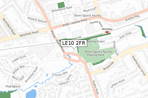
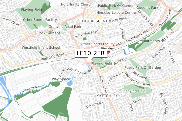
LE10 2FR is located in the Burbage St Catherines and Lash Hill electoral ward, within the local authority district of Hinckley and Bosworth and the English Parliamentary constituency of Bosworth. The Sub Integrated Care Board (ICB) Location is NHS Leicester, Leicestershire and Rutland ICB - 04V and the police force is Leicestershire. This postcode has been in use since November 2019.


GetTheData
Source: OS Open Zoomstack (Ordnance Survey)
Licence: Open Government Licence (requires attribution)
Attribution: Contains OS data © Crown copyright and database right 2024
Source: Open Postcode Geo
Licence: Open Government Licence (requires attribution)
Attribution: Contains OS data © Crown copyright and database right 2024; Contains Royal Mail data © Royal Mail copyright and database right 2024; Source: Office for National Statistics licensed under the Open Government Licence v.3.0
| Easting | 442498 |
| Northing | 293129 |
| Latitude | 52.534392 |
| Longitude | -1.374900 |
GetTheData
Source: Open Postcode Geo
Licence: Open Government Licence
| Country | England |
| Postcode District | LE10 |
| ➜ LE10 open data dashboard ➜ See where LE10 is on a map ➜ Where is Hinckley? | |
GetTheData
Source: Land Registry Price Paid Data
Licence: Open Government Licence
| Ward | Burbage St Catherines And Lash Hill |
| Constituency | Bosworth |
GetTheData
Source: ONS Postcode Database
Licence: Open Government Licence
| June 2022 | Shoplifting | On or near Rugby Road | 136m |
| June 2022 | Violence and sexual offences | On or near Rugby Road | 136m |
| June 2022 | Public order | On or near Rugby Road | 136m |
| ➜ Get more crime data in our Crime section | |||
GetTheData
Source: data.police.uk
Licence: Open Government Licence
| Brookfield Road (Rugby Road) | Burbage | 64m |
| Brookfield Road (Rugby Road) | Burbage | 107m |
| Lidl Store (Hawley Road) | Hinckley | 136m |
| Lidl Store (Hawley Road) | Hinckley | 153m |
| Rugby Road (Brookfield Road) | Burbage | 155m |
| Hinckley Station | 0.2km |
GetTheData
Source: NaPTAN
Licence: Open Government Licence
GetTheData
Source: ONS Postcode Database
Licence: Open Government Licence


➜ Get more ratings from the Food Standards Agency
GetTheData
Source: Food Standards Agency
Licence: FSA terms & conditions
| Last Collection | |||
|---|---|---|---|
| Location | Mon-Fri | Sat | Distance |
| Southfield Road | 17:30 | 11:00 | 285m |
| Brookside | 17:30 | 11:30 | 295m |
| Rugby Road | 18:00 | 11:45 | 424m |
GetTheData
Source: Dracos
Licence: Creative Commons Attribution-ShareAlike
| Facility | Distance |
|---|---|
| The Gym Group (Hinckley) Hawley Road, Hinckley Health and Fitness Gym | 90m |
| Westfield Junior School Westfield Road, Hinckley Grass Pitches, Swimming Pool | 479m |
| Hinckley Squash Club (Closed) Brunel Road, Hinckley Squash Courts | 483m |
GetTheData
Source: Active Places
Licence: Open Government Licence
| School | Phase of Education | Distance |
|---|---|---|
| R.E.A.L Independent Schools Hinckley 27 Station Road, Hinckley, Leicestershire, LE10 1AP | Not applicable | 481m |
| Westfield Junior School Westfield Road, Hinckley, LE10 0LT | Primary | 490m |
| Westfield Infant School Ashford Road, Hinckley, LE10 0JL | Primary | 688m |
GetTheData
Source: Edubase
Licence: Open Government Licence
The below table lists the International Territorial Level (ITL) codes (formerly Nomenclature of Territorial Units for Statistics (NUTS) codes) and Local Administrative Units (LAU) codes for LE10 2FR:
| ITL 1 Code | Name |
|---|---|
| TLF | East Midlands (England) |
| ITL 2 Code | Name |
| TLF2 | Leicestershire, Rutland and Northamptonshire |
| ITL 3 Code | Name |
| TLF22 | Leicestershire CC and Rutland |
| LAU 1 Code | Name |
| E07000132 | Hinckley and Bosworth |
GetTheData
Source: ONS Postcode Directory
Licence: Open Government Licence
The below table lists the Census Output Area (OA), Lower Layer Super Output Area (LSOA), and Middle Layer Super Output Area (MSOA) for LE10 2FR:
| Code | Name | |
|---|---|---|
| OA | E00131058 | |
| LSOA | E01025829 | Hinckley and Bosworth 013C |
| MSOA | E02005389 | Hinckley and Bosworth 013 |
GetTheData
Source: ONS Postcode Directory
Licence: Open Government Licence
| LE10 0PR | Hawley Road | 169m |
| LE10 2NE | Crimson Way | 213m |
| LE10 2UE | West Close | 232m |
| LE10 0QF | Willowbank Road | 233m |
| LE10 2XB | Dudley Rise | 236m |
| LE10 2XA | Garden Close | 261m |
| LE10 2LL | Brookfield Road | 283m |
| LE10 0QH | Rutland Avenue | 288m |
| LE10 2NF | Stretton Close | 292m |
| LE10 2PG | Ruby Close | 294m |
GetTheData
Source: Open Postcode Geo; Land Registry Price Paid Data
Licence: Open Government Licence