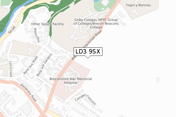
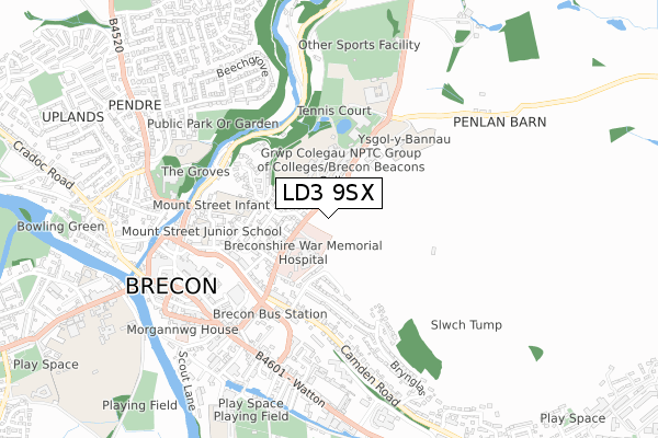
LD3 9SX is located in the Brecon East electoral ward, within the unitary authority of Powys and the Welsh Parliamentary constituency of Brecon and Radnorshire. The Local Health Board is Powys Teaching and the police force is Dyfed-Powys. This postcode has been in use since November 2020.


GetTheData
Source: OS Open Zoomstack (Ordnance Survey)
Licence: Open Government Licence (requires attribution)
Attribution: Contains OS data © Crown copyright and database right 2024
Source: Open Postcode Geo
Licence: Open Government Licence (requires attribution)
Attribution: Contains OS data © Crown copyright and database right 2024; Contains Royal Mail data © Royal Mail copyright and database right 2024; Source: Office for National Statistics licensed under the Open Government Licence v.3.0
| Easting | 305160 |
| Northing | 228865 |
| Latitude | 51.950170 |
| Longitude | -3.381367 |
GetTheData
Source: Open Postcode Geo
Licence: Open Government Licence
| Country | Wales |
| Postcode District | LD3 |
| ➜ LD3 open data dashboard ➜ See where LD3 is on a map ➜ Where is Brecon? | |
GetTheData
Source: Land Registry Price Paid Data
Licence: Open Government Licence
| Ward | Brecon East |
| Constituency | Brecon And Radnorshire |
GetTheData
Source: ONS Postcode Database
Licence: Open Government Licence
27, HOGGAN PARK, BRECON, LD3 9SX 2023 25 MAY £450,000 |
21, HOGGAN PARK, BRECON, LD3 9SX 2022 2 NOV £465,000 |
20, HOGGAN PARK, BRECON, LD3 9SX 2022 1 NOV £520,000 |
19, HOGGAN PARK, BRECON, LD3 9SX 2022 7 JAN £395,000 |
18, HOGGAN PARK, BRECON, LD3 9SX 2021 5 MAR £365,000 |
9, HOGGAN PARK, BRECON, LD3 9SX 2020 20 NOV £210,000 |
2, HOGGAN PARK, BRECON, LD3 9SX 2020 4 AUG £255,000 |
1, HOGGAN PARK, BRECON, LD3 9SX 2020 31 JUL £255,000 |
GetTheData
Source: HM Land Registry Price Paid Data
Licence: Contains HM Land Registry data © Crown copyright and database right 2024. This data is licensed under the Open Government Licence v3.0.
| June 2022 | Other theft | On or near Cerrigcochion Lane | 286m |
| June 2022 | Violence and sexual offences | On or near Rhodfa Eluned | 420m |
| May 2022 | Criminal damage and arson | On or near Cerrigcochion Lane | 286m |
| ➜ Get more crime data in our Crime section | |||
GetTheData
Source: data.police.uk
Licence: Open Government Licence
| Coleg Powys (Cerrigcochion Road) | Brecon | 243m |
| Coleg Powys (Cerrigcochion Road) | Brecon | 266m |
| Hospital (Cerrigcochion Road) | Brecon | 294m |
| Hospital (Cerrigcochion Road) | Brecon | 302m |
| Driving Test Centre (Camden Road) | Brecon | 435m |
GetTheData
Source: NaPTAN
Licence: Open Government Licence
GetTheData
Source: ONS Postcode Database
Licence: Open Government Licence


➜ Get more ratings from the Food Standards Agency
GetTheData
Source: Food Standards Agency
Licence: FSA terms & conditions
| Last Collection | |||
|---|---|---|---|
| Location | Mon-Fri | Sat | Distance |
| Struet | 16:45 | 11:45 | 681m |
| St Marys Street | 17:15 | 12:15 | 767m |
| Castle Hotel | 16:45 | 11:30 | 893m |
GetTheData
Source: Dracos
Licence: Creative Commons Attribution-ShareAlike
| School | Phase of Education | Distance |
|---|---|---|
| Brecon High School Penlan, Brecon, Powys, LD3 9SR | Not applicable | 258m |
| Ysgol y Bannau Penlan, Aberhonddu, Powys, LD3 9SR | Not applicable | 270m |
| Mount Street C.P. Infants Rhosferig Road, Brecon, Powys, LD3 7NG | Not applicable | 485m |
GetTheData
Source: Edubase
Licence: Open Government Licence
The below table lists the International Territorial Level (ITL) codes (formerly Nomenclature of Territorial Units for Statistics (NUTS) codes) and Local Administrative Units (LAU) codes for LD3 9SX:
| ITL 1 Code | Name |
|---|---|
| TLL | Wales |
| ITL 2 Code | Name |
| TLL2 | East Wales |
| ITL 3 Code | Name |
| TLL24 | Powys |
| LAU 1 Code | Name |
| W06000023 | Powys |
GetTheData
Source: ONS Postcode Directory
Licence: Open Government Licence
The below table lists the Census Output Area (OA), Lower Layer Super Output Area (LSOA), and Middle Layer Super Output Area (MSOA) for LD3 9SX:
| Code | Name | |
|---|---|---|
| OA | W00002627 | |
| LSOA | W01000493 | Powys 017E |
| MSOA | W02000113 | Powys 017 |
GetTheData
Source: ONS Postcode Directory
Licence: Open Government Licence
| LD3 7NP | Cerrigcochion Lane | 241m |
| LD3 7PG | School Gardens | 284m |
| LD3 7NW | Cerrigcochion Lane | 338m |
| LD3 7BY | Camden Crescent | 339m |
| LD3 7NR | Cerrigcochion Road | 345m |
| LD3 7PA | Belle Vue Gardens | 372m |
| LD3 7NN | Nythfa Gardens | 386m |
| LD3 7NT | Cerrigcochion Road | 405m |
| LD3 7NF | Belle Vue Road | 406m |
| LD3 7FB | Eluneds Drive | 409m |
GetTheData
Source: Open Postcode Geo; Land Registry Price Paid Data
Licence: Open Government Licence