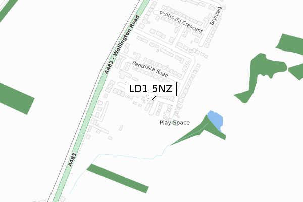
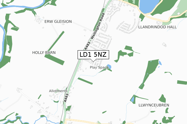
LD1 5NZ is located in the Llandrindod South electoral ward, within the unitary authority of Powys and the Welsh Parliamentary constituency of Brecon and Radnorshire. The Local Health Board is Powys Teaching and the police force is Dyfed-Powys. This postcode has been in use since December 2017.


GetTheData
Source: OS Open Zoomstack (Ordnance Survey)
Licence: Open Government Licence (requires attribution)
Attribution: Contains OS data © Crown copyright and database right 2024
Source: Open Postcode Geo
Licence: Open Government Licence (requires attribution)
Attribution: Contains OS data © Crown copyright and database right 2024; Contains Royal Mail data © Royal Mail copyright and database right 2024; Source: Office for National Statistics licensed under the Open Government Licence v.3.0
| Easting | 305560 |
| Northing | 259634 |
| Latitude | 52.226792 |
| Longitude | -3.384080 |
GetTheData
Source: Open Postcode Geo
Licence: Open Government Licence
| Country | Wales |
| Postcode District | LD1 |
| ➜ LD1 open data dashboard ➜ See where LD1 is on a map ➜ Where is Llandrindod Wells? | |
GetTheData
Source: Land Registry Price Paid Data
Licence: Open Government Licence
| Ward | Llandrindod South |
| Constituency | Brecon And Radnorshire |
GetTheData
Source: ONS Postcode Database
Licence: Open Government Licence
3, DOLYDD PENTROSFA, LLANDRINDOD WELLS, LD1 5NZ 2024 31 JAN £270,000 |
2023 4 OCT £360,000 |
2023 24 JUL £270,000 |
40, DOLYDD PENTROSFA, LLANDRINDOD WELLS, LD1 5NZ 2022 23 SEP £272,500 |
2022 8 JUN £250,000 |
2022 18 MAY £325,000 |
2022 12 APR £255,000 |
2021 29 JAN £210,000 |
2020 18 DEC £280,000 |
24, DOLYDD PENTROSFA, LLANDRINDOD WELLS, LD1 5NZ 2020 14 FEB £190,000 |
➜ Llandrindod Wells house prices
GetTheData
Source: HM Land Registry Price Paid Data
Licence: Contains HM Land Registry data © Crown copyright and database right 2024. This data is licensed under the Open Government Licence v3.0.
| June 2022 | Drugs | On or near Wellington Road | 411m |
| June 2022 | Other theft | On or near Wellington Road | 411m |
| May 2022 | Violence and sexual offences | On or near Wally Range | 164m |
| ➜ Get more crime data in our Crime section | |||
GetTheData
Source: data.police.uk
Licence: Open Government Licence
| Pentrosfa House (Pentrosfa) | Llandrindod Wells | 199m |
| Pentrosfa (Wellington Road) | Llandrindod Wells | 301m |
| Pentrosfa (Wellington Road) | Llandrindod Wells | 324m |
| Ridgebourne (Wellington Road) | Llandrindod Wells | 568m |
| Ridgebourne (Wellington Road) | Llandrindod Wells | 588m |
| Llandrindod Station | 1.8km |
GetTheData
Source: NaPTAN
Licence: Open Government Licence
| Percentage of properties with Next Generation Access | 100.0% |
| Percentage of properties with Superfast Broadband | 100.0% |
| Percentage of properties with Ultrafast Broadband | 95.5% |
| Percentage of properties with Full Fibre Broadband | 95.5% |
Superfast Broadband is between 30Mbps and 300Mbps
Ultrafast Broadband is > 300Mbps
| Percentage of properties unable to receive 2Mbps | 0.0% |
| Percentage of properties unable to receive 5Mbps | 0.0% |
| Percentage of properties unable to receive 10Mbps | 0.0% |
| Percentage of properties unable to receive 30Mbps | 0.0% |
GetTheData
Source: Ofcom
Licence: Ofcom Terms of Use (requires attribution)
GetTheData
Source: ONS Postcode Database
Licence: Open Government Licence


➜ Get more ratings from the Food Standards Agency
GetTheData
Source: Food Standards Agency
Licence: FSA terms & conditions
| Last Collection | |||
|---|---|---|---|
| Location | Mon-Fri | Sat | Distance |
| Ridgebourne | 17:45 | 12:00 | 885m |
| Lakeside | 17:45 | 12:00 | 919m |
| Howey Post Office | 17:15 | 11:00 | 1,029m |
GetTheData
Source: Dracos
Licence: Creative Commons Attribution-ShareAlike
| School | Phase of Education | Distance |
|---|---|---|
| Ysgol Cefnllys Cefnllys Lane, Llandrindod Wells, Powys, LD1 5WA | Not applicable | 1.7km |
| Ysgol Trefonnen Church In Wales Community Primary Trefonnen Lane, Llandrindod Wells, Powys, LD1 5EP | Not applicable | 2.2km |
| Newbridge-On-Wye V.P. Newbridge-on-Wye, Llandrindod Wells, Powys, LD1 6LD | Not applicable | 4.2km |
GetTheData
Source: Edubase
Licence: Open Government Licence
The below table lists the International Territorial Level (ITL) codes (formerly Nomenclature of Territorial Units for Statistics (NUTS) codes) and Local Administrative Units (LAU) codes for LD1 5NZ:
| ITL 1 Code | Name |
|---|---|
| TLL | Wales |
| ITL 2 Code | Name |
| TLL2 | East Wales |
| ITL 3 Code | Name |
| TLL24 | Powys |
| LAU 1 Code | Name |
| W06000023 | Powys |
GetTheData
Source: ONS Postcode Directory
Licence: Open Government Licence
The below table lists the Census Output Area (OA), Lower Layer Super Output Area (LSOA), and Middle Layer Super Output Area (MSOA) for LD1 5NZ:
| Code | Name | |
|---|---|---|
| OA | W00002431 | |
| LSOA | W01000456 | Powys 013C |
| MSOA | W02000109 | Powys 013 |
GetTheData
Source: ONS Postcode Directory
Licence: Open Government Licence
| LD1 5NL | Pentrosfa Road | 117m |
| LD1 5ND | Wellington Road | 155m |
| LD1 5AL | Pentrosfa | 211m |
| LD1 5PH | 240m | |
| LD1 5NW | Pentrosfa Crescent | 267m |
| LD1 5HB | Brynteg | 353m |
| LD1 5EW | Oakridge Drive | 479m |
| LD1 5PL | 534m | |
| LD1 5EX | Cedar Ridge | 546m |
| LD1 5NQ | Ridgebourne Close | 614m |
GetTheData
Source: Open Postcode Geo; Land Registry Price Paid Data
Licence: Open Government Licence