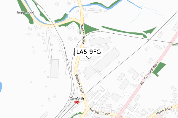
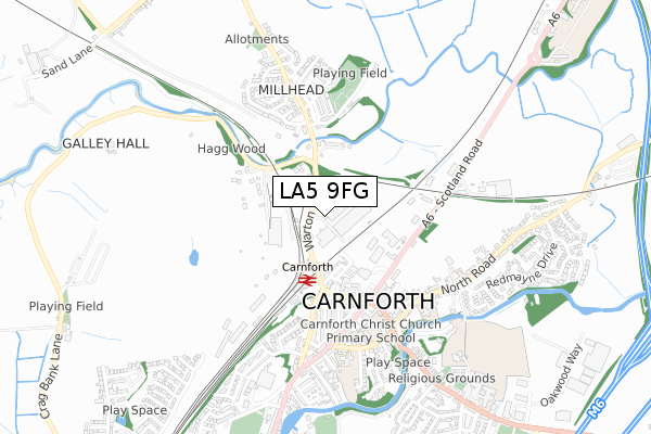
LA5 9FG is located in the Carnforth & Millhead electoral ward, within the local authority district of Lancaster and the English Parliamentary constituency of Morecambe and Lunesdale. The Sub Integrated Care Board (ICB) Location is NHS Lancashire and South Cumbria ICB - 01K and the police force is Lancashire. This postcode has been in use since November 2018.


GetTheData
Source: OS Open Zoomstack (Ordnance Survey)
Licence: Open Government Licence (requires attribution)
Attribution: Contains OS data © Crown copyright and database right 2024
Source: Open Postcode Geo
Licence: Open Government Licence (requires attribution)
Attribution: Contains OS data © Crown copyright and database right 2024; Contains Royal Mail data © Royal Mail copyright and database right 2024; Source: Office for National Statistics licensed under the Open Government Licence v.3.0
| Easting | 349943 |
| Northing | 470938 |
| Latitude | 54.131849 |
| Longitude | -2.767552 |
GetTheData
Source: Open Postcode Geo
Licence: Open Government Licence
| Country | England |
| Postcode District | LA5 |
| ➜ LA5 open data dashboard ➜ See where LA5 is on a map ➜ Where is Carnforth? | |
GetTheData
Source: Land Registry Price Paid Data
Licence: Open Government Licence
| Ward | Carnforth & Millhead |
| Constituency | Morecambe And Lunesdale |
GetTheData
Source: ONS Postcode Database
Licence: Open Government Licence
| June 2022 | Anti-social behaviour | On or near Back Hunter Street | 243m |
| June 2022 | Violence and sexual offences | On or near Market Street | 328m |
| June 2022 | Anti-social behaviour | On or near New Street | 436m |
| ➜ Get more crime data in our Crime section | |||
GetTheData
Source: data.police.uk
Licence: Open Government Licence
| Railway Club (Warton Road) | Carnforth | 211m |
| Railway Club (Warton Road) | Carnforth | 224m |
| Scotland Road | Carnforth | 243m |
| Scotland Road | Carnforth | 262m |
| Midland Terrace (Warton Road) | Millhead | 310m |
| Carnforth Station | 0.3km |
| Silverdale Station | 4.9km |
GetTheData
Source: NaPTAN
Licence: Open Government Licence
GetTheData
Source: ONS Postcode Database
Licence: Open Government Licence

➜ Get more ratings from the Food Standards Agency
GetTheData
Source: Food Standards Agency
Licence: FSA terms & conditions
| Last Collection | |||
|---|---|---|---|
| Location | Mon-Fri | Sat | Distance |
| Carnforth Post Office | 17:30 | 12:00 | 330m |
| North Road | 16:45 | 10:00 | 464m |
| New Street | 17:00 | 11:30 | 518m |
GetTheData
Source: Dracos
Licence: Creative Commons Attribution-ShareAlike
| Facility | Distance |
|---|---|
| Carnforth Civic Hall North Road, Carnforth Sports Hall | 456m |
| Christ Church C.e. Primary School North Road, Carnforth Grass Pitches | 468m |
| Iodine Park Carlisle Terrace, Millhead, Carnforth Grass Pitches | 550m |
GetTheData
Source: Active Places
Licence: Open Government Licence
| School | Phase of Education | Distance |
|---|---|---|
| Carnforth Christ Church, Church of England, Voluntary Aided Primary School North Road, Carnforth, LA5 9LJ | Primary | 451m |
| Carnforth Community Primary School North Road, Carnforth, LA5 9LQ | Primary | 508m |
| Our Lady of Lourdes Catholic Primary School, Carnforth Kellet Road, Carnforth, LA5 9LS | Primary | 635m |
GetTheData
Source: Edubase
Licence: Open Government Licence
The below table lists the International Territorial Level (ITL) codes (formerly Nomenclature of Territorial Units for Statistics (NUTS) codes) and Local Administrative Units (LAU) codes for LA5 9FG:
| ITL 1 Code | Name |
|---|---|
| TLD | North West (England) |
| ITL 2 Code | Name |
| TLD4 | Lancashire |
| ITL 3 Code | Name |
| TLD44 | Lancaster and Wyre |
| LAU 1 Code | Name |
| E07000121 | Lancaster |
GetTheData
Source: ONS Postcode Directory
Licence: Open Government Licence
The below table lists the Census Output Area (OA), Lower Layer Super Output Area (LSOA), and Middle Layer Super Output Area (MSOA) for LA5 9FG:
| Code | Name | |
|---|---|---|
| OA | E00127366 | |
| LSOA | E01025098 | Lancaster 001D |
| MSOA | E02005221 | Lancaster 001 |
GetTheData
Source: ONS Postcode Directory
Licence: Open Government Licence
| LA5 9JZ | Scotland Road | 186m |
| LA5 9BL | Pond Terrace | 191m |
| LA5 9BN | Pond Street | 209m |
| LA5 9BW | Ramsden Street | 220m |
| LA5 9BP | Hunter Street | 256m |
| LA5 9LY | Oliver Place | 287m |
| LA5 9EZ | Midland Terrace | 300m |
| LA5 9BF | Ashtrees Way | 303m |
| LA5 9JY | Scotland Road | 312m |
| LA5 9LA | Hawk Street | 320m |
GetTheData
Source: Open Postcode Geo; Land Registry Price Paid Data
Licence: Open Government Licence