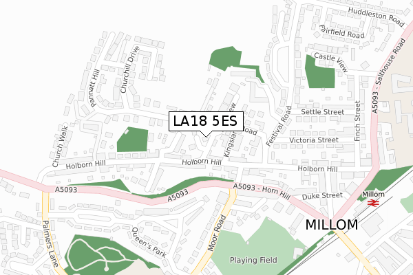
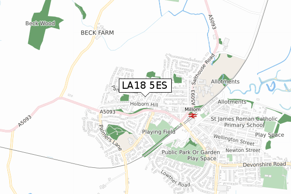
LA18 5ES is located in the Millom electoral ward, within the unitary authority of Cumberland and the English Parliamentary constituency of Copeland. The Sub Integrated Care Board (ICB) Location is NHS Lancashire and South Cumbria ICB - 01K and the police force is Cumbria. This postcode has been in use since November 2019.


GetTheData
Source: OS Open Zoomstack (Ordnance Survey)
Licence: Open Government Licence (requires attribution)
Attribution: Contains OS data © Crown copyright and database right 2024
Source: Open Postcode Geo
Licence: Open Government Licence (requires attribution)
Attribution: Contains OS data © Crown copyright and database right 2024; Contains Royal Mail data © Royal Mail copyright and database right 2024; Source: Office for National Statistics licensed under the Open Government Licence v.3.0
| Easting | 316812 |
| Northing | 480401 |
| Latitude | 54.212497 |
| Longitude | -3.276640 |
GetTheData
Source: Open Postcode Geo
Licence: Open Government Licence
| Country | England |
| Postcode District | LA18 |
| ➜ LA18 open data dashboard ➜ See where LA18 is on a map ➜ Where is Millom? | |
GetTheData
Source: Land Registry Price Paid Data
Licence: Open Government Licence
| Ward | Millom |
| Constituency | Copeland |
GetTheData
Source: ONS Postcode Database
Licence: Open Government Licence
4, BAY VIEW CLOSE, MILLOM, LA18 5ES 2022 17 JUN £280,000 |
GetTheData
Source: HM Land Registry Price Paid Data
Licence: Contains HM Land Registry data © Crown copyright and database right 2024. This data is licensed under the Open Government Licence v3.0.
| June 2022 | Criminal damage and arson | On or near Butler Street | 222m |
| June 2022 | Violence and sexual offences | On or near Settle Street | 315m |
| June 2022 | Violence and sexual offences | On or near Petrol Station | 365m |
| ➜ Get more crime data in our Crime section | |||
GetTheData
Source: data.police.uk
Licence: Open Government Licence
| Moor Road | Millom | 162m |
| Horn Hill (Moor Road) | Millom | 183m |
| Cleator Street (Holborn Hill) | Millom | 222m |
| Leyfield Close (Festival Road) | Millom | 223m |
| Cleator Street (Holborn Hill) | Millom | 225m |
| Millom Station | 0.4km |
| Silecroft Station | 4km |
| Green Road Station | 4.1km |
GetTheData
Source: NaPTAN
Licence: Open Government Licence
GetTheData
Source: ONS Postcode Database
Licence: Open Government Licence


➜ Get more ratings from the Food Standards Agency
GetTheData
Source: Food Standards Agency
Licence: FSA terms & conditions
| Last Collection | |||
|---|---|---|---|
| Location | Mon-Fri | Sat | Distance |
| Holborn Hill Post Office | 16:45 | 10:45 | 131m |
| Huddleston Road | 16:45 | 10:45 | 436m |
| Millom Post Office | 17:30 | 10:45 | 591m |
GetTheData
Source: Dracos
Licence: Creative Commons Attribution-ShareAlike
| Facility | Distance |
|---|---|
| Millom Cricket Club St. Georges Road, Millom Grass Pitches | 339m |
| Black Combe Junior School Moor Road, Millom Grass Pitches, Sports Hall | 424m |
| Millom School Salthouse Road, Millom Swimming Pool, Artificial Grass Pitch, Grass Pitches, Sports Hall | 497m |
GetTheData
Source: Active Places
Licence: Open Government Licence
| School | Phase of Education | Distance |
|---|---|---|
| Black Combe Junior School Moor Road, Millom, LA18 5DT | Primary | 424m |
| Parkview Nursery School St. Georges Road, Millom, LA18 4LE | Nursery | 485m |
| Millom School Salthouse Road, Millom, LA18 5AB | Secondary | 500m |
GetTheData
Source: Edubase
Licence: Open Government Licence
The below table lists the International Territorial Level (ITL) codes (formerly Nomenclature of Territorial Units for Statistics (NUTS) codes) and Local Administrative Units (LAU) codes for LA18 5ES:
| ITL 1 Code | Name |
|---|---|
| TLD | North West (England) |
| ITL 2 Code | Name |
| TLD1 | Cumbria |
| ITL 3 Code | Name |
| TLD11 | West Cumbria |
| LAU 1 Code | Name |
| E07000029 | Copeland |
GetTheData
Source: ONS Postcode Directory
Licence: Open Government Licence
The below table lists the Census Output Area (OA), Lower Layer Super Output Area (LSOA), and Middle Layer Super Output Area (MSOA) for LA18 5ES:
| Code | Name | |
|---|---|---|
| OA | E00097494 | |
| LSOA | E01019289 | Copeland 008C |
| MSOA | E02004007 | Copeland 008 |
GetTheData
Source: ONS Postcode Directory
Licence: Open Government Licence
| LA18 5BX | Newton Terrace | 45m |
| LA18 5BL | Holborn Hill | 84m |
| LA18 5BS | Holborn Terrace | 100m |
| LA18 5DF | Bay View | 100m |
| LA18 5BJ | Holborn Hill | 107m |
| LA18 5BP | Kingsland Road | 108m |
| LA18 5BG | Red Lion Court | 132m |
| LA18 5DR | Moor Road | 144m |
| LA18 5BT | Robinson Row | 148m |
| LA18 5DB | Pannatt Hill | 156m |
GetTheData
Source: Open Postcode Geo; Land Registry Price Paid Data
Licence: Open Government Licence