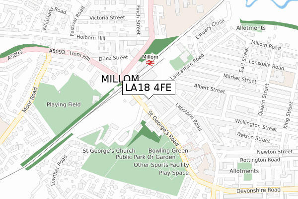
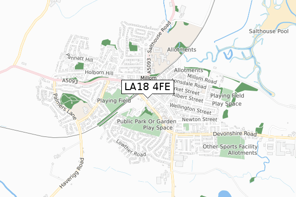
LA18 4FE is located in the Millom electoral ward, within the unitary authority of Cumberland and the English Parliamentary constituency of Copeland. The Sub Integrated Care Board (ICB) Location is NHS Lancashire and South Cumbria ICB - 01K and the police force is Cumbria. This postcode has been in use since November 2017.


GetTheData
Source: OS Open Zoomstack (Ordnance Survey)
Licence: Open Government Licence (requires attribution)
Attribution: Contains OS data © Crown copyright and database right 2024
Source: Open Postcode Geo
Licence: Open Government Licence (requires attribution)
Attribution: Contains OS data © Crown copyright and database right 2024; Contains Royal Mail data © Royal Mail copyright and database right 2024; Source: Office for National Statistics licensed under the Open Government Licence v.3.0
| Easting | 317242 |
| Northing | 480111 |
| Latitude | 54.210037 |
| Longitude | -3.270415 |
GetTheData
Source: Open Postcode Geo
Licence: Open Government Licence
| Country | England |
| Postcode District | LA18 |
| ➜ LA18 open data dashboard ➜ See where LA18 is on a map | |
GetTheData
Source: Land Registry Price Paid Data
Licence: Open Government Licence
| Ward | Millom |
| Constituency | Copeland |
GetTheData
Source: ONS Postcode Database
Licence: Open Government Licence
| October 2023 | Violence and sexual offences | On or near Parking Area | 436m |
| June 2022 | Anti-social behaviour | On or near Market Square | 42m |
| June 2022 | Violence and sexual offences | On or near Market Square | 42m |
| ➜ Get more crime data in our Crime section | |||
GetTheData
Source: data.police.uk
Licence: Open Government Licence
| Market Square | Millom | 72m |
| Rail Station (Station Road) | Millom | 144m |
| Rail Station (Station Road) | Millom | 152m |
| Horn Hill | Millom | 162m |
| Station Road (St George's Road) | Millom | 175m |
| Millom Station | 0.1km |
| Green Road Station | 4.2km |
| Silecroft Station | 4.5km |
GetTheData
Source: NaPTAN
Licence: Open Government Licence
GetTheData
Source: ONS Postcode Database
Licence: Open Government Licence


➜ Get more ratings from the Food Standards Agency
GetTheData
Source: Food Standards Agency
Licence: FSA terms & conditions
| Last Collection | |||
|---|---|---|---|
| Location | Mon-Fri | Sat | Distance |
| Millom Post Office | 17:30 | 10:45 | 88m |
| Millom Delivery Office | 17:30 | 11:15 | 155m |
| Lapstone Road | 16:45 | 10:30 | 335m |
GetTheData
Source: Dracos
Licence: Creative Commons Attribution-ShareAlike
| Facility | Distance |
|---|---|
| Another Level Fitness Centre (Closed) Market Square, Millom Health and Fitness Gym | 43m |
| Millom Recreation Centre Lancashire Road, Millom Sports Hall, Health and Fitness Gym | 190m |
| Millom Park St Georges Road, St Georges Road, Millom Outdoor Tennis Courts | 211m |
GetTheData
Source: Active Places
Licence: Open Government Licence
| School | Phase of Education | Distance |
|---|---|---|
| Parkview Nursery School St. Georges Road, Millom, LA18 4LE | Nursery | 149m |
| Millom Infant School Lapstone Road, Millom Infant School, Millom, LA18 4LP | Primary | 312m |
| Millom School Salthouse Road, Millom, LA18 5AB | Secondary | 350m |
GetTheData
Source: Edubase
Licence: Open Government Licence
The below table lists the International Territorial Level (ITL) codes (formerly Nomenclature of Territorial Units for Statistics (NUTS) codes) and Local Administrative Units (LAU) codes for LA18 4FE:
| ITL 1 Code | Name |
|---|---|
| TLD | North West (England) |
| ITL 2 Code | Name |
| TLD1 | Cumbria |
| ITL 3 Code | Name |
| TLD11 | West Cumbria |
| LAU 1 Code | Name |
| E07000029 | Copeland |
GetTheData
Source: ONS Postcode Directory
Licence: Open Government Licence
The below table lists the Census Output Area (OA), Lower Layer Super Output Area (LSOA), and Middle Layer Super Output Area (MSOA) for LA18 4FE:
| Code | Name | |
|---|---|---|
| OA | E00097537 | |
| LSOA | E01019299 | Copeland 008G |
| MSOA | E02004007 | Copeland 008 |
GetTheData
Source: ONS Postcode Directory
Licence: Open Government Licence
| LA18 4FD | Lancashire Road | 0m |
| LA18 4HZ | Market Square | 30m |
| LA18 4HX | St Georges Road | 50m |
| LA18 4BT | Lapstone Road | 61m |
| LA18 4DB | St Georges Terrace | 70m |
| LA18 4JA | St Georges Road | 91m |
| LA18 4BU | Lapstone Road | 91m |
| LA18 4AB | Albert Street | 148m |
| LA18 4AG | Crown Street | 182m |
| LA18 5DW | St Georges Road | 199m |
GetTheData
Source: Open Postcode Geo; Land Registry Price Paid Data
Licence: Open Government Licence