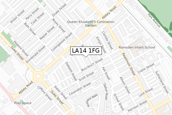
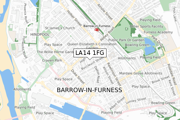
LA14 1FG is located in the Old Barrow and Hindpool electoral ward, within the unitary authority of Westmorland and Furness and the English Parliamentary constituency of Barrow and Furness. The Sub Integrated Care Board (ICB) Location is NHS Lancashire and South Cumbria ICB - 01K and the police force is Cumbria. This postcode has been in use since January 2020.


GetTheData
Source: OS Open Zoomstack (Ordnance Survey)
Licence: Open Government Licence (requires attribution)
Attribution: Contains OS data © Crown copyright and database right 2024
Source: Open Postcode Geo
Licence: Open Government Licence (requires attribution)
Attribution: Contains OS data © Crown copyright and database right 2024; Contains Royal Mail data © Royal Mail copyright and database right 2024; Source: Office for National Statistics licensed under the Open Government Licence v.3.0
| Easting | 319880 |
| Northing | 469498 |
| Latitude | 54.115095 |
| Longitude | -3.227149 |
GetTheData
Source: Open Postcode Geo
Licence: Open Government Licence
| Country | England |
| Postcode District | LA14 |
| ➜ LA14 open data dashboard ➜ See where LA14 is on a map ➜ Where is Barrow-in-Furness? | |
GetTheData
Source: Land Registry Price Paid Data
Licence: Open Government Licence
| Ward | Old Barrow And Hindpool |
| Constituency | Barrow And Furness |
GetTheData
Source: ONS Postcode Database
Licence: Open Government Licence
| January 2024 | Criminal damage and arson | On or near Parking Area | 101m |
| January 2024 | Public order | On or near Parking Area | 101m |
| January 2024 | Violence and sexual offences | On or near Parking Area | 101m |
| ➜ Get more crime data in our Crime section | |||
GetTheData
Source: data.police.uk
Licence: Open Government Licence
| The Furness Railway (Abbey Road) | Barrow-in-furness | 98m |
| The Furness Railway (Abbey Road) | Barrow-in-furness | 101m |
| Coronation Gardens (Abbey Road) | Barrow-in-furness | 164m |
| Magistrates Courts (Abbey Road) | Barrow-in-furness | 185m |
| House Of Lords (Abbey Road) | Barrow-in-furness | 210m |
| Barrow-in-Furness Station | 0.4km |
| Roose Station | 2.1km |
| Dalton Station | 5.4km |
GetTheData
Source: NaPTAN
Licence: Open Government Licence
GetTheData
Source: ONS Postcode Database
Licence: Open Government Licence


➜ Get more ratings from the Food Standards Agency
GetTheData
Source: Food Standards Agency
Licence: FSA terms & conditions
| Last Collection | |||
|---|---|---|---|
| Location | Mon-Fri | Sat | Distance |
| Duke Street Post Office | 17:30 | 12:15 | 263m |
| Barrow Delivery Office | 17:30 | 12:30 | 307m |
| Town Hall | 18:00 | 11:00 | 406m |
GetTheData
Source: Dracos
Licence: Creative Commons Attribution-ShareAlike
| Facility | Distance |
|---|---|
| D S Fitness Centre Abbey Road, Barrow-in-furness Health and Fitness Gym, Studio | 97m |
| Furness Health Studio (Barrow) (Closed) Greengate Street, Barrow-in-furness Health and Fitness Gym | 463m |
| Flexappeal (Barrow In Furness) Hartington Street, Barrow-in-furness Health and Fitness Gym, Studio | 499m |
GetTheData
Source: Active Places
Licence: Open Government Licence
| School | Phase of Education | Distance |
|---|---|---|
| Ramsden Infant School Thwaite Street, Barrow-in-Furness, LA14 1AN | Primary | 300m |
| Greengate Junior School Greengate Street, Barrow-in-Furness, LA14 1BG | Primary | 555m |
| St James' CofE Junior School Blake Street, Barrow-in-Furness, LA14 1NY | Primary | 618m |
GetTheData
Source: Edubase
Licence: Open Government Licence
The below table lists the International Territorial Level (ITL) codes (formerly Nomenclature of Territorial Units for Statistics (NUTS) codes) and Local Administrative Units (LAU) codes for LA14 1FG:
| ITL 1 Code | Name |
|---|---|
| TLD | North West (England) |
| ITL 2 Code | Name |
| TLD1 | Cumbria |
| ITL 3 Code | Name |
| TLD11 | West Cumbria |
| LAU 1 Code | Name |
| E07000027 | Barrow-in-Furness |
GetTheData
Source: ONS Postcode Directory
Licence: Open Government Licence
The below table lists the Census Output Area (OA), Lower Layer Super Output Area (LSOA), and Middle Layer Super Output Area (MSOA) for LA14 1FG:
| Code | Name | |
|---|---|---|
| OA | E00096826 | |
| LSOA | E01019157 | Barrow-in-Furness 008D |
| MSOA | E02003984 | Barrow-in-Furness 008 |
GetTheData
Source: ONS Postcode Directory
Licence: Open Government Licence
| LA14 1PQ | Dalton Road | 12m |
| LA14 1PH | Dalton Road | 19m |
| LA14 1PN | Dalton Road | 40m |
| LA14 1QQ | Buccleuch Street | 45m |
| LA14 1QR | Manchester Street | 59m |
| LA14 1QL | High Street | 71m |
| LA14 1QJ | Coulton Street | 78m |
| LA14 1QP | Buccleuch Street | 91m |
| LA14 1QS | Emlyn Street | 103m |
| LA14 1QG | Buccleuch Street | 104m |
GetTheData
Source: Open Postcode Geo; Land Registry Price Paid Data
Licence: Open Government Licence