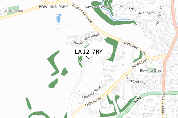
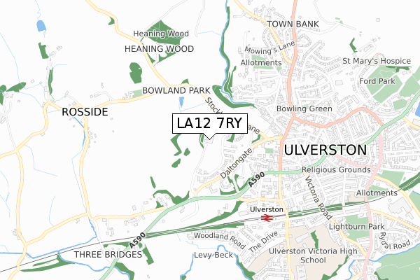
LA12 7RY is located in the Ulverston electoral ward, within the unitary authority of Westmorland and Furness and the English Parliamentary constituency of Barrow and Furness. The Sub Integrated Care Board (ICB) Location is NHS Lancashire and South Cumbria ICB - 01K and the police force is Cumbria. This postcode has been in use since January 2018.


GetTheData
Source: OS Open Zoomstack (Ordnance Survey)
Licence: Open Government Licence (requires attribution)
Attribution: Contains OS data © Crown copyright and database right 2024
Source: Open Postcode Geo
Licence: Open Government Licence (requires attribution)
Attribution: Contains OS data © Crown copyright and database right 2024; Contains Royal Mail data © Royal Mail copyright and database right 2024; Source: Office for National Statistics licensed under the Open Government Licence v.3.0
| Easting | 328127 |
| Northing | 478346 |
| Latitude | 54.195822 |
| Longitude | -3.103132 |
GetTheData
Source: Open Postcode Geo
Licence: Open Government Licence
| Country | England |
| Postcode District | LA12 |
| ➜ LA12 open data dashboard ➜ See where LA12 is on a map ➜ Where is Ulverston? | |
GetTheData
Source: Land Registry Price Paid Data
Licence: Open Government Licence
| Ward | Ulverston |
| Constituency | Barrow And Furness |
GetTheData
Source: ONS Postcode Database
Licence: Open Government Licence
| January 2024 | Violence and sexual offences | On or near Upper Brook Street | 418m |
| December 2023 | Criminal damage and arson | On or near Upper Brook Street | 418m |
| November 2023 | Criminal damage and arson | On or near Upper Brook Street | 418m |
| ➜ Get more crime data in our Crime section | |||
GetTheData
Source: data.police.uk
Licence: Open Government Licence
| Daltongate Business Centre (A590) | Ulverston | 334m |
| The Gill | North Ulverston | 399m |
| Daltongate Business Centre (Lightburn Road) | Ulverston | 427m |
| Rose And Crown (King Street) | Ulverston | 486m |
| Health Centre (Stanley Street) | North Ulverston | 516m |
| Ulverston Station | 0.6km |
GetTheData
Source: NaPTAN
Licence: Open Government Licence
| Percentage of properties with Next Generation Access | 100.0% |
| Percentage of properties with Superfast Broadband | 100.0% |
| Percentage of properties with Ultrafast Broadband | 75.0% |
| Percentage of properties with Full Fibre Broadband | 75.0% |
Superfast Broadband is between 30Mbps and 300Mbps
Ultrafast Broadband is > 300Mbps
| Percentage of properties unable to receive 2Mbps | 0.0% |
| Percentage of properties unable to receive 5Mbps | 0.0% |
| Percentage of properties unable to receive 10Mbps | 0.0% |
| Percentage of properties unable to receive 30Mbps | 0.0% |
GetTheData
Source: Ofcom
Licence: Ofcom Terms of Use (requires attribution)
GetTheData
Source: ONS Postcode Database
Licence: Open Government Licence


➜ Get more ratings from the Food Standards Agency
GetTheData
Source: Food Standards Agency
Licence: FSA terms & conditions
| Last Collection | |||
|---|---|---|---|
| Location | Mon-Fri | Sat | Distance |
| 11 Market Place | 17:30 | 11:45 | 453m |
| Stanley Street | 17:30 | 11:45 | 494m |
| 21 Princes Street | 17:00 | 11:15 | 553m |
GetTheData
Source: Dracos
Licence: Creative Commons Attribution-ShareAlike
| Facility | Distance |
|---|---|
| St Marys Catholic Primary School Springfield Road, Ulverston Grass Pitches | 766m |
| Ulverston Victoria High School Springfield Road, Ulverston Grass Pitches, Sports Hall | 997m |
| Swarthmoor Football Club Park Road, Swarthmoor Grass Pitches | 1.4km |
GetTheData
Source: Active Places
Licence: Open Government Licence
| School | Phase of Education | Distance |
|---|---|---|
| Church Walk CofE Primary School Church Walk, Ulverston, LA12 7EN | Primary | 744m |
| St Mary's Catholic Primary School, Ulverston Springfield Road, Ulverston, LA12 0EA | Primary | 766m |
| Sir John Barrow School Argyle Street, Sir John Barrow School, Ulverston, LA12 0BD | Primary | 941m |
GetTheData
Source: Edubase
Licence: Open Government Licence
The below table lists the International Territorial Level (ITL) codes (formerly Nomenclature of Territorial Units for Statistics (NUTS) codes) and Local Administrative Units (LAU) codes for LA12 7RY:
| ITL 1 Code | Name |
|---|---|
| TLD | North West (England) |
| ITL 2 Code | Name |
| TLD1 | Cumbria |
| ITL 3 Code | Name |
| TLD12 | East Cumbria |
| LAU 1 Code | Name |
| E07000031 | South Lakeland |
GetTheData
Source: ONS Postcode Directory
Licence: Open Government Licence
The below table lists the Census Output Area (OA), Lower Layer Super Output Area (LSOA), and Middle Layer Super Output Area (MSOA) for LA12 7RY:
| Code | Name | |
|---|---|---|
| OA | E00098072 | |
| LSOA | E01019393 | South Lakeland 014E |
| MSOA | E02004028 | South Lakeland 014 |
GetTheData
Source: ONS Postcode Directory
Licence: Open Government Licence
| LA12 7XA | Stone Cross Gardens | 139m |
| LA12 7BG | Stockbridge Lane | 255m |
| LA12 7BE | Daltongate | 281m |
| LA12 7TN | The Knoll | 285m |
| LA12 7XB | Deerfield | 329m |
| LA12 7XD | Fallowfield Avenue | 334m |
| LA12 7XE | Machell Close | 337m |
| LA12 7FF | Gill Garth | 348m |
| LA12 7FQ | Union Close | 360m |
| LA12 7BN | The Gill | 364m |
GetTheData
Source: Open Postcode Geo; Land Registry Price Paid Data
Licence: Open Government Licence